Earth 3D Map - Explore globe landscapes
Explore the world in stunning 3D, planning your next adventures

- 2.3.1.5 Version
- 3.2 Score
- 4M+ Downloads
- In-app purchases License
- 3+ Content Rating


Features:
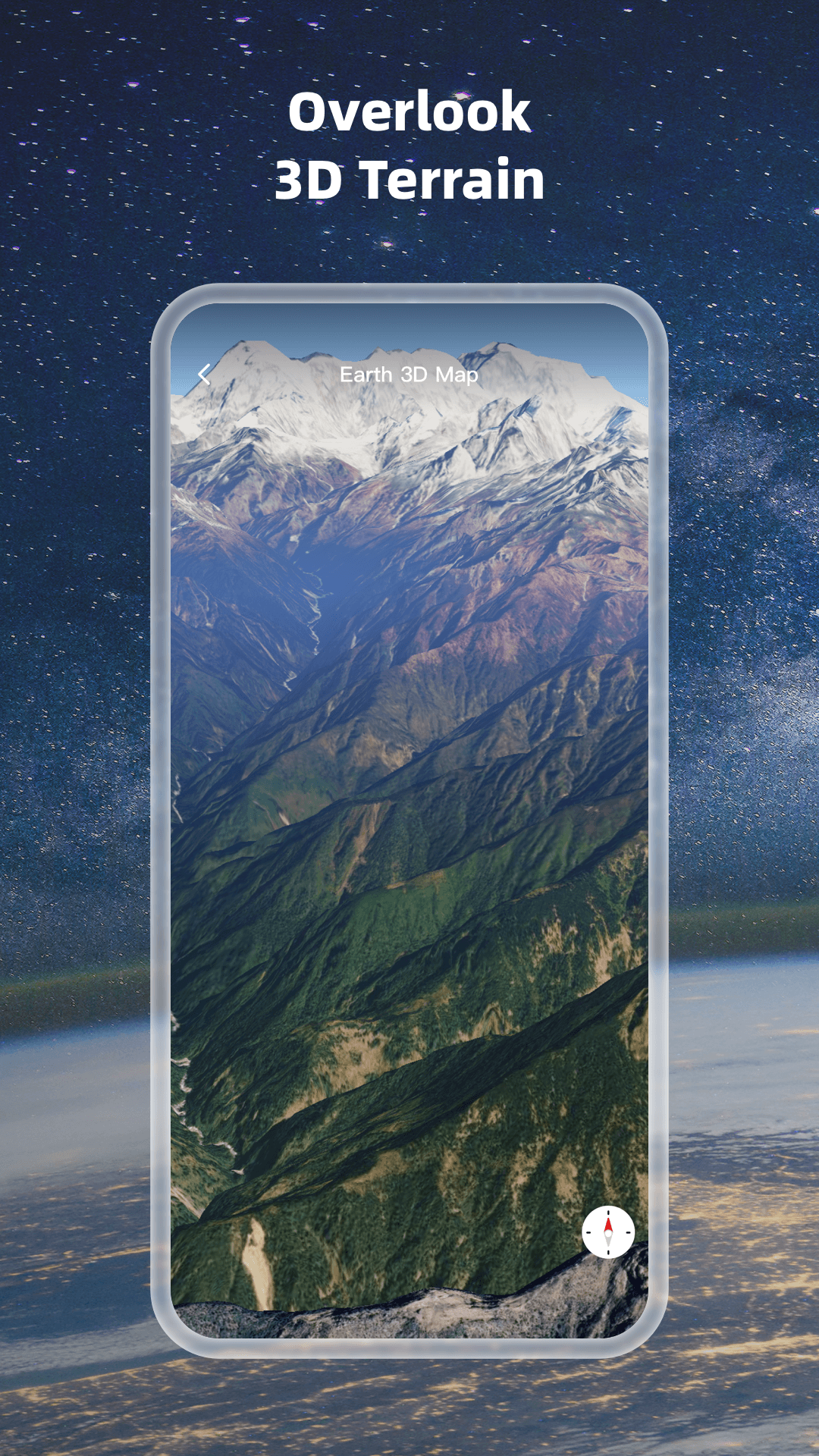
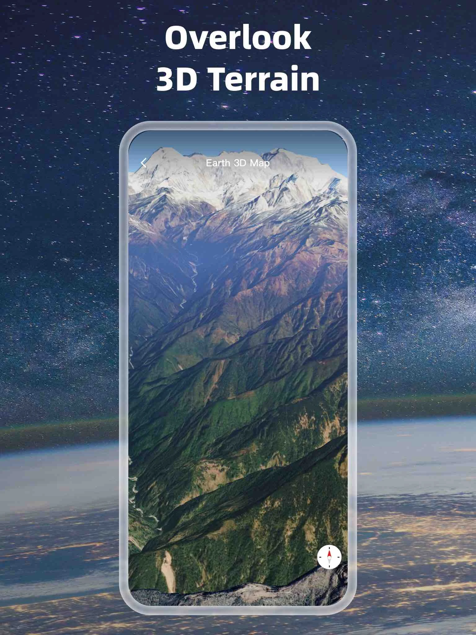
1.Experience a high-resolution 3D representation of the globe.
2.Access and display map tile data.
3.Utilize an Eastern-style compass feature.
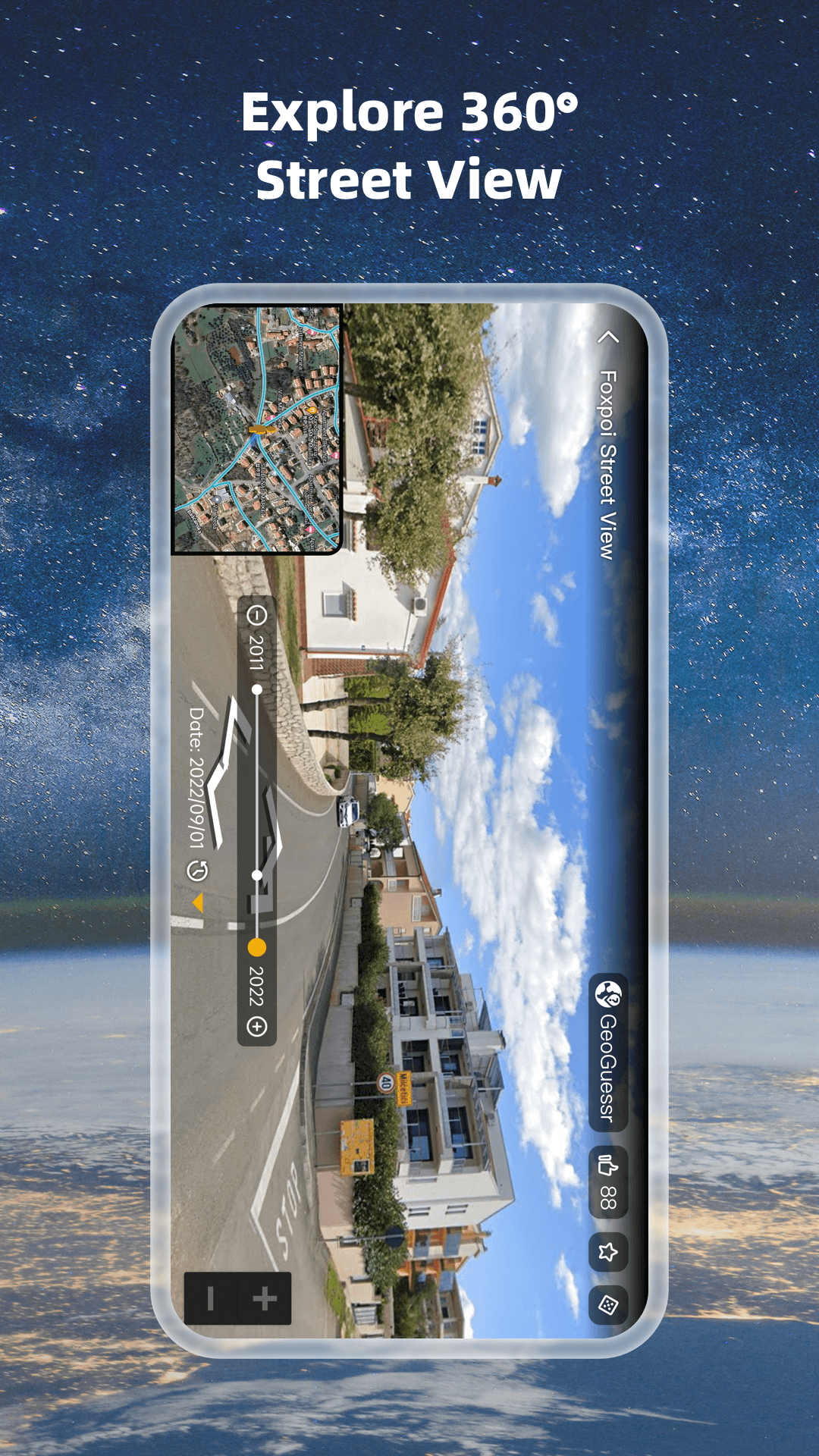
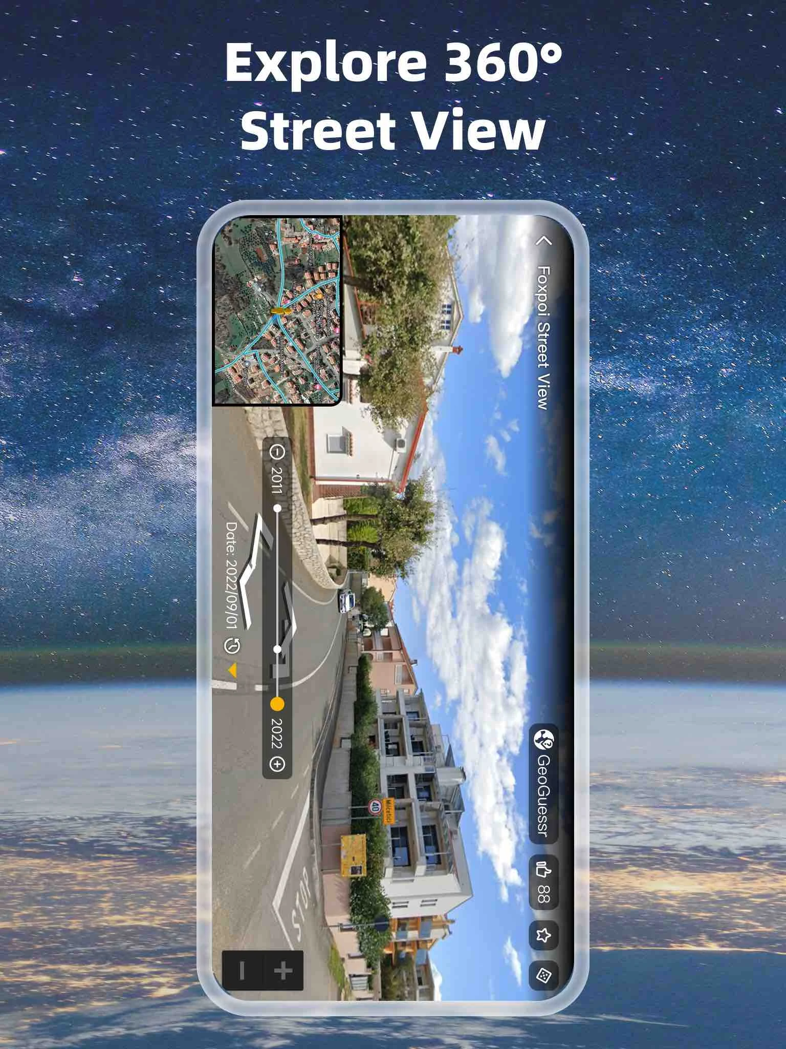
4.Explore historical street views.
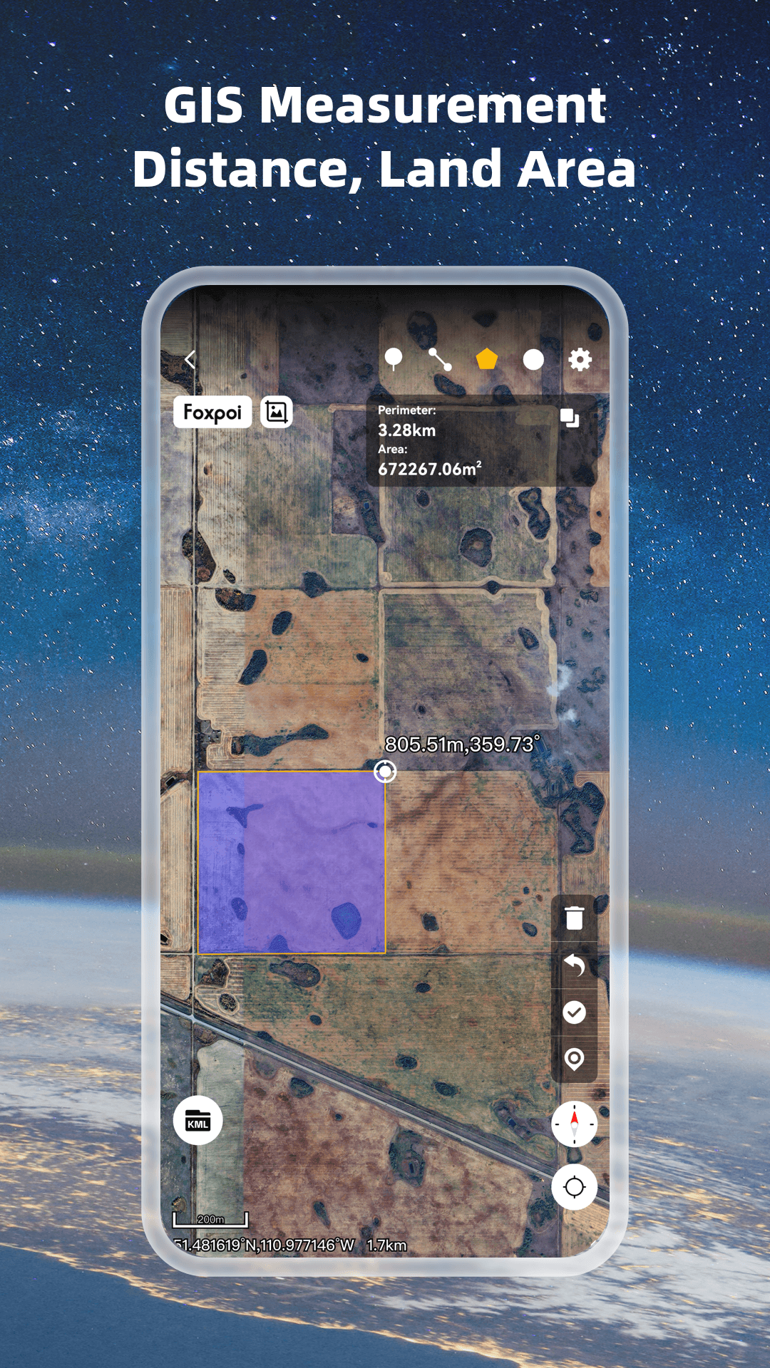
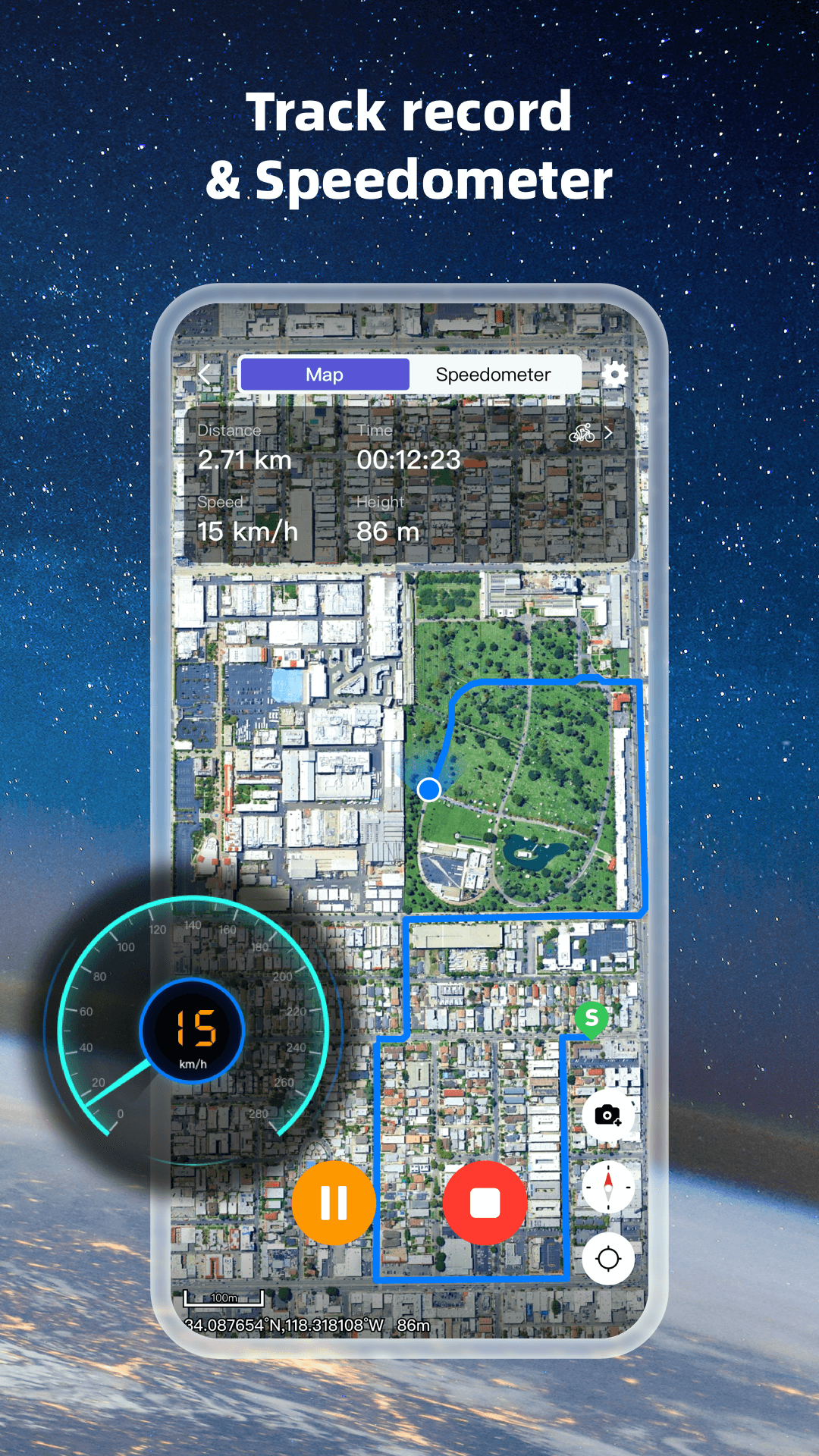
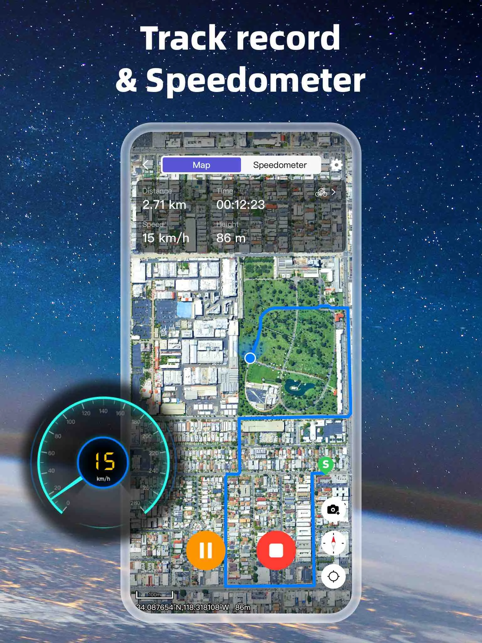
5.Measure distances and areas accurately.
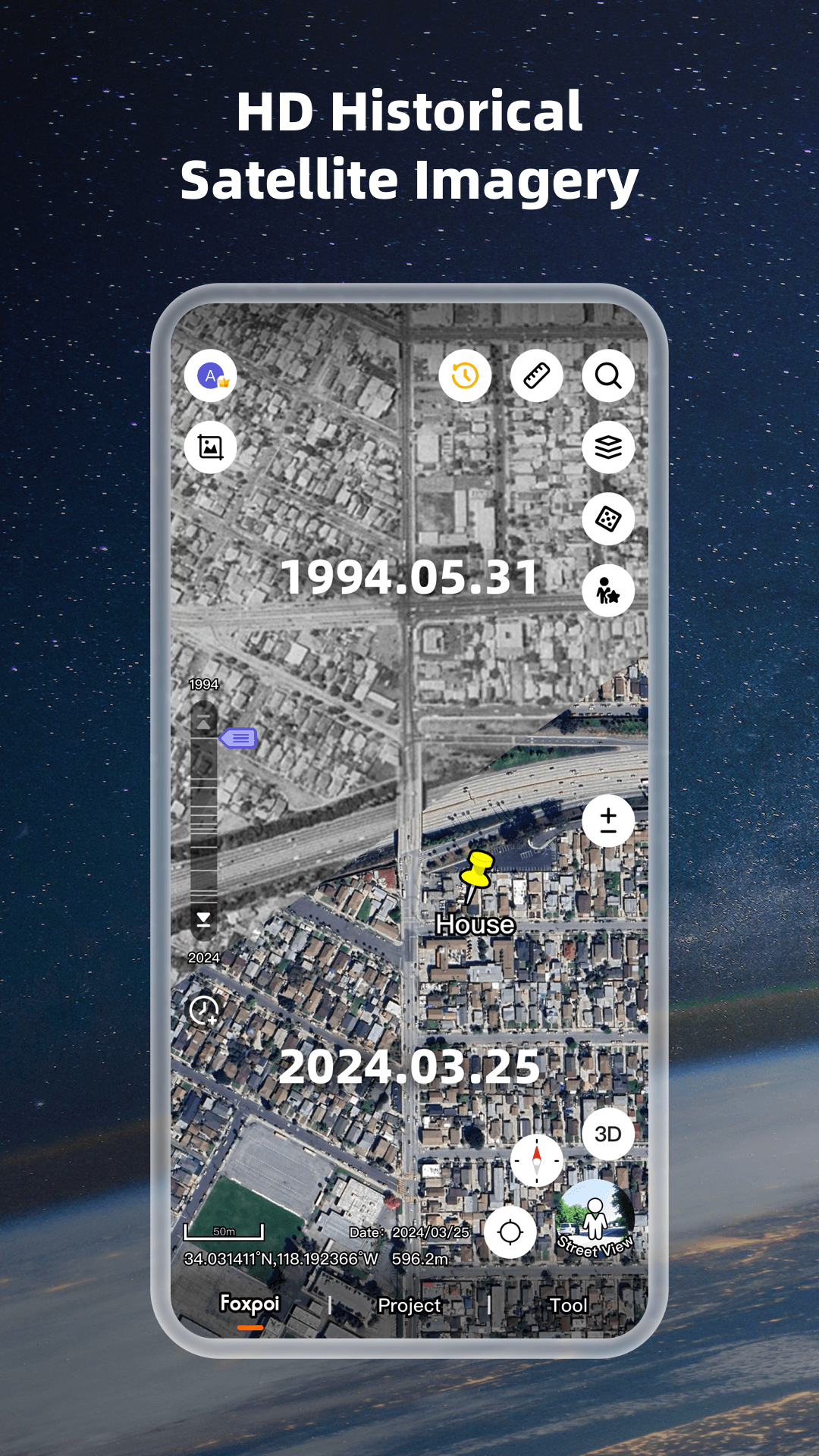
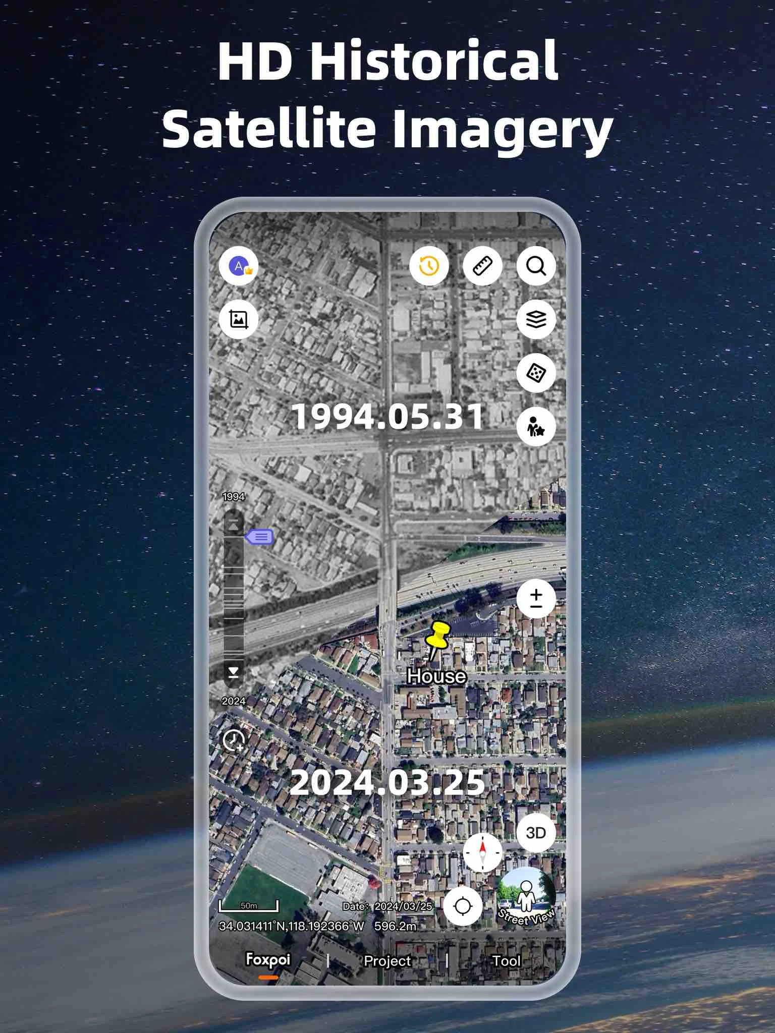
6.Stay updated with the latest satellite images.
World Satellite Map application offers users the opportunity to explore any location on Earth through satellite imagery. The key advantage of this map lies in its ability to showcase detailed surface features such as terrains, forests, rivers, lakes, buildings, and roads with exceptional precision. By using satellite maps, users can virtually visit various destinations around the globe via their mobile devices, providing a unique online travel experience without physical travel requirements.
Source: Adapted from World Satellite Map.
How to use
Installation and launch:
Download and install the selected 3D map software (such as Google Earth or ArcGIS Earth). For the web version of the tool, make sure the browser supports the relevant functions.
Search and locate:
After opening the application, use the search bar to enter the place name or coordinates to locate the target area.
Switch 3D view:
Select the 3D view mode in the control panel and adjust the viewing angle by dragging the mouse, zooming with the scroll wheel, or touching the screen.
Add layers:
Add layers such as political boundaries, administrative divisions, terrain, etc. as needed to obtain richer geographical information.
Custom settings:
Adjust parameters such as lighting, shadows, and textures to optimize the visual effects of the 3D map.
Explore and mark:
Use the bookmark and annotation functions to mark specific locations for later reference.
Notes
Hardware and software requirements:
Make sure your device meets the minimum configuration requirements, such as at least a 2 GHz processor, 4GB RAM, and a graphics card compatible with OpenGL 2.0.
Use Windows 10, macOS 10.14 or higher operating system.
Network connection:
A stable network connection is key to a smooth experience, especially when loading high-definition maps and layers.
Data accuracy:
Although the 3D map provides rich geographic information, some details may not be completely accurate. It is recommended to verify with other materials.
Regular updates:
Check for software updates regularly to get the latest features and improvements.
Privacy and security:
When using street view and 3D view functions, pay attention to protecting personal privacy and avoid displaying sensitive information in public.
- Version2.3.1.5
- UpdateFeb 14, 2025
- DeveloperFoxpoi
- CategoryMaps & Navigation
- Requires AndroidAndroid 6+
- Downloads4M+
- Package Namecom.think.earth
- Signature798e15bc3c94d46450c7d115484b0084
- Available on
- ReportFlag as inappropriate
-
NameSizeDownload
-
58.41 MB
-
59.03 MB
-
57.51 MB


Realistic visualization
Strong interactivity
Rich information layers
Real-time updates
Multi-platform support
High technical requirements
Large data volume
Complex operation