Geo Tracker - GPS Tracking & Sharing
Explore your adventures with precise GPS tracking, vibrant map views & share your thrilling routes with friends easily!
- 5.4.0.4293 Version
- 4.3 Score
- 6M+ Downloads
- In-app purchases License
- 3+ Content Rating

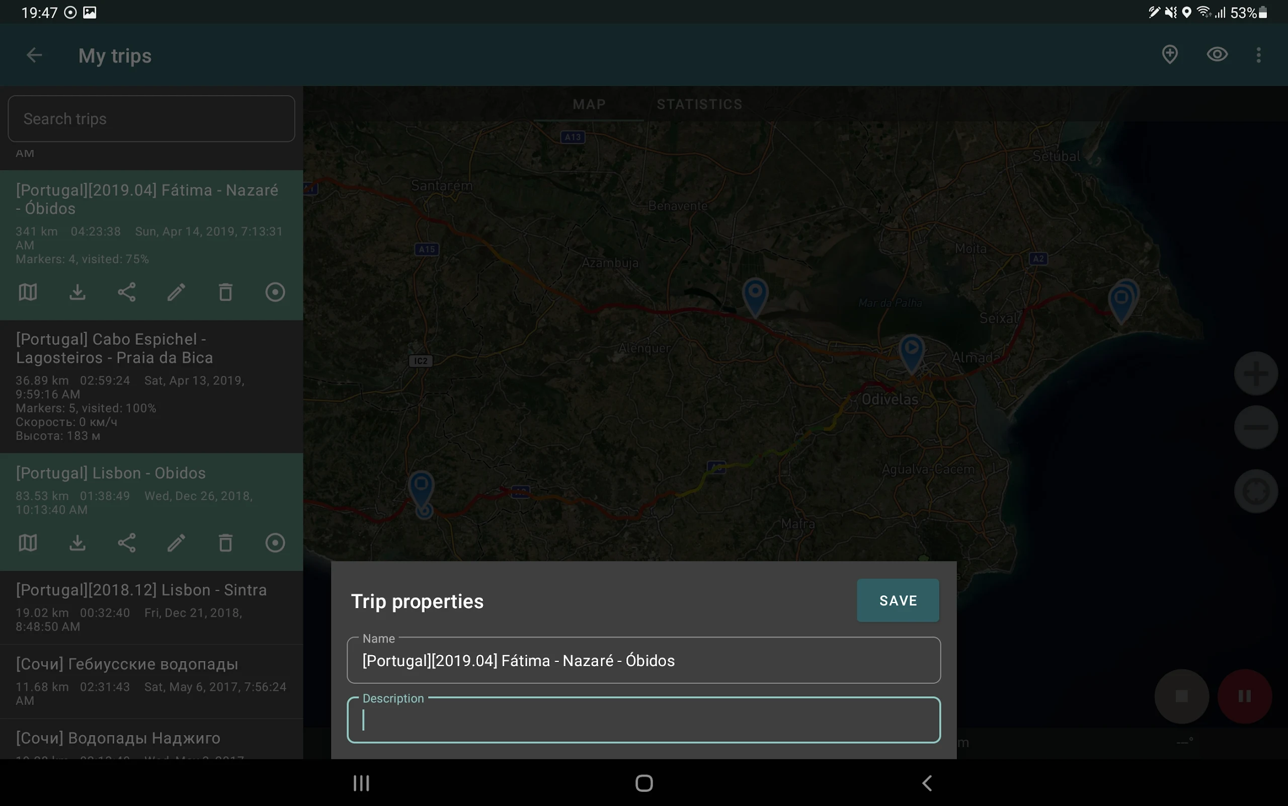
If you're on the hunt for a top-notch GPS tracker compatible with Open Street Maps or Google, and enjoy outdoor adventures or traveling, this app is perfect for you!
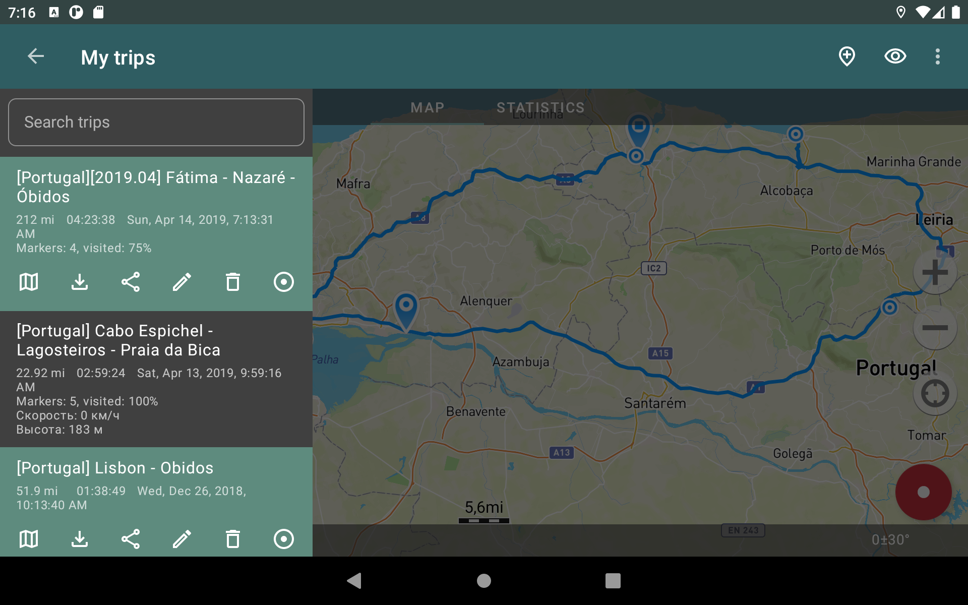
Capture GPS routes of your journeys, evaluate statistics, and share them with your friends!
Geo Tracker can assist you in several ways:
• Finding your way back in an unfamiliar place without getting lost;
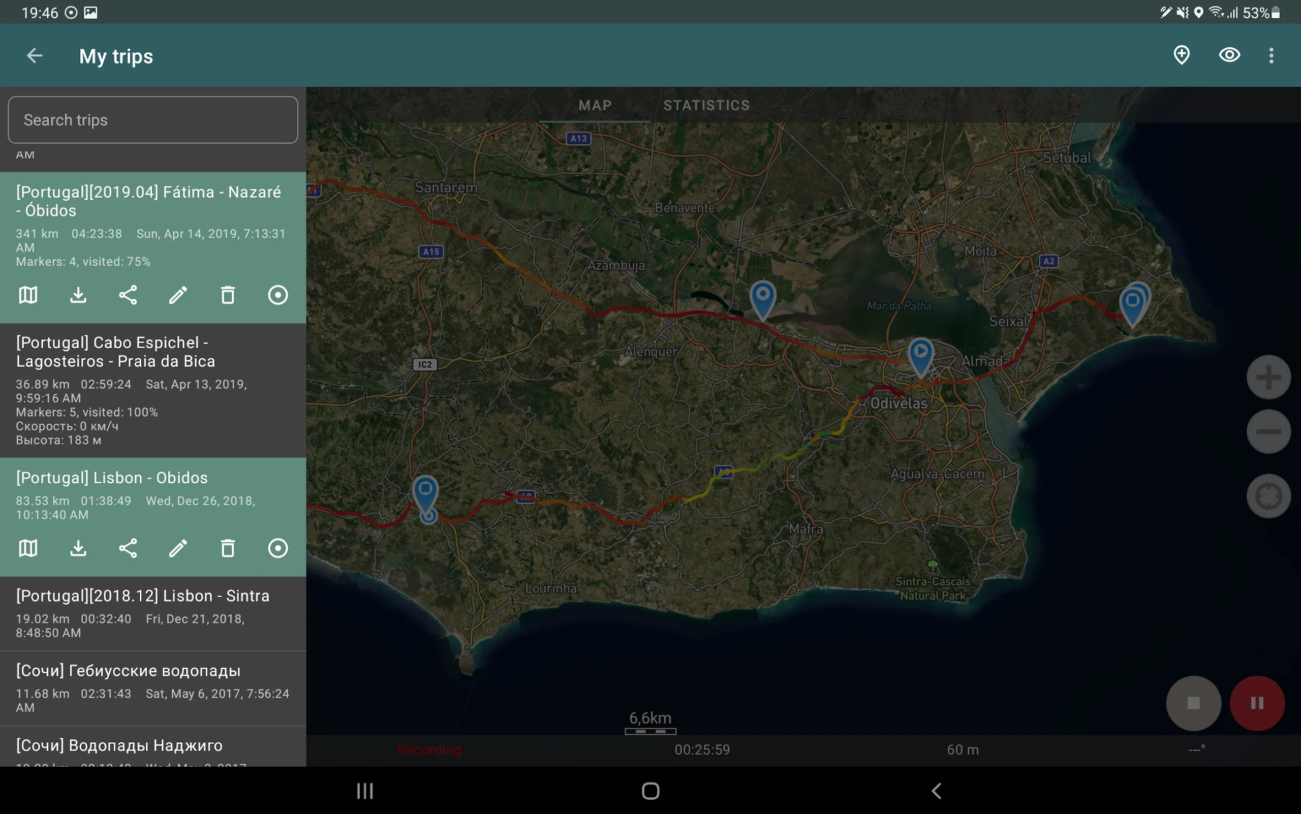
• Sharing your journey with friends;
• Utilizing another person's route from GPX, KML, or KMZ files;
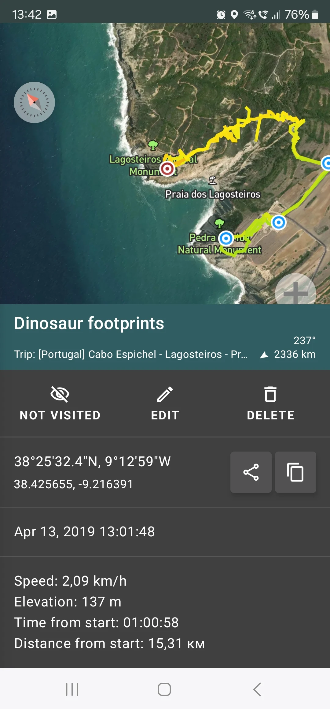
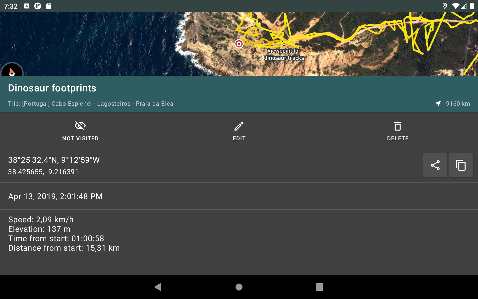
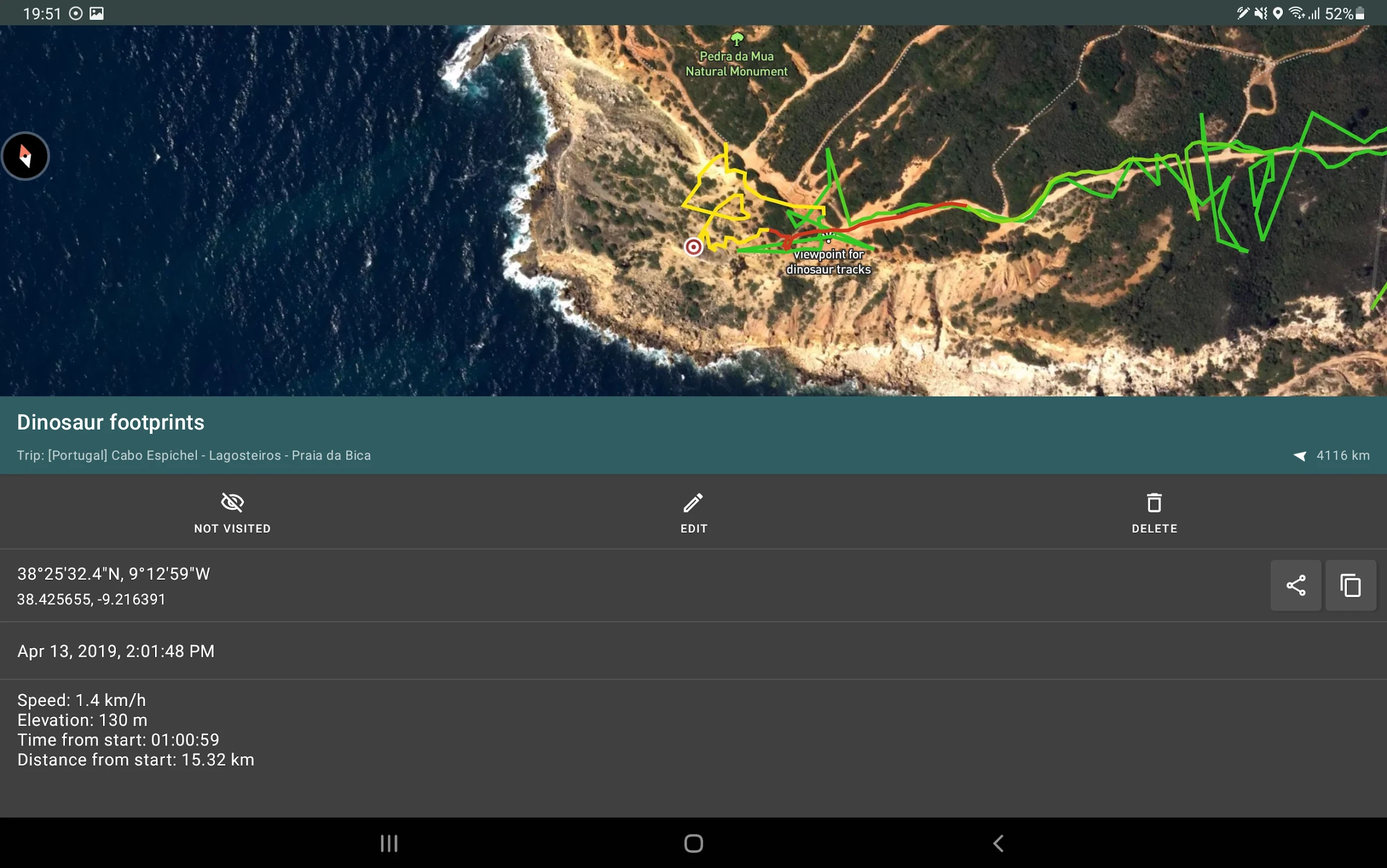
• Marking significant or interesting locations along your path;
• Identifying a point on the map if you have its coordinates;
• Showcasing vibrant screenshots of your achievements on social media.
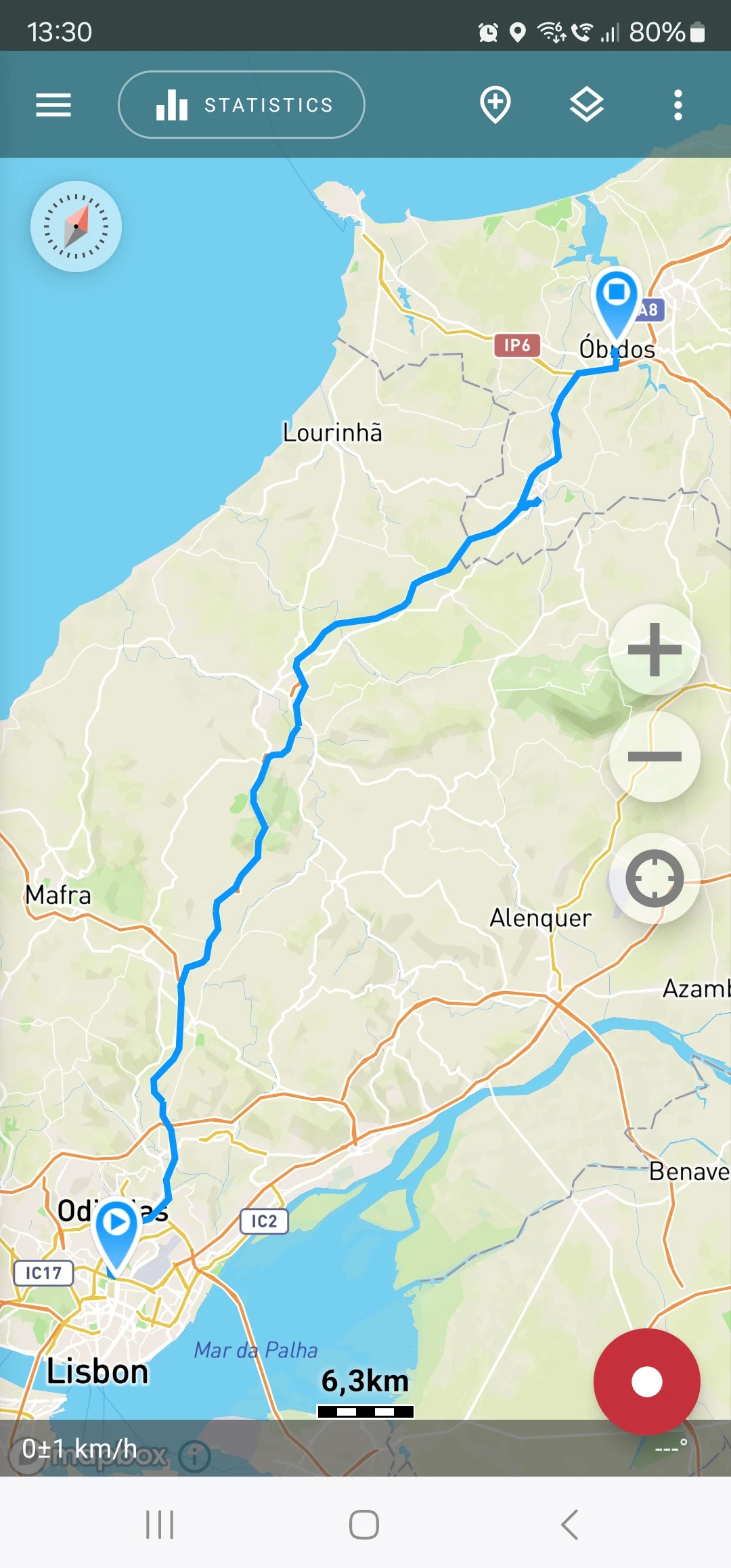
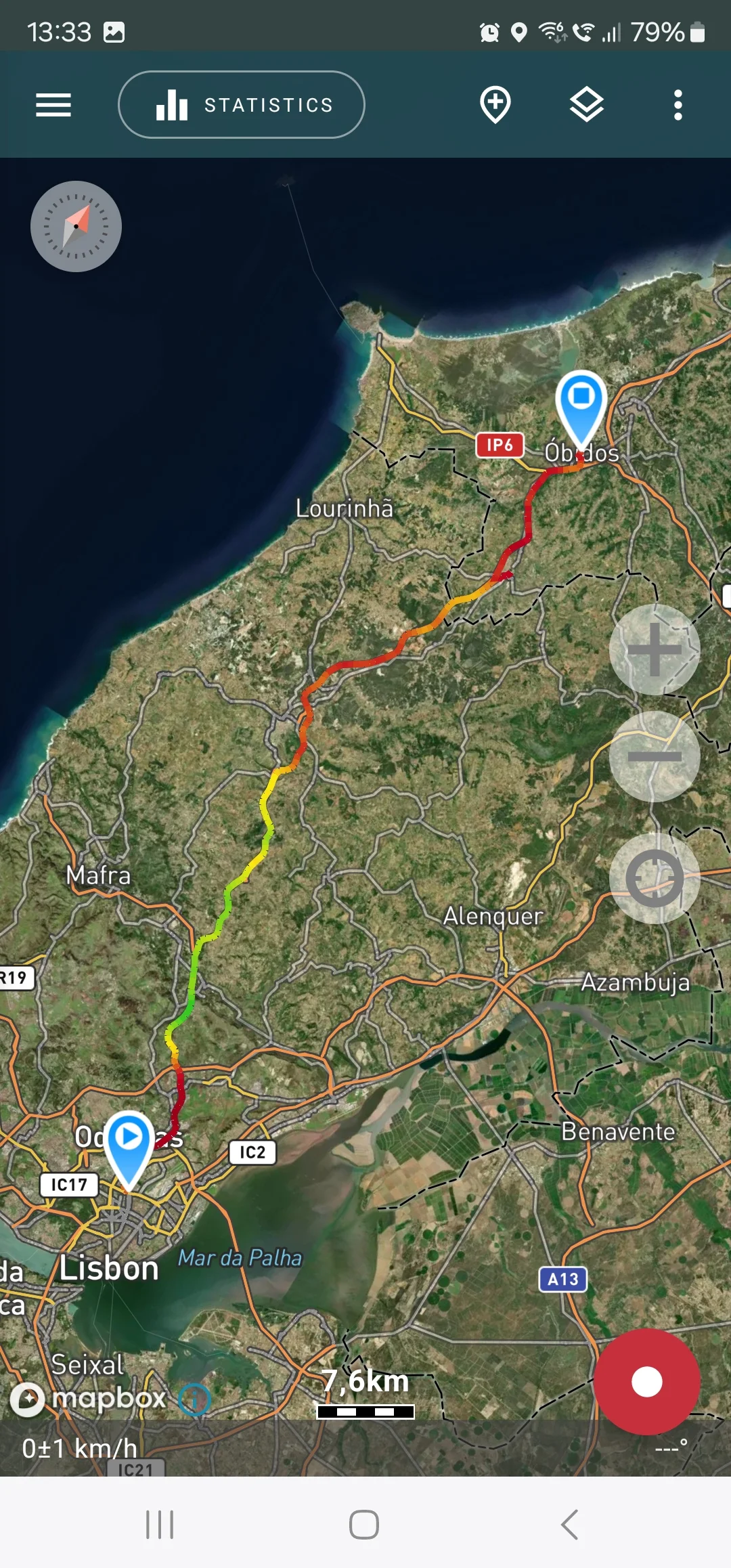
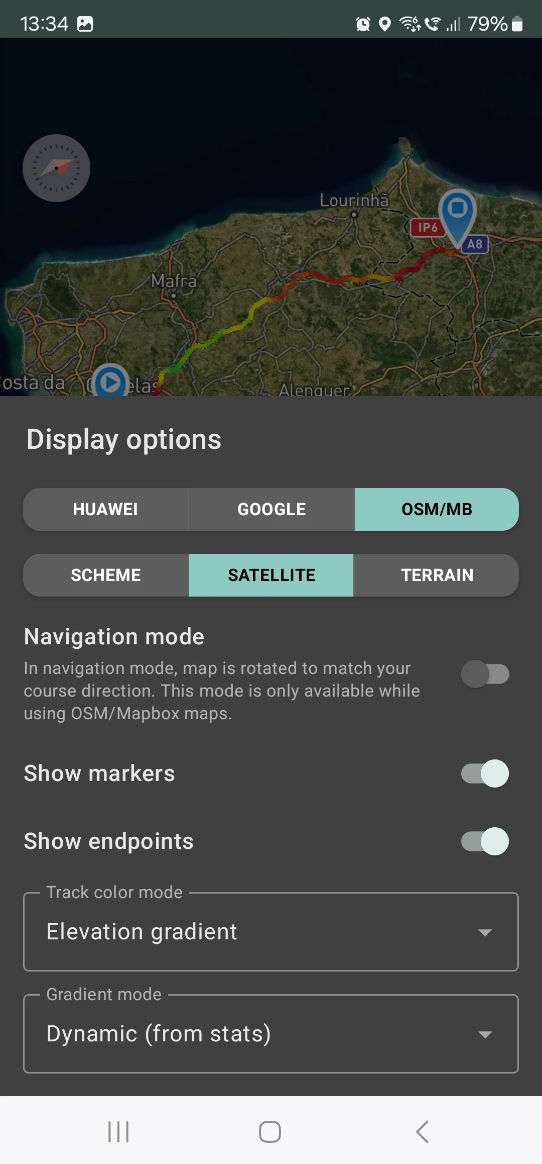
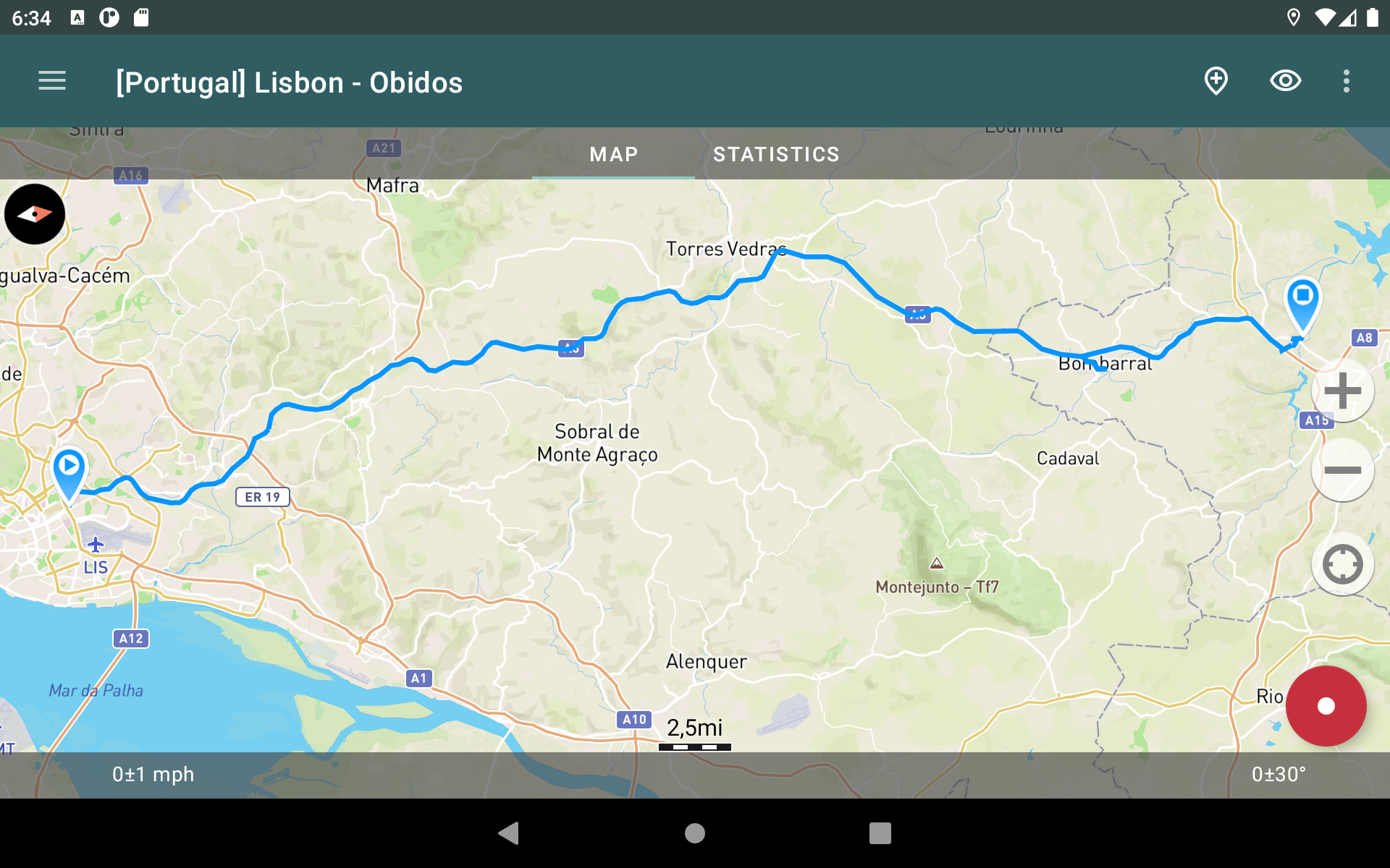
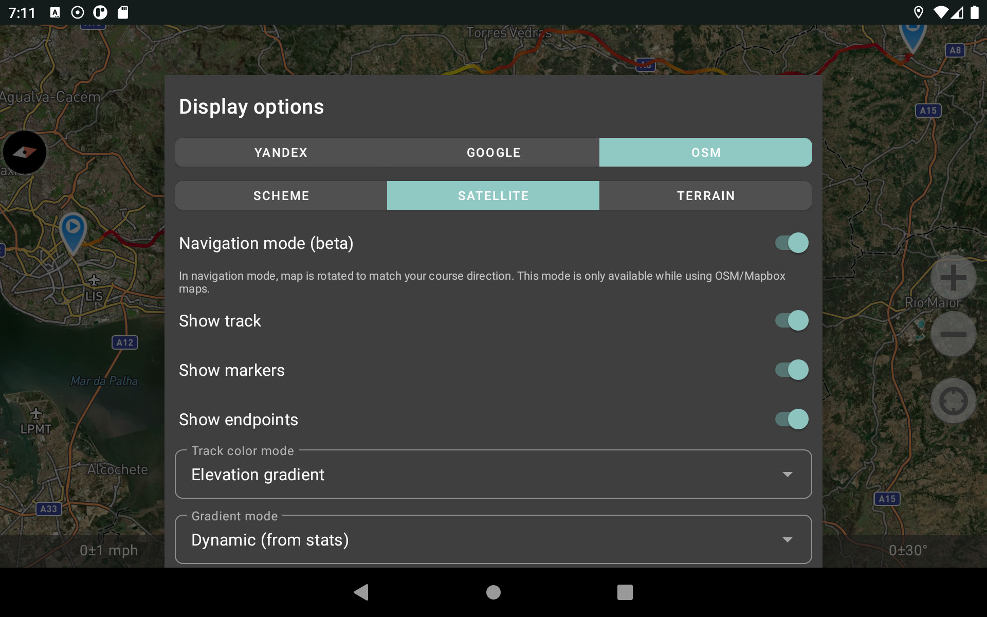
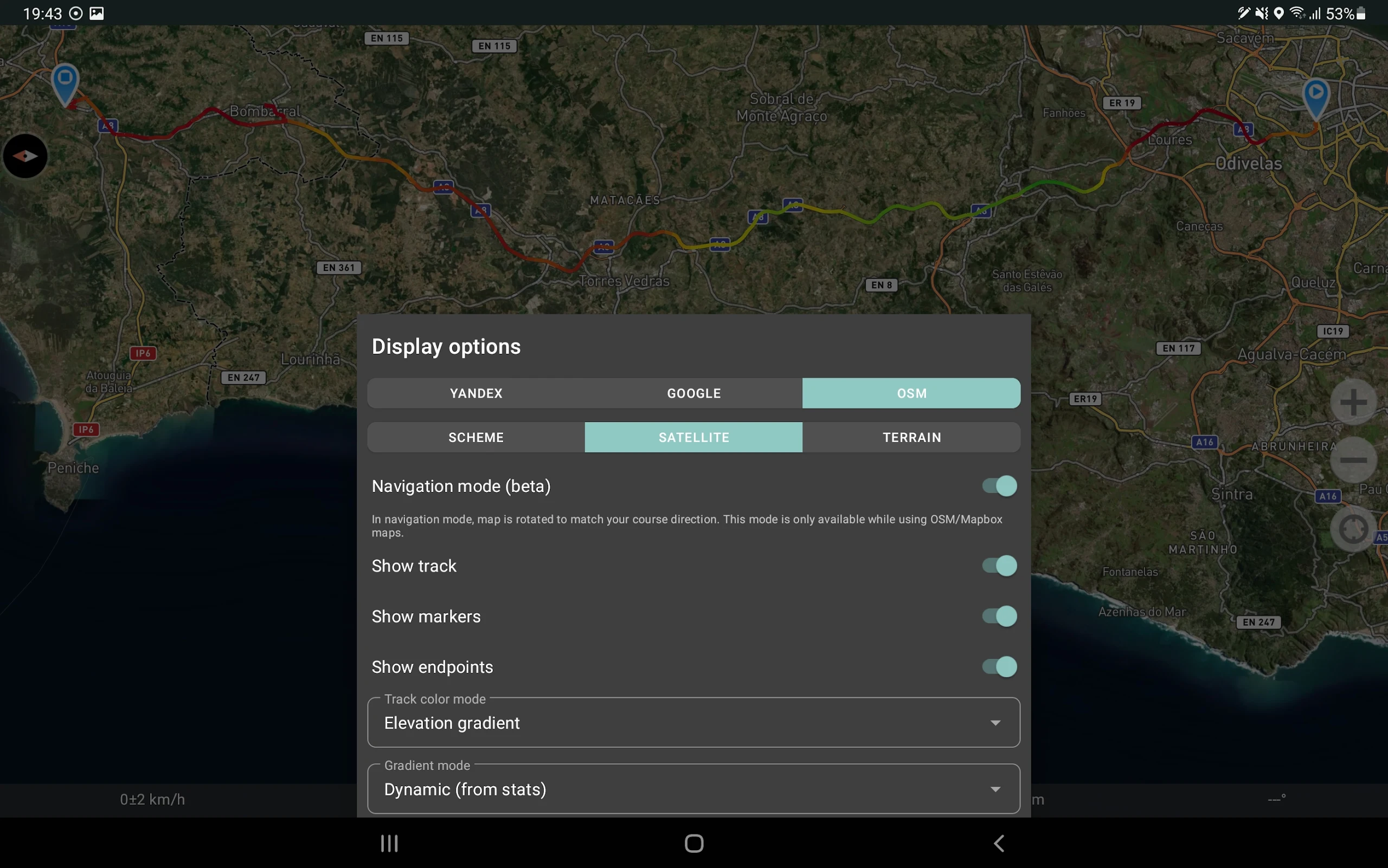
You can explore tracks and their surroundings within the app using either OSM or Google maps, as well as satellite images from Google or Mapbox—ensuring you always have access to the most detailed maps worldwide. The regions you examine are saved to your device and remain accessible offline for some time (this feature works best with OSM maps and Mapbox's satellite visuals). To capture and compute track stats, only a GPS signal is necessary—the internet is required solely for downloading map images.
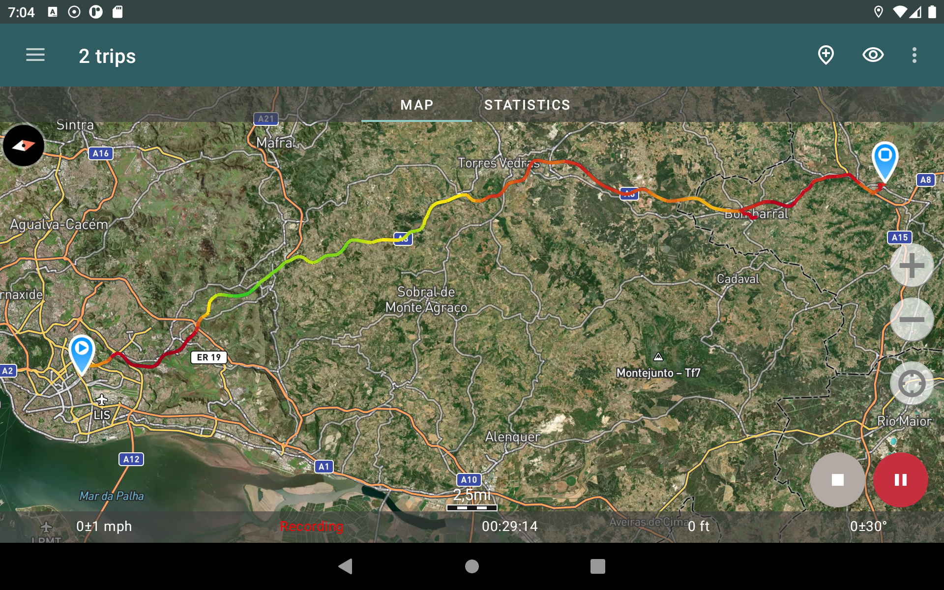
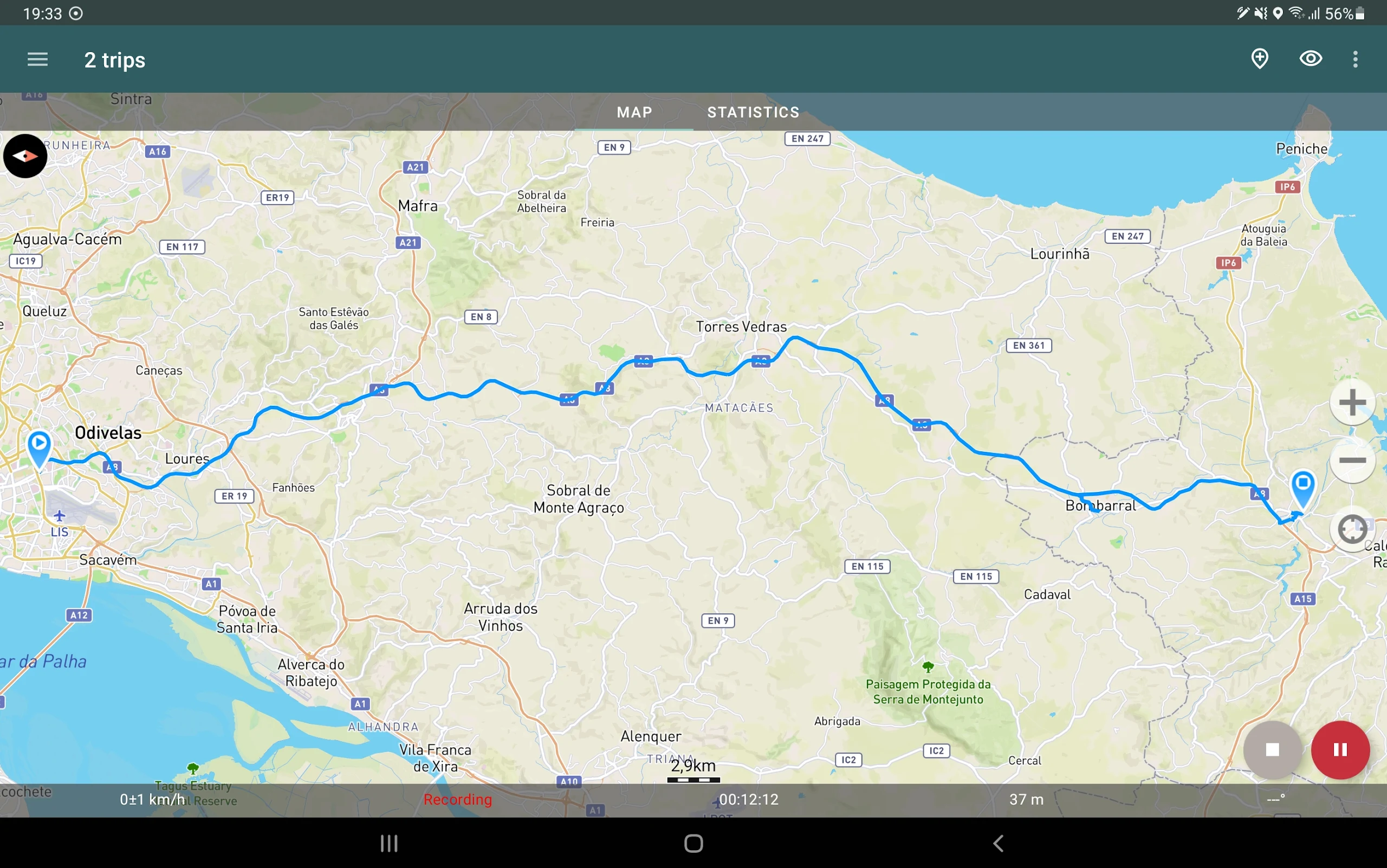
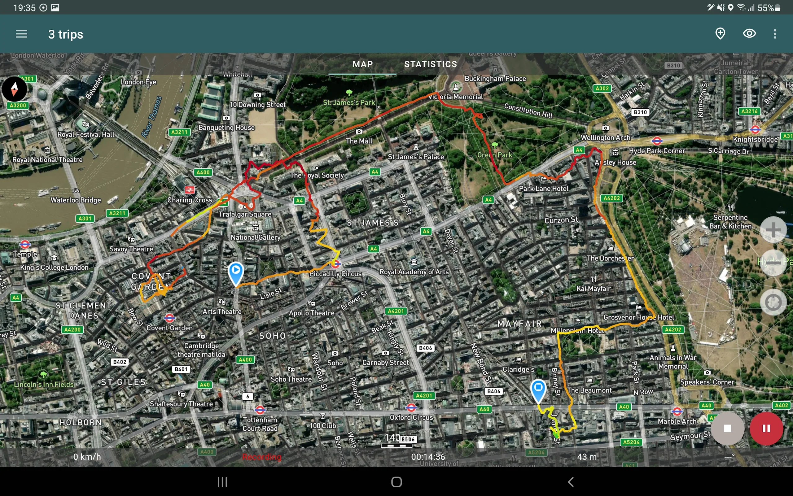
When driving, you can activate navigation mode, which automatically adjusts the map's orientation according to your direction of travel, significantly easing navigation.
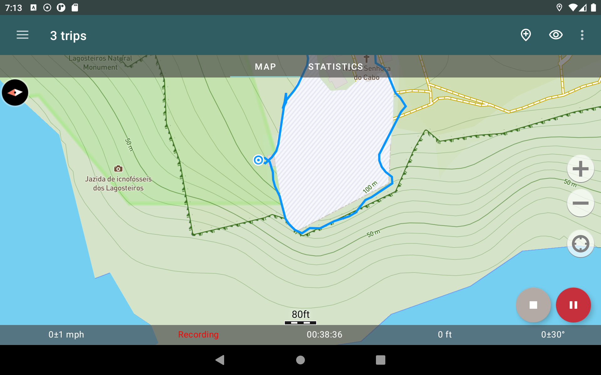
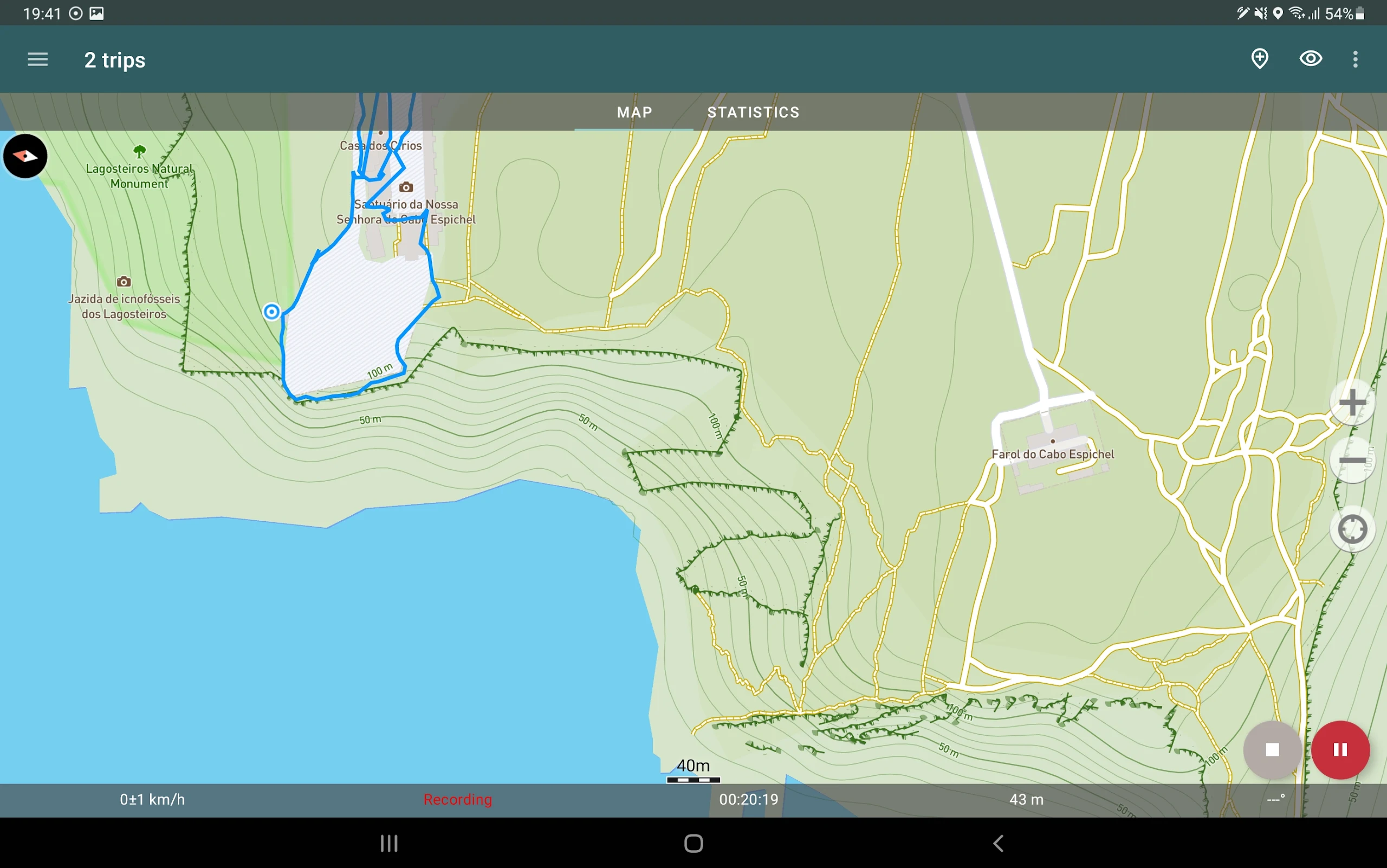
The application can record tracks while running in the background (on many devices, this may require additional adjustments in the system—proceed with caution! Instructions for these settings are provided within the app). Power consumption in background mode is highly optimized—on average, the battery can last a full day of recording. An energy-saving mode is also available; you can enable it in the app settings.
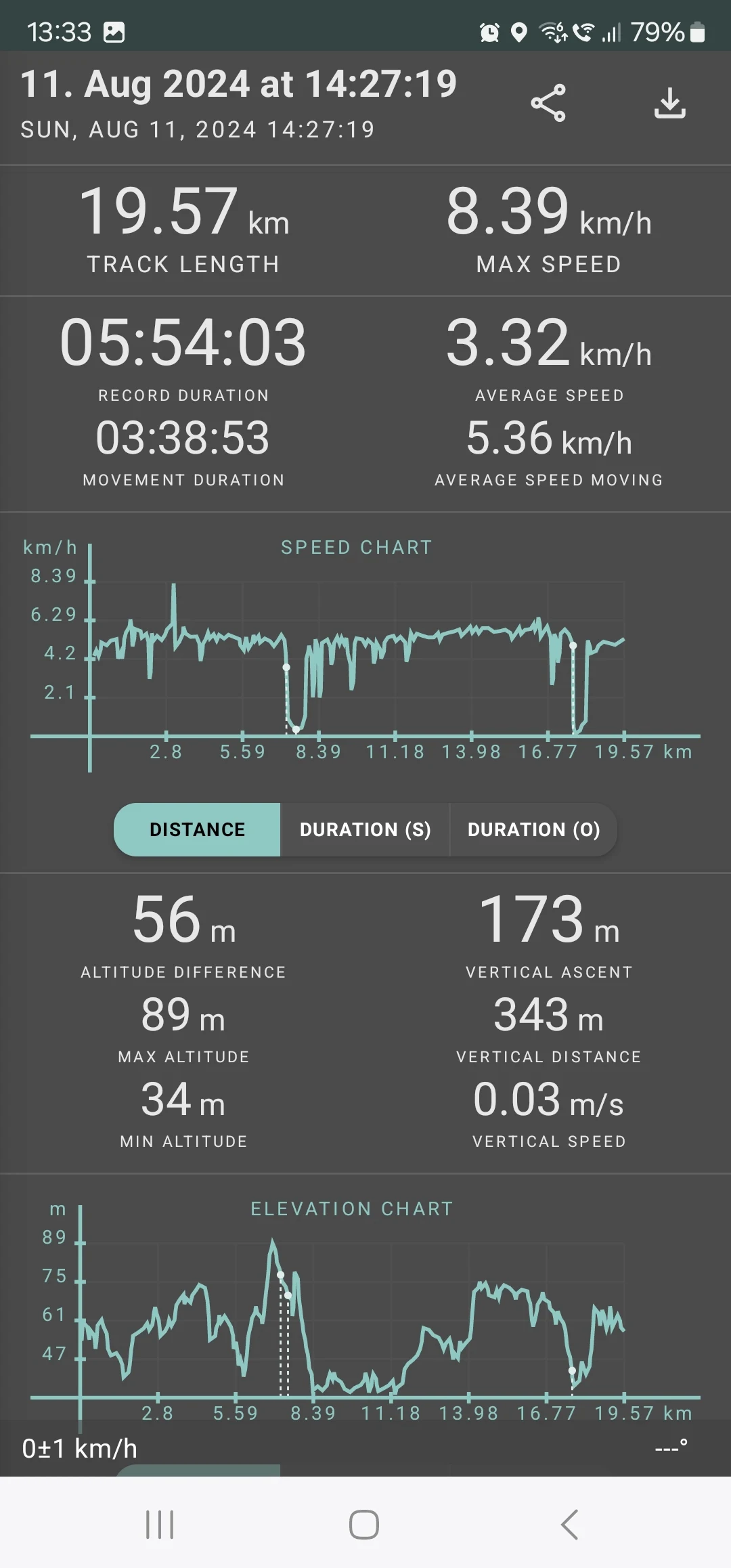
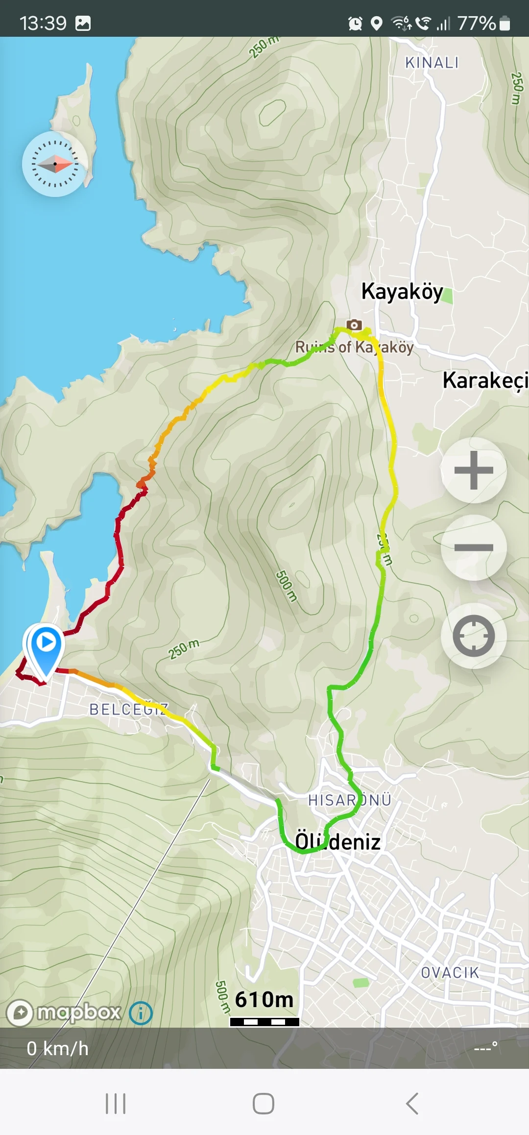
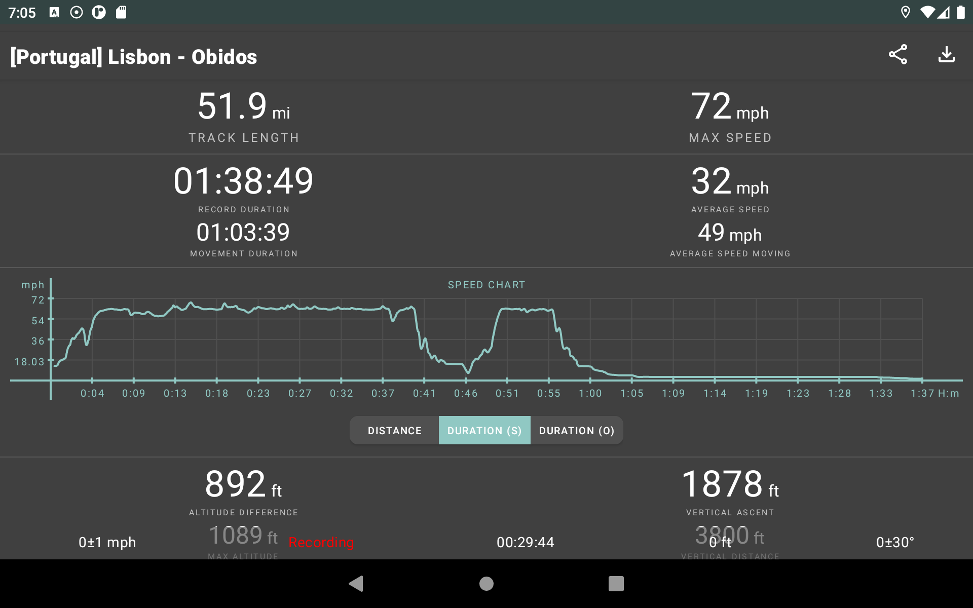
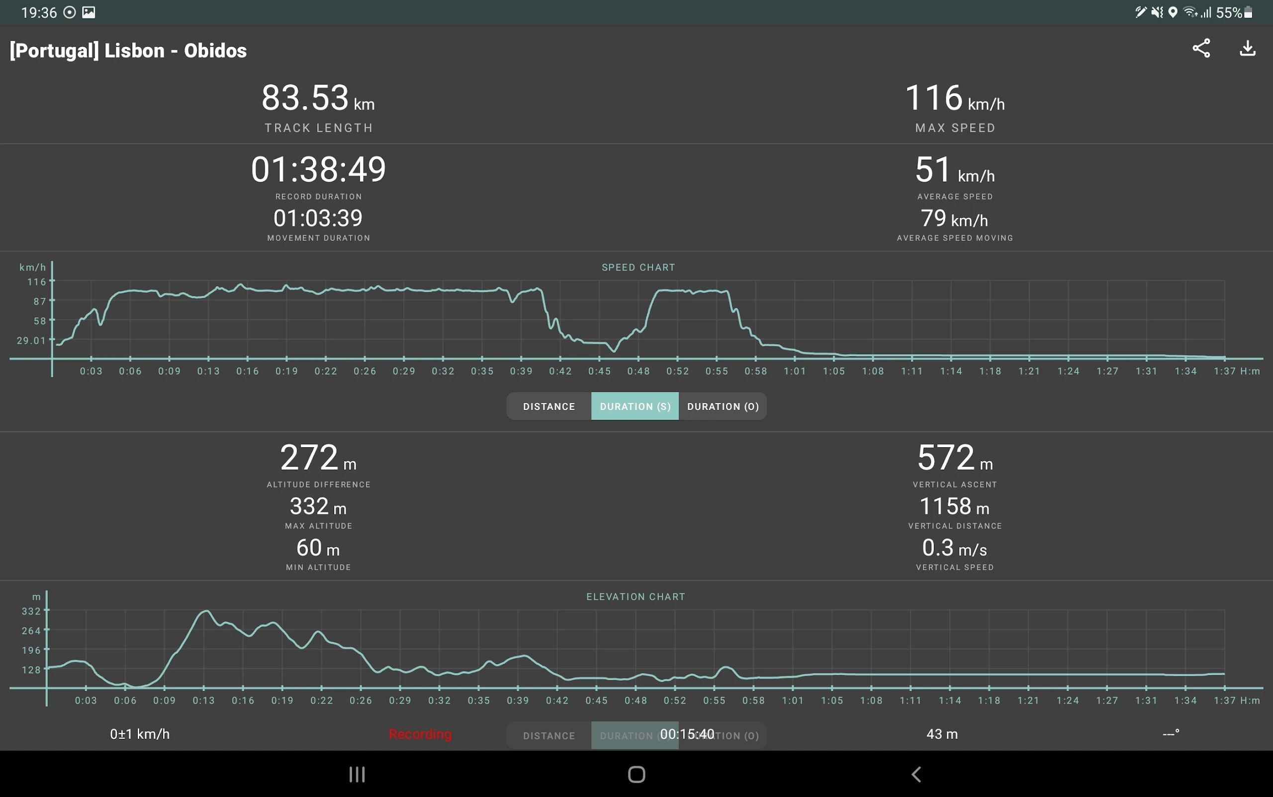
Geo Tracker computes various statistics:
• Distance traveled and duration of recording;
• Maximum and average speed throughout the journey;
• Duration and average speed while in motion;
• Minimum and maximum altitude during the trip, along with altitude differences;
• Vertical distance, ascent details, and speed;
• Minimum, maximum, and average slope.
Additionally, there are comprehensive charts displaying speed and elevation data.
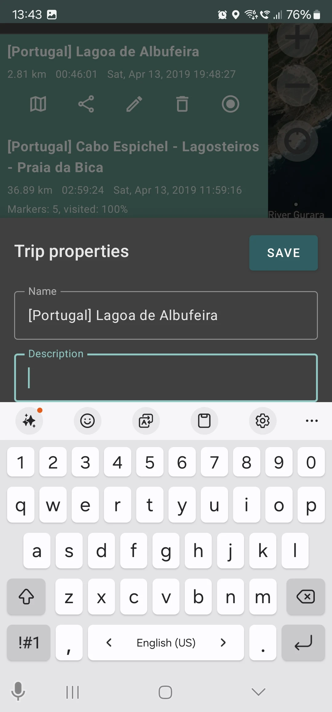
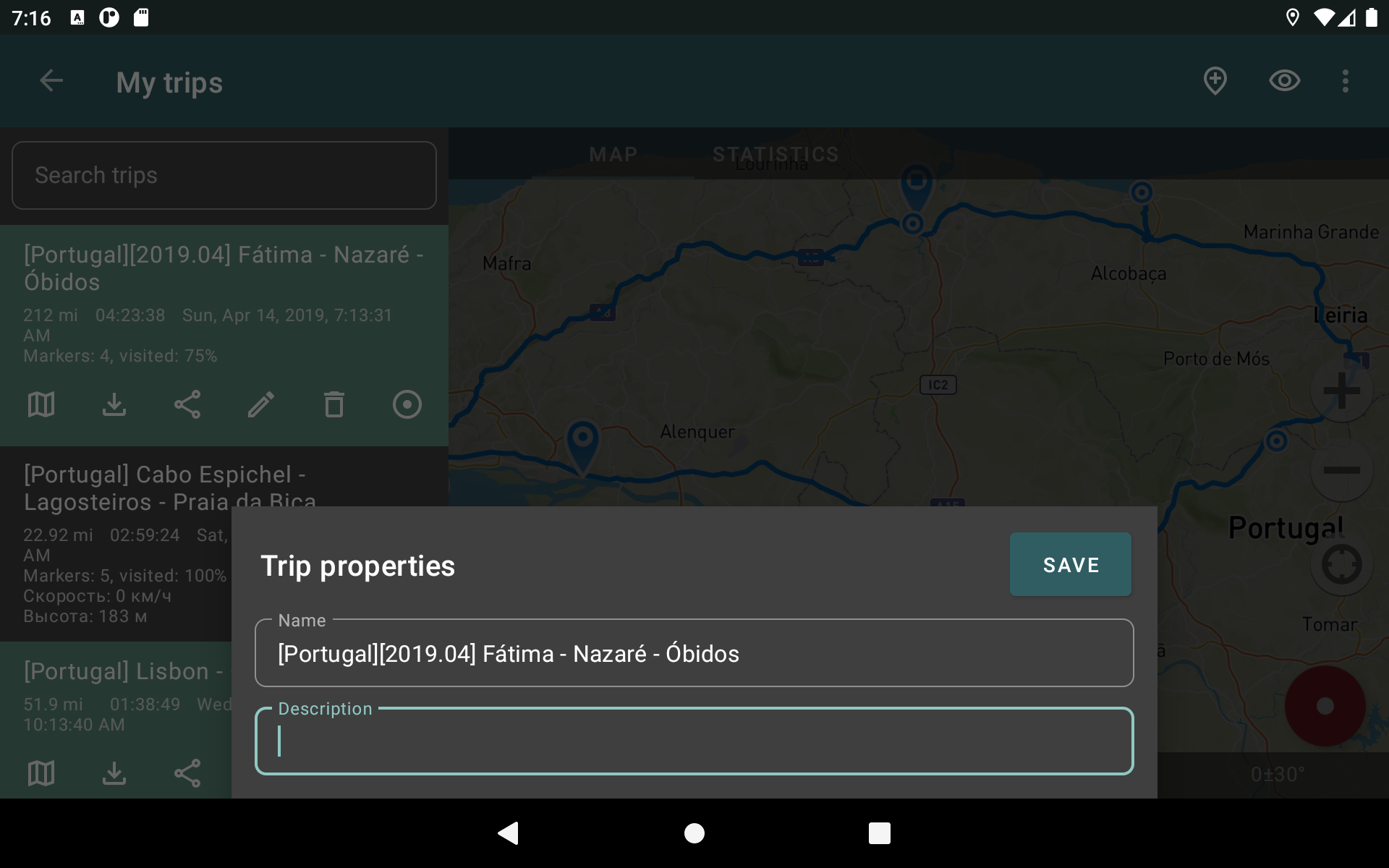
Tracks can be saved in GPX, KML, and KMZ formats, allowing usage in other popular applications like Google Earth or Ozi Explorer. These tracks are stored locally and not sent to external servers.
The app is ad-free and does not rely on your personal data for revenue. Support for the development of the project can be offered through voluntary donations made within the app.
Here are some helpful tips & tricks to address typical GPS issues with your smartphone:
• When beginning tracking, please wait momentarily for the GPS signal to fix.
• Restart your smartphone and ensure you have a "clear view" of the sky prior to starting (avoid obstructions like tall buildings, forests, etc.).
• Reception quality can change constantly due to factors such as weather, season, satellite positioning, areas with poor GPS coverage, tall buildings, and forests.
• Navigate to phone settings, select "Location," and activate it.
• Access your phone settings, go to "Date & time," and enable "Automatic date & time" and "Automatic time zone." A misconfigured time zone might delay the GPS signal acquisition.
• Disable airplane mode in your phone settings.
If these suggestions do not resolve your issues, consider uninstalling and reinstalling the app.
Keep in mind that Google utilizes not only GPS data but also additional information regarding the current location from nearby WLANs and/or mobile networks in its Google Maps application.
For more answers to common queries and solutions for frequent problems, further information is available directly in the app.
FAQ
How to move my recordings in Geo Tracker to the new phone?
To move your tracks from your current phone to a new one, follow these steps:
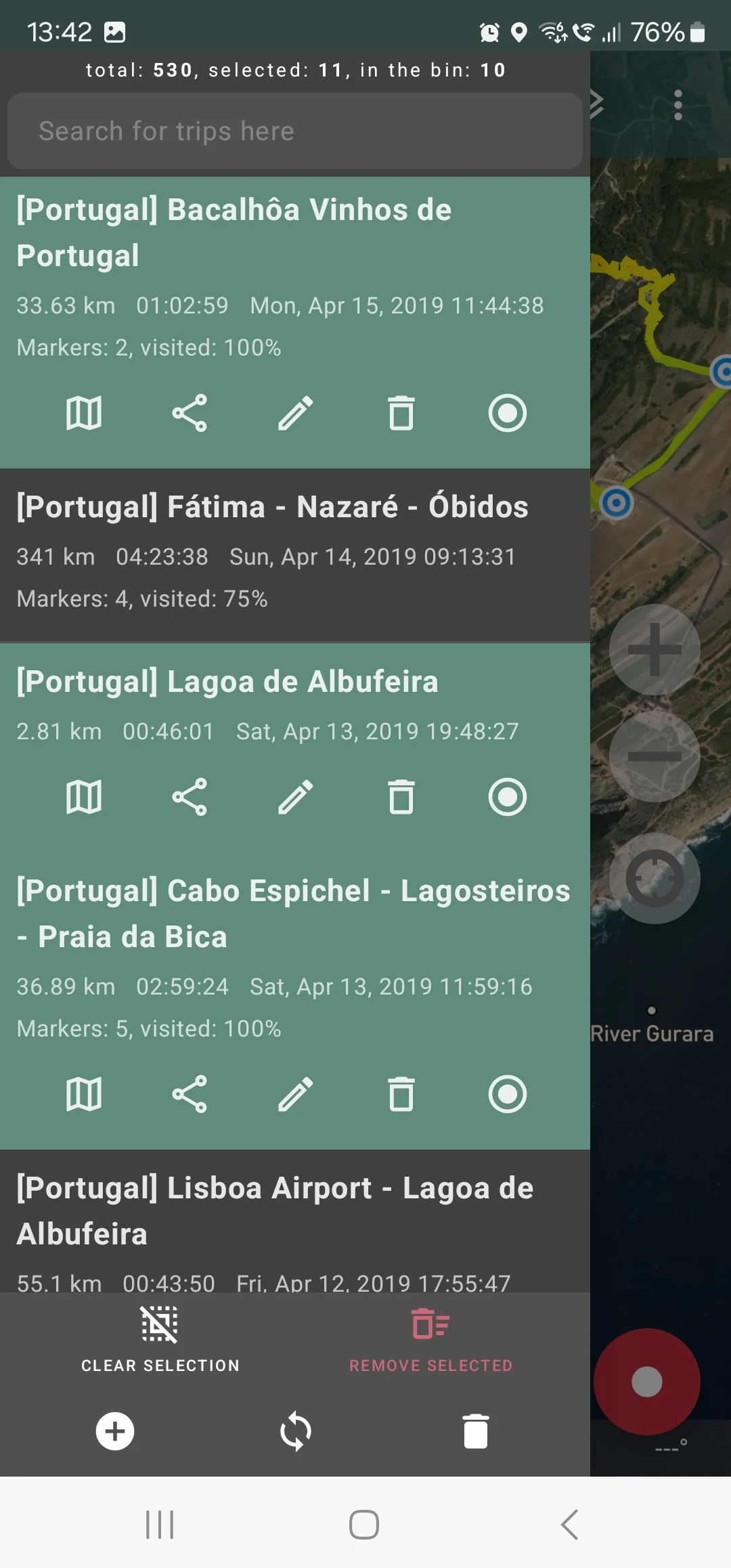
On your current phone, open Geo Tracker and tap the sync-icon from the bottom of the trip list.
Select any folder on your device where you want to put the exported tracks. Also, you can pick any export format. We suggest KMZ as it's most space-efficient.
Once the synchronization finishes, transfer all the files produced there to the new phone using any convenient method: connect your phone to a computer, send files by email, etc. The most important part here is to put all the files from this folder into some folder on a new phone. Let’s say this folder on the new phone will be “/Documents/MyTracks/”
Open Geo Tracker on the new device and tap the sync-icon from the trip list. Select the folder you created in the previous step and the format you selected in the first step.
You will now see all your tracks on the new device after the import process finishes.
I lost my phone. Can I find it with Geo Tracker?
Unfortunately, you cannot find your phone with Geo Tracker. Geo Tracker stores your tracks locally and does not save the phone's position to any server.
However, you can try to use Google's Find My Device.
How can I open a GPX/KML file with Geo Tracker?
Transfer the file to your device any way you like (via email, for example). Open it in that app – a dialog should pop up to select an app to open the file. Select Geo Tracker – and that’s it.
Why is access to OSM maps a paid feature?
Access to Open Street Maps in Geo Tracker is implemented through Mapbox, a commercial platform responsible for managing map data and images. This service comes with associated costs. Consequently, the choice to utilize OSM/Mapbox is exclusively available to our subscribers who choose a paid subscription.
- Version5.4.0.4293
- UpdateMar 31, 2025
- DeveloperIlya Bogdanovich
- CategoryTravel & Local
- Requires AndroidAndroid 5.0+
- Downloads6M+
- Package Namecom.ilyabogdanovich.geotracker
- Signature3b8084e42663107e9b3818433955ebb4
- Available on
- ReportFlag as inappropriate
-
NameSizeDownload
-
23.63 MB
-
23.00 MB


Photos can be geotagged
You can record the places you have been to
Does not consume power
Save time on the move
Excellent at marking waypoints
Recording stops when the screen turns off
No cloud storage feature
No color markings
After the update, all previous records disappeared