GLand Measure - Land measurement tool & GPS
Experience accurate land measurements with GPS tools, area calculations, and camera features tailored for your needs!

- 3.22.0 Version
- 3.1 Score
- 3M+ Downloads
- In-app purchases License
- 3+ Content Rating


INTRODUCTION
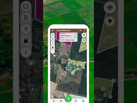
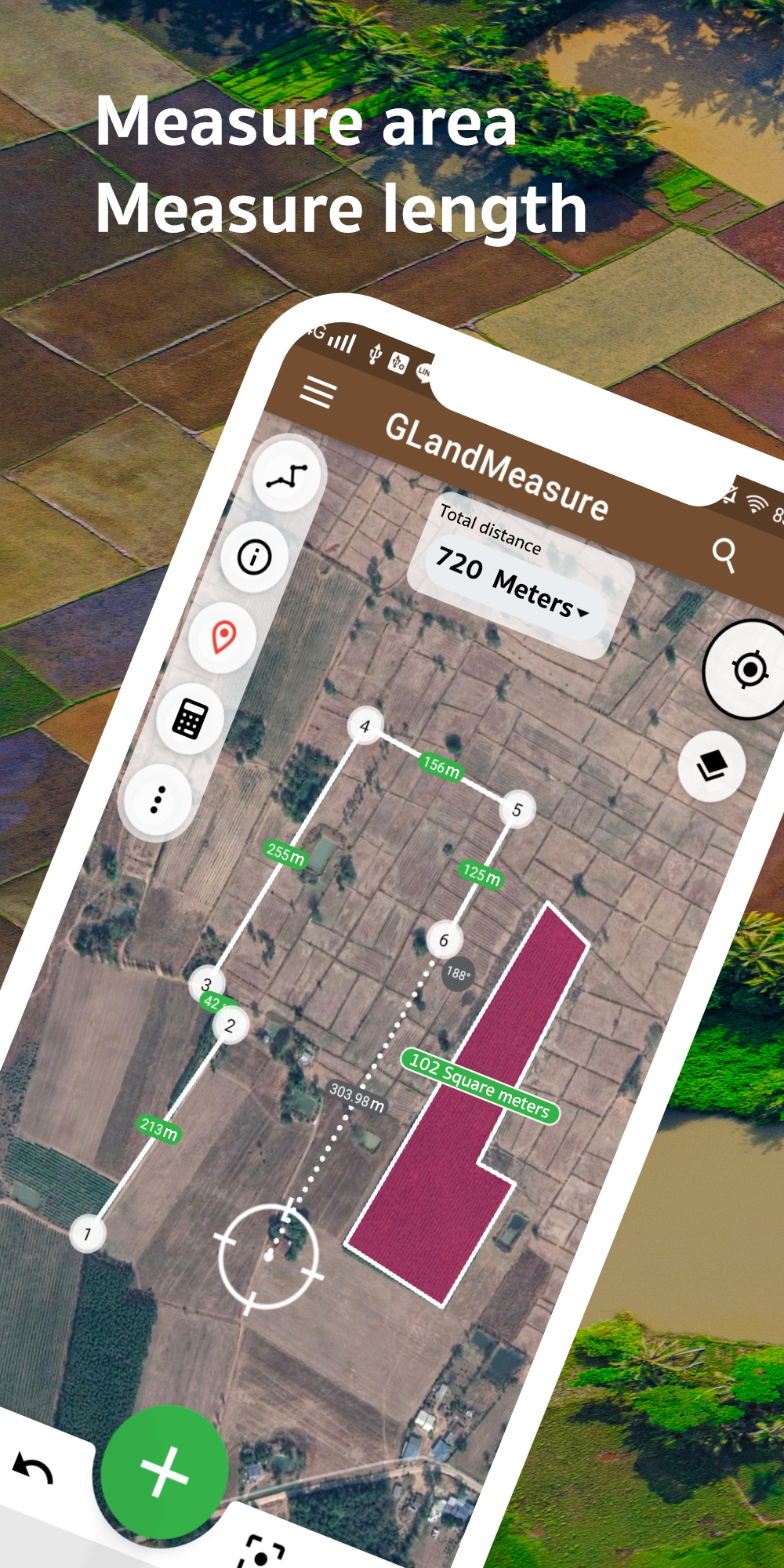
GLandMeasure is the ideal application for accurate land measurements. Whether you wish to determine land areas, measure distances, or obtain precise area metrics by walking, this app meets all your needs. It boasts features such as an area calculator tailored for land, GPS-based field area assessments, and an area finder that guarantees reliable results consistently. Our distinct 'area measurement app with camera' function lets you take pictures while measuring areas in real-time. You can explore our area map, use the geo area calculator, and effortlessly measure distances with our dedicated distance tool. The app accommodates users working in various measurement units, providing flexibility for all scenarios. Whether you are a farmer assessing agricultural land, a professional requiring a dependable land measurement tool, or simply someone interested in understanding their property size, GLandMeasure serves as the perfect solution for any measurement requirement. Explore extensive measurement capabilities through features like geojson compatibility, GPS speedometer functionality, and satellite measurement support. From straightforward area calculations to sophisticated methods such as a 'length measurement app by walking', GLandMeasure offers a holistic answer for every measurement task. Try it out today and enjoy top-tier tools for land, field, and distance measurements.
Area Measure Length GPS, GLand is your go to application for you to know the exact distance, measure, length of a certain space for you to know. By knowing the exact measurements, you can have an advantage on how to sell properties and units to your clients. Of course, this application can be also used for academic purposes. In addition, there are awesome features that you are going to explore and discover like accuracy, precision, and easy to use interface, touch controls and more. Lastly, you don't have to worry about anything else because this is completely free for you to use.
DESCRIPTION
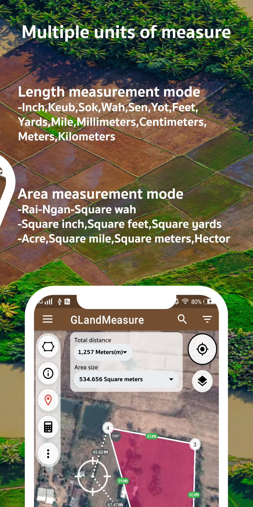
GLandMeasure is a versatile app that allows users to easily measure areas and lengths for a variety of purposes such as land, farm, field, and home measurements. The app offers two convenient methods of measurement - pinning on the map or using the actual walking method. By simply inputting the necessary points, the app will automatically calculate the area and length. Additionally, users have the flexibility to choose from a wide range of measurement units.
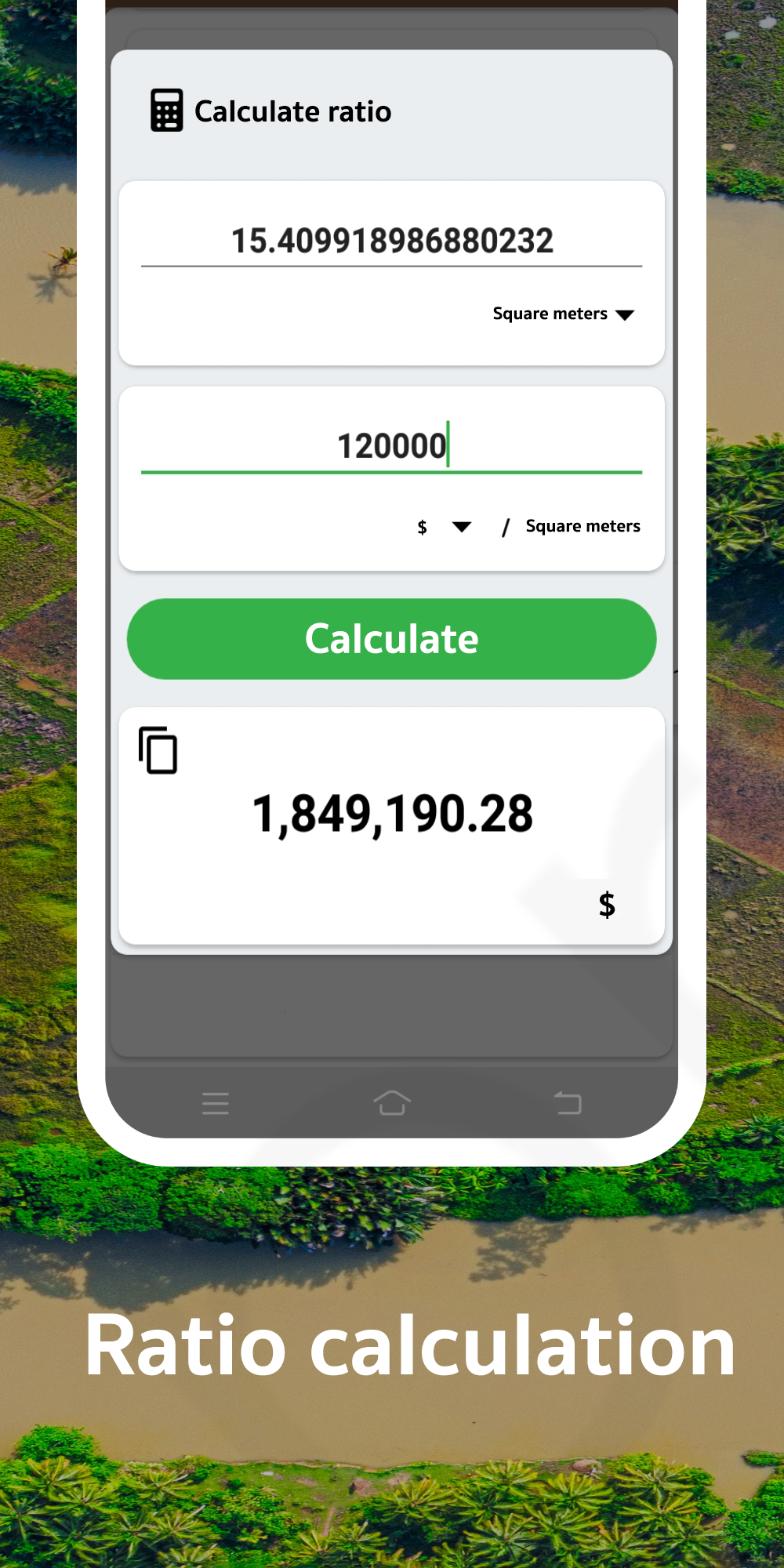
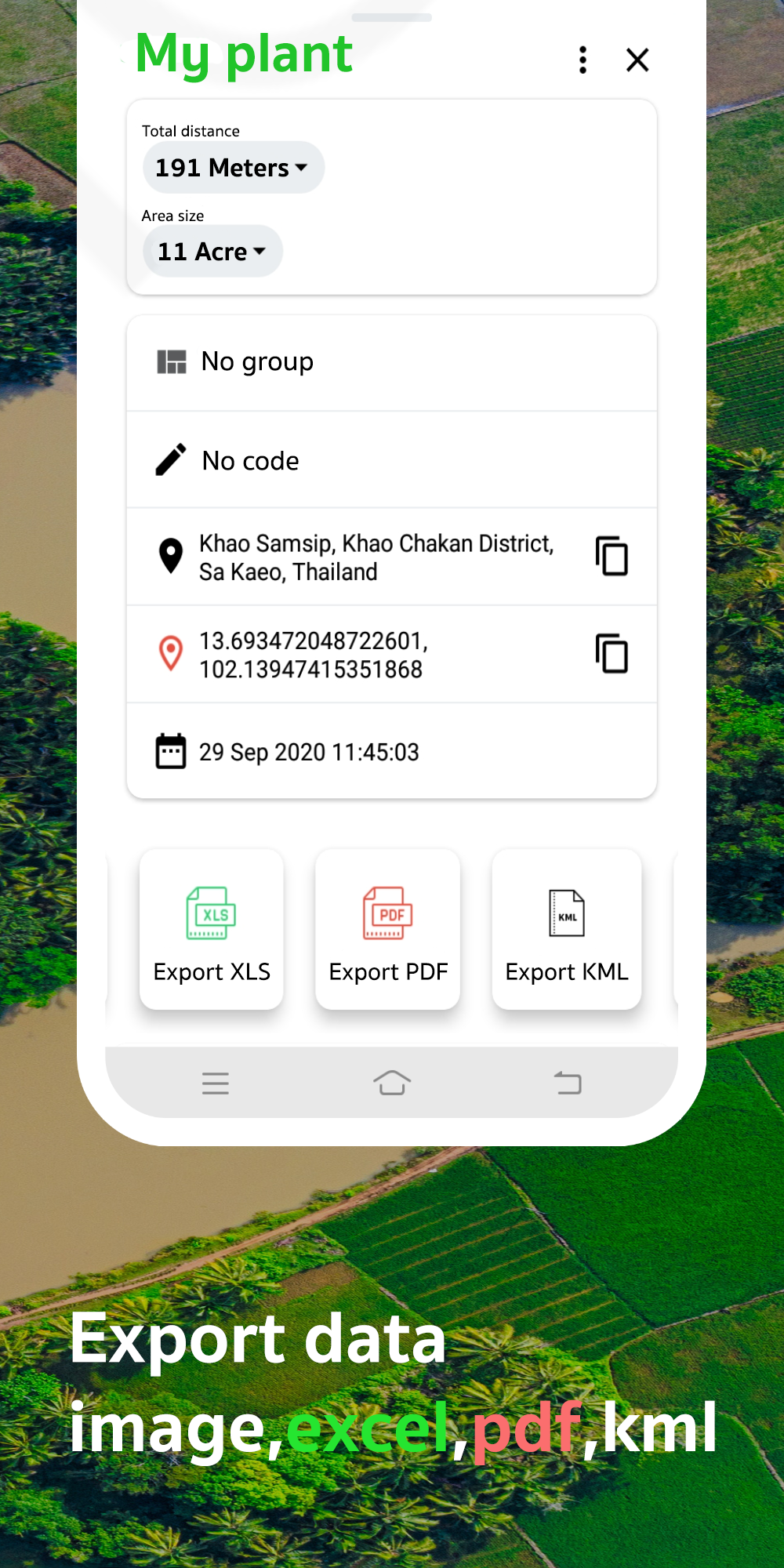
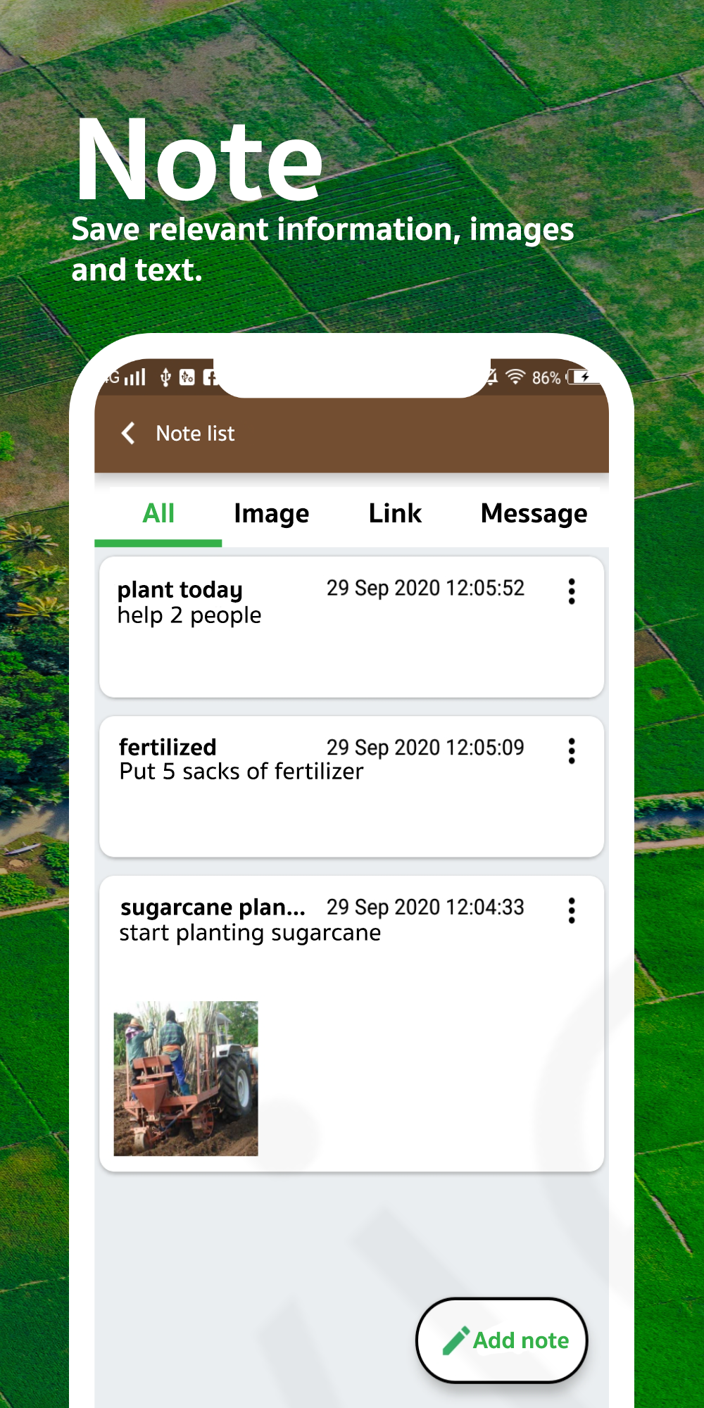
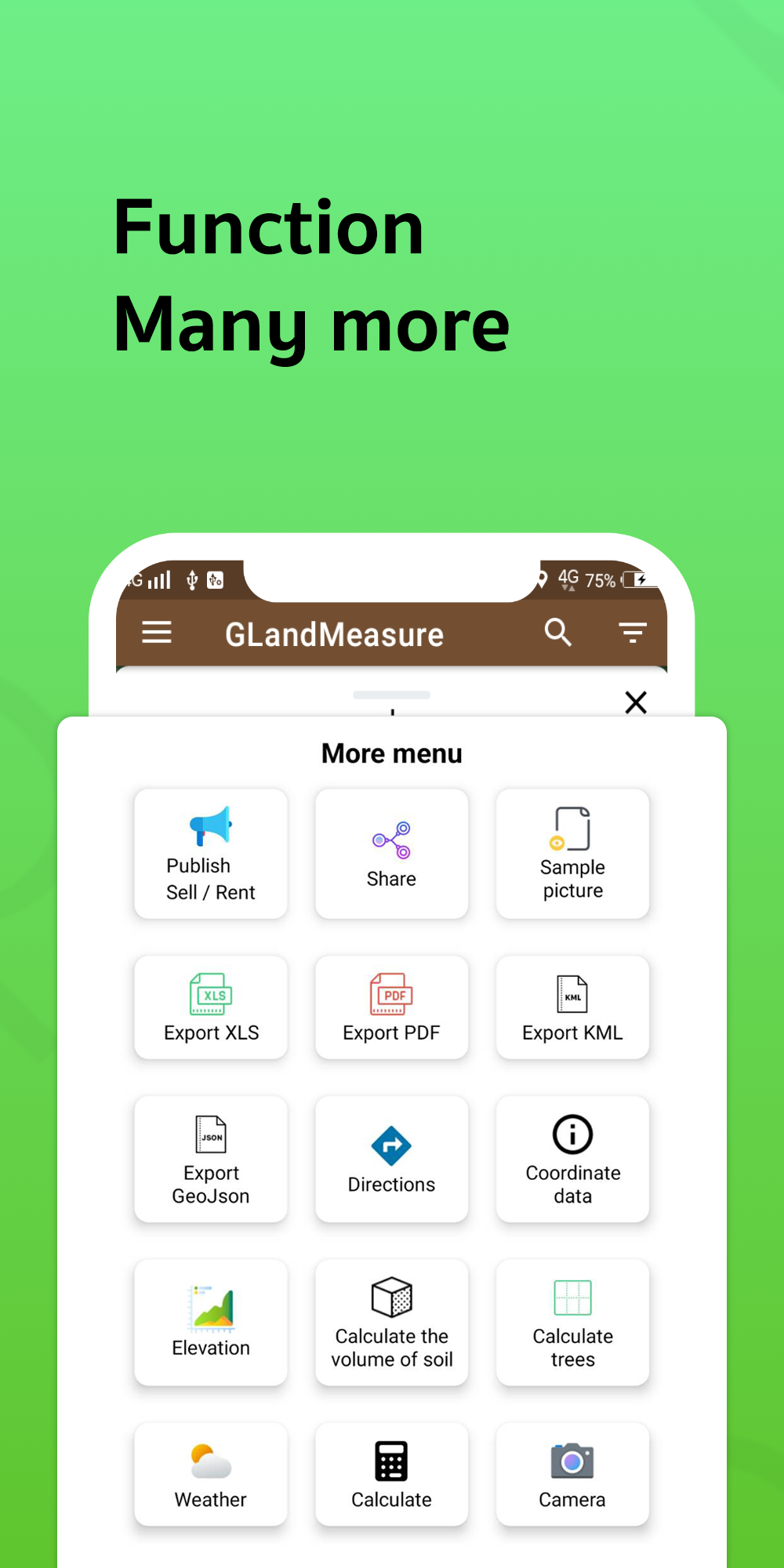
This app caters to various professionals, including those in real estate and farming industries.Those working in real estate can benefit from GLandMeasure's ability to export coordinates in various formats such as land sales announcements, PDF, Excel, KML, Geojson, map photos, route finder, elevation, soil cue calculations, tree counts in area, weather forecasts, calculations, and cameras.
GLandMeasure offers an array of valuable tools for users such as a compass tool, measurement unit conversion, coordinate unit conversion (GEO - Lat Long), UTM MGRS conversions, and geographic camera.
The app supports multiple layers including WMS (Web Map Services), XYZ Tiles, Image Layers, and current rain layers.
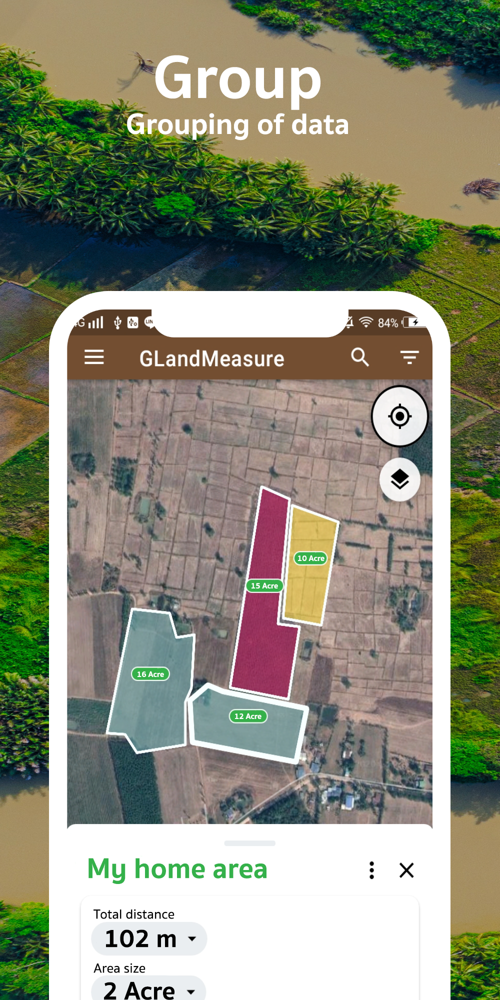
With GLandMeasure, users have the ability to create and manage multiple projects and efficiently handle large amounts of data.
FAQ
-What is Area Measure Length GPS, GLand?
Area Measure Length GPS, GLand is a mobile app developed by Authai Yaprasat that allows users to measure the area and length of land or any other surface using GPS technology.
-How does Area Measure Length GPS, GLand work?
The app uses GPS technology on the user's mobile device to accurately measure the area and length of a land or surface. Users need to walk around the perimeter of the area they want to measure, and the app calculates the measurements based on the GPS data it collects.
-What features does Area Measure Length GPS, GLand offer?
Some of the key features of Area Measure Length GPS, GLand include measuring land area and length, saving and sharing measurements, and providing accurate results using GPS technology.
-Is the app easy to use?
Yes, Area Measure Length GPS, GLand is designed to be user-friendly and easy to use. The interface is intuitive, making it simple for users to navigate and utilize the app's features.
-Can I use Area Measure Length GPS, GLand offline?
No, since Area Measure Length GPS, GLand relies on GPS technology for accurate measurements, an internet connection is required for the app to function properly.
-Is Area Measure Length GPS, GLand available for both Android and iOS devices?
Yes, Area Measure Length GPS, GLand is available for download on both the Google Play Store for Android devices and the Apple App Store for iOS devices.
-Does Area Measure Length GPS, GLand require any additional equipment?
No, users only need their mobile device with a working GPS connection to use Area Measure Length GPS, GLand. No additional equipment is necessary.
-Can I save and export measurements taken with Area Measure Length GPS, GLand?
Yes, users can save their measurements within the app and also have the option to export them for further analysis or sharing purposes.
-Is there a premium version of Area Measure Length GPS, GLand with additional features?
Currently, there is no premium version of Area Measure Length GPS, GLand. All features are available in the free version of the app.
-Who is the developer of Area Measure Length GPS, GLand?
Area Measure Length GPS, GLand is developed by Authai Yaprasat.
- Version3.22.0
- UpdateApr 13, 2025
- DeveloperMaps Tools Utilities Team
- CategoryMaps & Navigation
- Requires AndroidAndroid 5.0+
- Downloads3M+
- Package Namecom.gis.toptoshirou.landmeasure.Glandmeasure
- Signaturebc8ec787d8a72ae63ca968dc48d28a4f
- Available on
- ReportFlag as inappropriate
-
NameSizeDownload
-
27.92 MB
-
27.90 MB
-
27.89 MB


User-friendly interface
Accurate measurements
Useful for land area calculation
Pro version available for ad-free experience
Ability to create and manage multiple projects
Good for professional users (e.g., contractors, surveyors)
Continuous updates requested by users
Simple and small app size
Frequent ads in the free version
Issues with deleting or editing points
Reports of bugs during export (e.g., language issues)
Lack of communication and support channels
Inconvenient without cell service in remote areas
Problems with subscription management
Map updates required for accuracy
Video tutorials not available in English