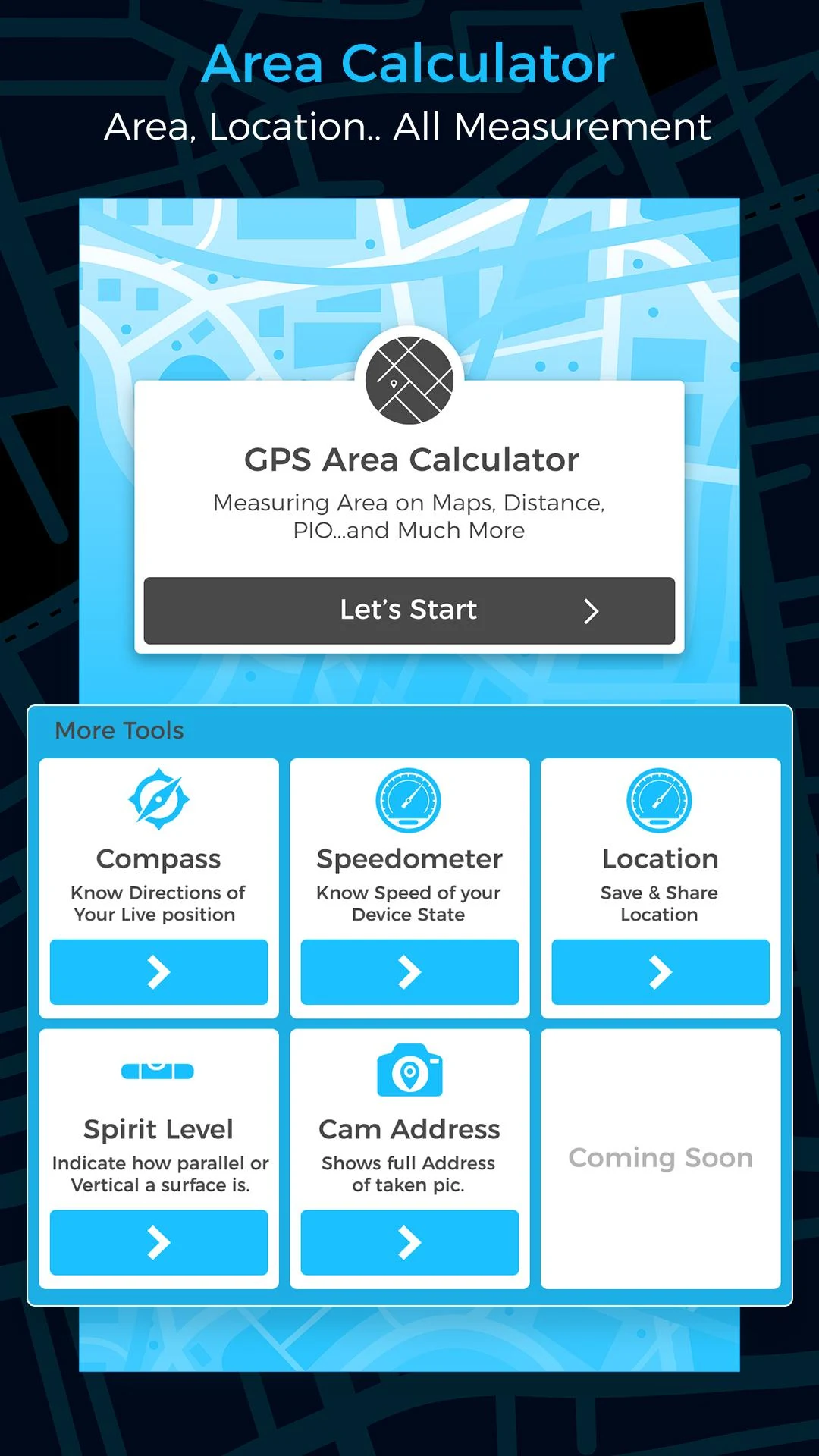
Gps Area Calculator - Measure & map distances
Measure areas on the go with GPS accuracy.
- 40.0 Version
- 4.6 Score
- 4M+ Downloads
- In-app purchases License
- 3+ Content Rating

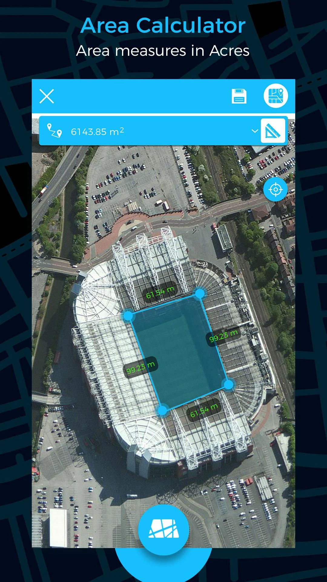
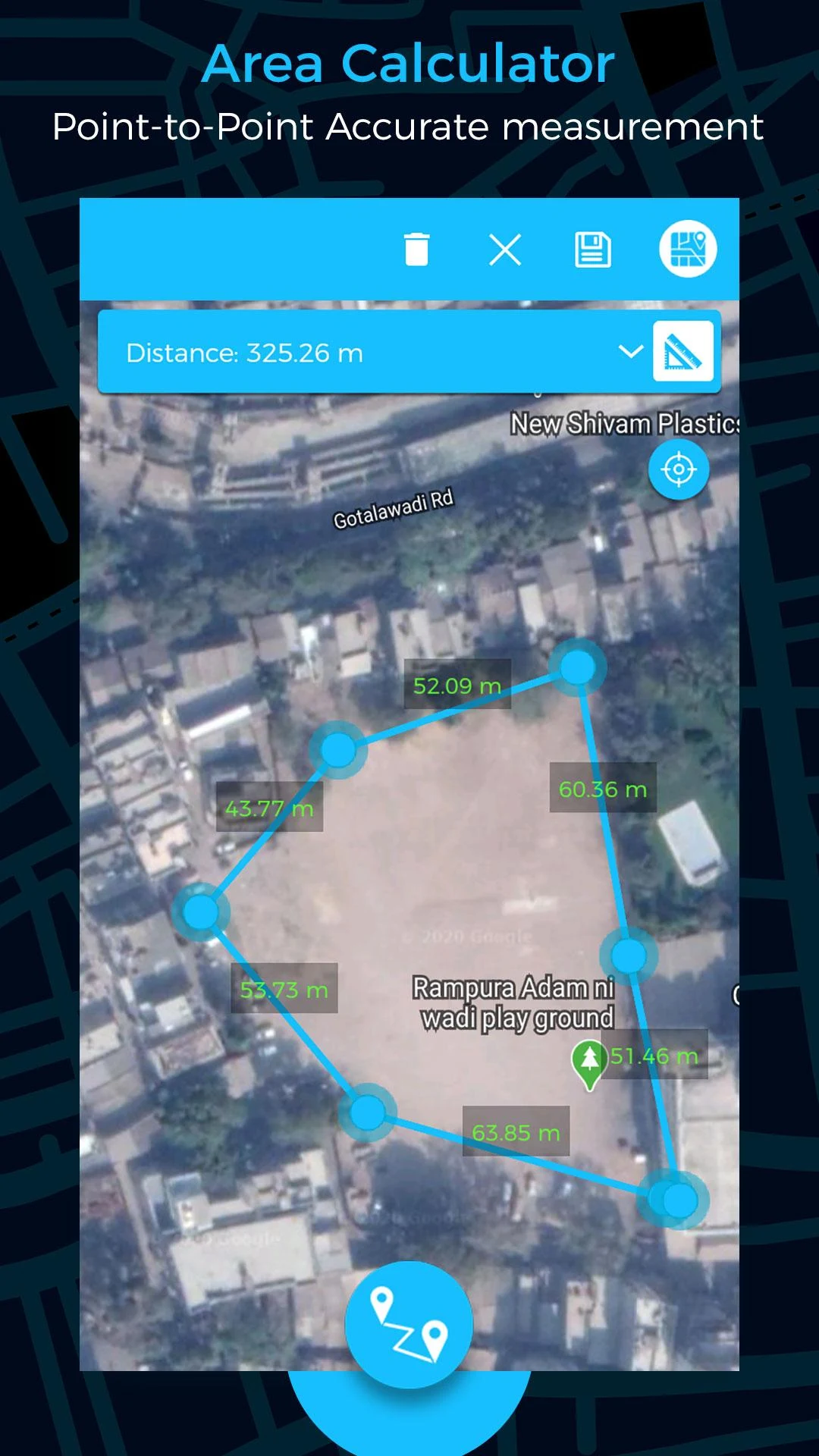
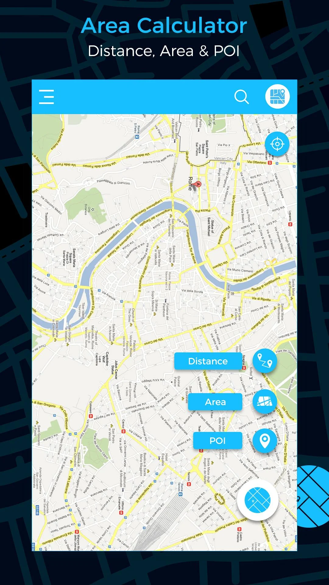
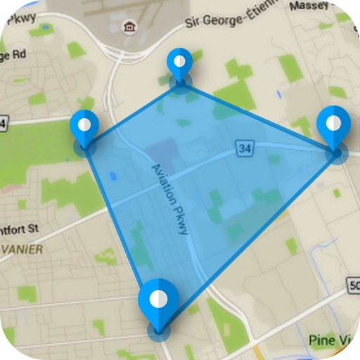
Fields Area Measure is a handy tool for measuring areas on a map. By placing points on the map and calculating the area between them, users can determine the total area of any route. This tool is beneficial for accurately measuring GPS distances and areas.
Key Features include:
- Quick mapping of areas/distances.
- Smart Marker Mode for precise pin placement.
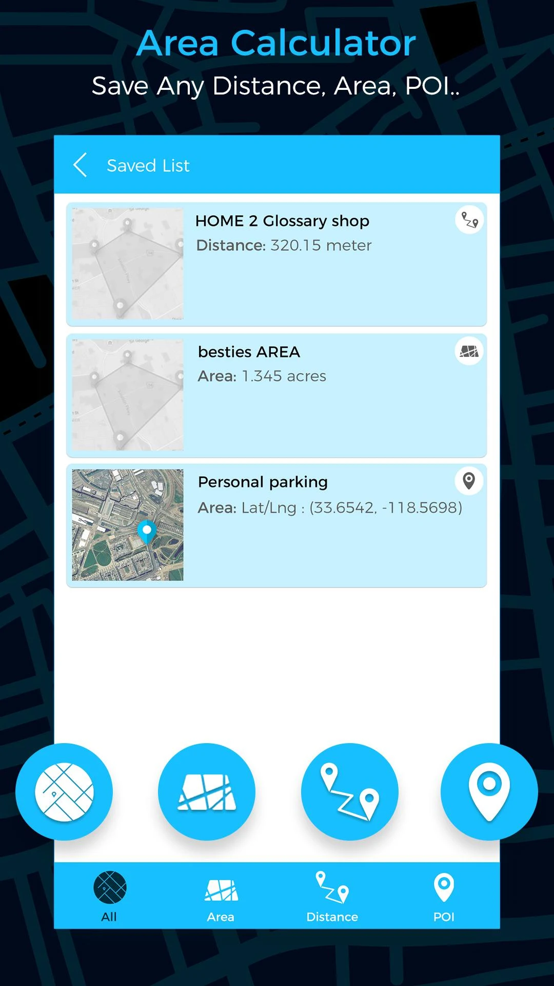
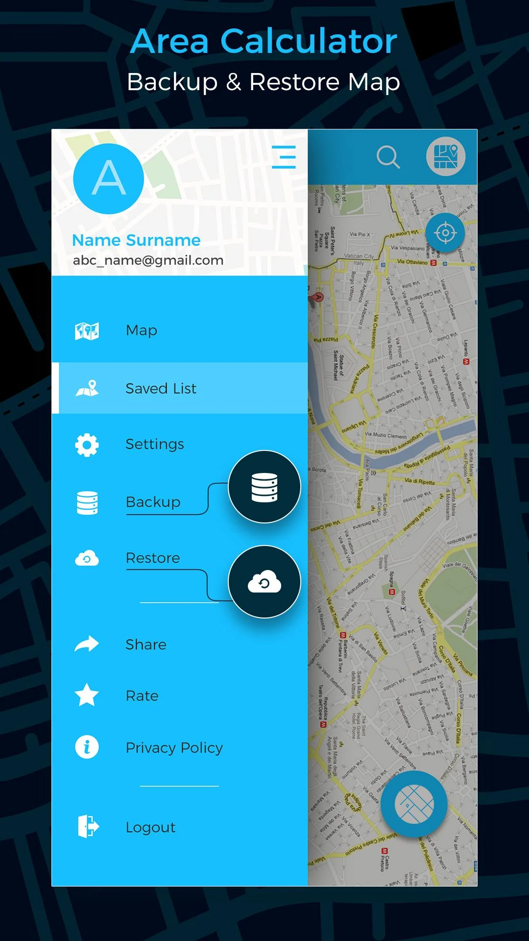
- Save and edit measurements.
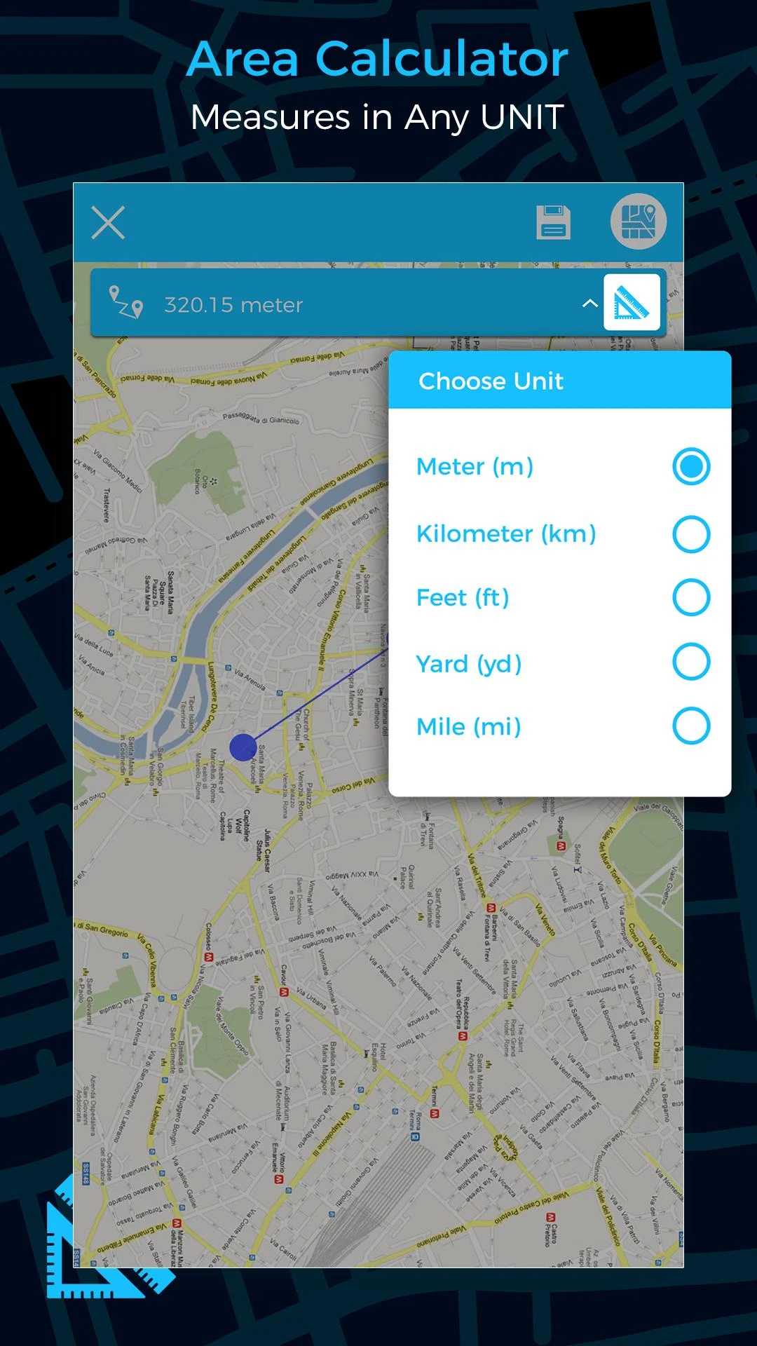
- Option to change measurement units.
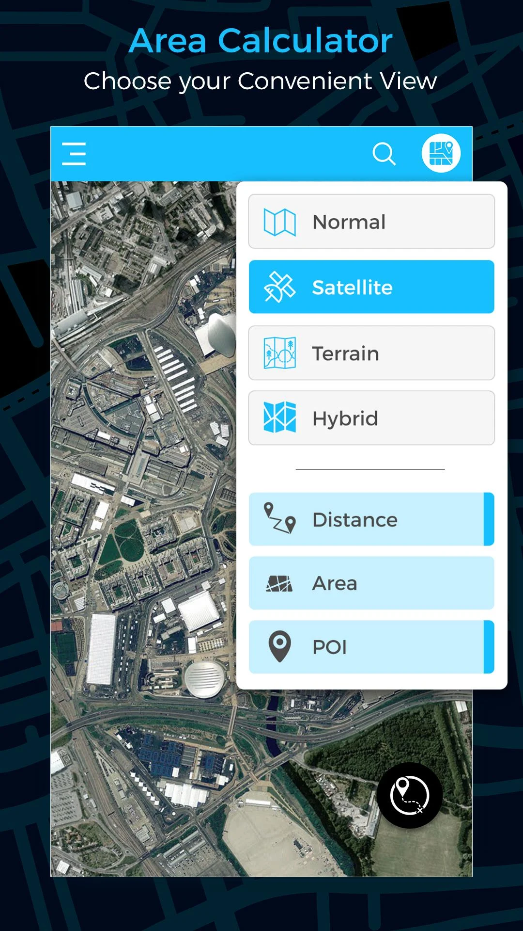
- Various map modes such as Map, Satellite, Terrain, and Hybrid.
- Facility for searching areas.
Highlights
High-precision measurement: Using advanced GPS technology, it can accurately measure land area, distance and perimeter, and maintain high accuracy even in complex terrain and remote areas.
Multi-function integration: It can not only measure area and distance, but also provide additional information such as altitude, time, speed, etc., which is suitable for a variety of outdoor activities.
Multiple map modes: Support map, satellite, terrain and hybrid modes, users can switch as needed to obtain more accurate measurements.
Data saving and sharing: Measurement results can be saved as image files (such as JPG) and easily shared to social platforms or with partners.
Offline function: Measured data can be saved and accessed even without a network.
Who it’s for
Farmers and landowners
Real estate agents
Engineers and construction workers
Outdoor enthusiasts (such as hikers, cyclists)
Homeowners and gardening enthusiasts
Land surveyors and urban planners
How it helps people
Agriculture: Farmers can quickly measure the area of farmland, pasture or agricultural land, optimize the layout of fields, and achieve efficient farm management.
Real estate: Real estate agents can accurately calculate the area of properties to help customers intuitively understand the size of the land.
Engineering and construction: Engineers and construction workers can measure the area and distance of construction sites and plan infrastructure such as fences and roads.
Outdoor activities: Hikers can plan routes and measure the distance of hiking or cycling to ensure safety and efficiency.
Home & Garden: Homeowners can measure yards, gardens, or property boundaries, plan fences, landscaping, and more.
GEO AREA is ideal for:
- Land surveys
- Farm management
- Land record keeping
- Construction surveys
- Agronomists
- Town planning
- Health and education facility mapping
- Sports track measurement
- Construction and building site areas
- Asset mapping
- Landscape artists and designers
Additional GPS tools include:
- GPS Compass
- GPS Speedometer
- Location saving and sharing options.
- Version40.0
- UpdateFeb 10, 2025
- DeveloperKBK INFOSOFT
- CategoryMaps & Navigation
- Requires AndroidAndroid 5.0+
- Downloads4M+
- Package Namekbk.maparea.measure.geo
- Signatureba5751e0babfb0e747b5b703251d03b4
- Available on
- ReportFlag as inappropriate
-
NameSizeDownload
-
31.96 MB
-
31.96 MB
-
31.96 MB