komoot - Outdoor adventures navigation
Discover hiking trails nationwide with GPS tracking, offline maps, and route planning.

- 2025.06.3 Version
- 3.9 Score
- 17M+ Downloads
- In-app purchases License
- 3+ Content Rating
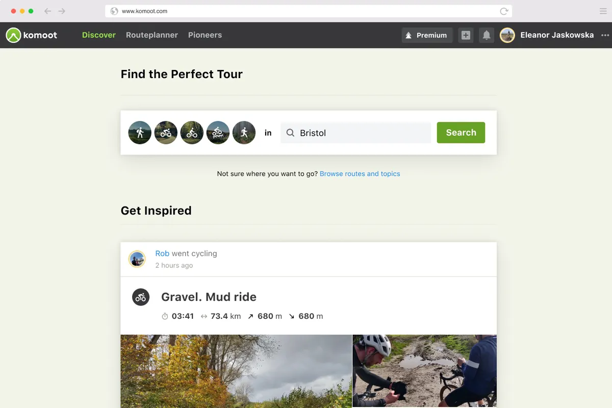
Transform your upcoming ride, hike, or run into an exciting adventure with komoot. Gain inspiration from tapping into shared community insights and suggestions, then bring your adventures to reality with the user-friendly route planner. Begin your journey with your initial region at no cost and embark on your next adventure!
Craft Your Ultimate Hiking, Road Cycling, or Mountain Biking Experience
Tailor your route to suit your preferred activity—whether it's smooth roads for your road bike, single tracks for your mountain bike, quiet cycling paths for touring, or natural hiking trails for your walks. Plan meticulously with essential details like surface type, difficulty level, distance, and elevation profile at your fingertips, and track your progress with the GPS tracker while running, walking, or cycling.
Guided Turn-by-Turn GPS Voice Navigation
Stay focused on the road with turn-by-turn GPS voice navigation, providing precise verbal directions without distracting you from your surroundings.
Offline Trail Maps for Outdoor Pursuits
Download your planned outdoor excursions and save topographic maps with a simple tap. Navigate outdoors even without internet access. Easily identify different paths like hiking trails, single tracks, paved roads, MTB trails, terrains, and land cover with a quick glance.
Explore Highlights: Top Spots Recommended by the komoot Community
Quickly decide on your next adventure destination by viewing trail Highlights on the map. Discover peaks, parks, points of interest, single tracks, mountain biking trails, hikes, and more recommended by fellow users. Share your own favorite spots with the community, inspiring others to explore them as well.
Share Your Adventures
Keep a record of your biking, walking, and running journeys using the GPS tracker. Add photos, Highlights, and tips to create your personal adventure log, storing your favorite experiences permanently. Keep them private or share them with the komoot community. Follow friends and like-minded adventurers to stay updated on their outdoor escapades.
Become a Local Authority. Turn into a Pioneer
Contribute by sharing photos, tips, and Highlights to establish yourself as a local authority. Earn recognition from the community and become a Pioneer by receiving the most upvotes for your sport in your area.
Seamless Sync Across All Devices
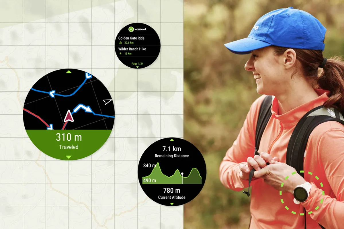
Whether you plan routes on your desktop or on-the-go, komoot synchronizes all data, including bike routes, hiking and running tracks, and MTB trail photos, across all your devices - smartphones, desktops, tablets, and Wear OS. Use the komoot complication icon on your Wear OS device for quick access to the app. Launch the app easily from your watch's homescreen and start navigation or select a planned Tour.
Enjoy komoot For Free
Your first region is free forever when you download komoot. Choose between single regions, region bundles, or the World Pack to expand your coverage area. Access offline trail maps, bike routes, turn-by-turn GPS voice navigation, and track your biking, walking, and running adventures with the GPS tracker anywhere you go.
How does Komoot work?

Komoot uses the open-source OpenStreetMap database for its base mapping but then uses its own algorithms to establish the best route depending on activity type, selected waypoints and points of interest.
Komoot provides map overlays including an Open Cycle Map that shows national cycleways and a Google satellite map. You can also upload GPX or FIT route files to Komoot.
Once a route has been selected, Komoot will give you onscreen and audible navigation in an offline mode to save the battery on your device. You can also send routes created on Komoot to your compatible cycling computer for navigation.
When riding, the Komoot app will tell you speed, distance travelled, distance remaining and let you alter the route on the fly.
When you have completed your ride you can upload it to your Komoot profile and add photos.
Komoot will also feature local highlights, as suggested by users and Komoot ambassadors.
Komoot can be used on a computer (PC or Mac), iPhone, Android phone, Garmin, Wahoo and most wearable devices, such as Apple Watch and Android Wear.
How do I get started on Komoot?

To start using Komoot you will need to set up an account.
You can start using Komoot for free straight away, planning routes and navigation. You can also pay to download maps for offline use.
Komoot also offers a Premium account that is aimed at adventurers and those looking to complete multi-day trips – it also offers discounts on products.

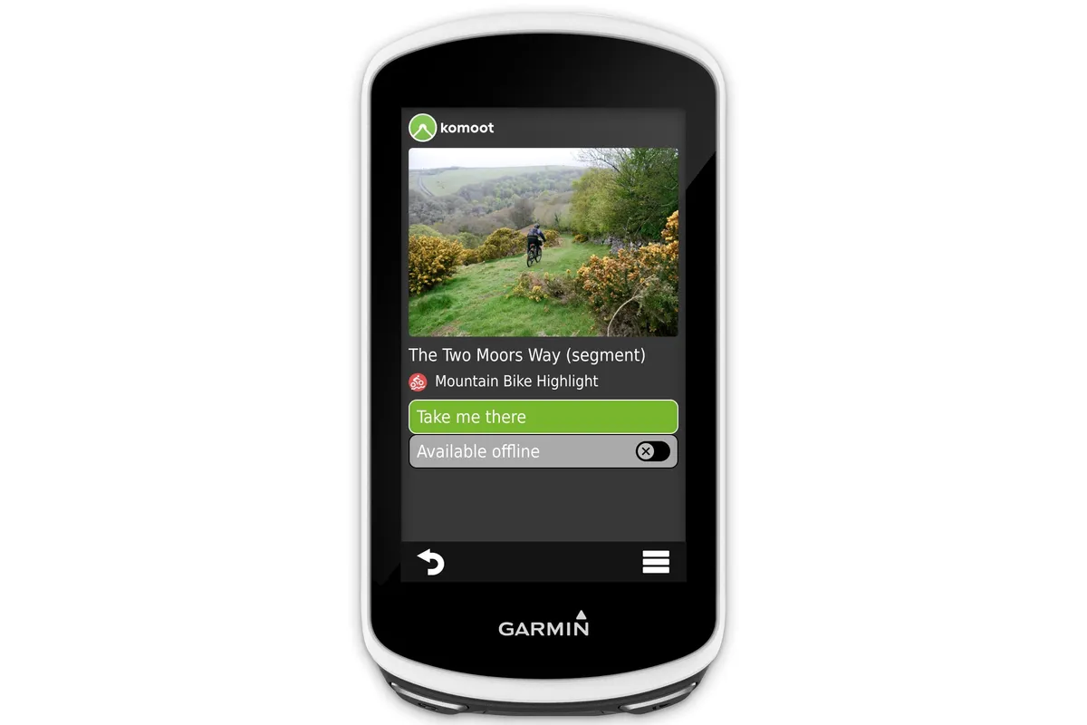
Once you are set up with a Komoot account and the app, you can integrate Komoot with your Garmin or Wahoo to send routes to the device.
Komoot has a proprietary app for Garmin that can be downloaded through the Garmin Connect IQ store.
For Wahoo, all you need to do is go to your Wahoo app, head to connections and login into your Komoot account. You will then be able to access routes and sync your rides to the Komoot app.
Compatible Devices
• Garmin - Download the komoot Garmin app in the IQ store and sync your accounts via Garmin Connect to share your walking, running, and biking GPS routes with your Garmin device.
• Wahoo - Link your komoot account to your Wahoo ELEMNT or ELEMNT BOLT bike computer for accessing top bike GPS routes and syncing back your recorded tracks.
• Sigma - Sync Komoot with your Sigma GPS computer to get real-time directions, distance, and speed on your head-unit.
• Bosch - Connect komoot with your Kiox or Nyon to record Tours and receive navigation guidance on your device.
For assistance and guidance, visit komoot support.
- Version2025.06.3
- UpdateFeb 17, 2025
- Developerkomoot GmbH
- CategoryHealth & Fitness
- Requires AndroidAndroid 8.0+
- Downloads17M+
- Package Namede.komoot.android
- Signatureb3a0bc33099ded1ec6eb74cc8357aabf
- Available on
- ReportFlag as inappropriate
-
NameSizeDownload
-
163.72 MB
-
149.46 MB
-
148.78 MB


Routing has useful features, offline mapping and navigation
Voice guidance works well
Highlights only as good as the people creating them
Curated content hard to navigate