Magic Earth Navigation & Maps - GPS navigation & mapping
Navigate confidently with smart routes
- 7.1.24.25.F3F2D565.FB706A2B Version
- 4.3 Score
- 1M+ Downloads
- Free License
- 3+ Content Rating

Discover the optimal path to your destination even without an internet connection. The app utilizes OpenStreetMap data and a robust search engine to provide you with the best routes for driving, cycling, hiking, and public transportation.
FAQs:
1. What operating system do I need to run Magic Earth?
You need at least iOS 15 or Android 4.4 (on some systems, Android 7.0) to run the newest Magic Earth versions.
2. Does live traffic require data/internet connection?
Yes, traffic data is live so it requires an internet connection.
Once maps, voices and map styles are downloaded, search, routing and navigation work offline, only with location/gps active (which uses the satellite GPS signal, no internet/data).
3. What are the options in Settings > Navigation > 2D/3D View?
This sets the desired map display for when you are driving:
Automatic: map switches from 2D to 3D when you drive straight at a higher speed and no turn is expected ahead, and from 3D to 2D when you approach a junction or a turn. The app also zooms out at higher driving speed and zooms in when slowing down. You can also adjust the view manually: drag with two fingers to change the tilt, pinch to change the zoom, and use the target icon in the upper right corner to return to Automatic
2D: map stays in 2D during navigation
3D: map stays in 3D during navigation
4. What map source do you use?
Magic Earth uses OpenStreetMap as map database. It is a collaborative mapping project that relies on contributions from users (just like Wikipedia etc).
5. How can I see my position (where I am) on the map?
The GPS/Location signal is from the satellites (has nothing to do with internet, data can be turned off) and is used for navigation, to get your position on the map. You cannot navigate without the satellite GPS/Location signal, so please make sure that GPS/Location is turned on in your phone settings, and Magic Earth has GPS/Location access.
Your position is indicated by the position arrow on the map.
What can you get
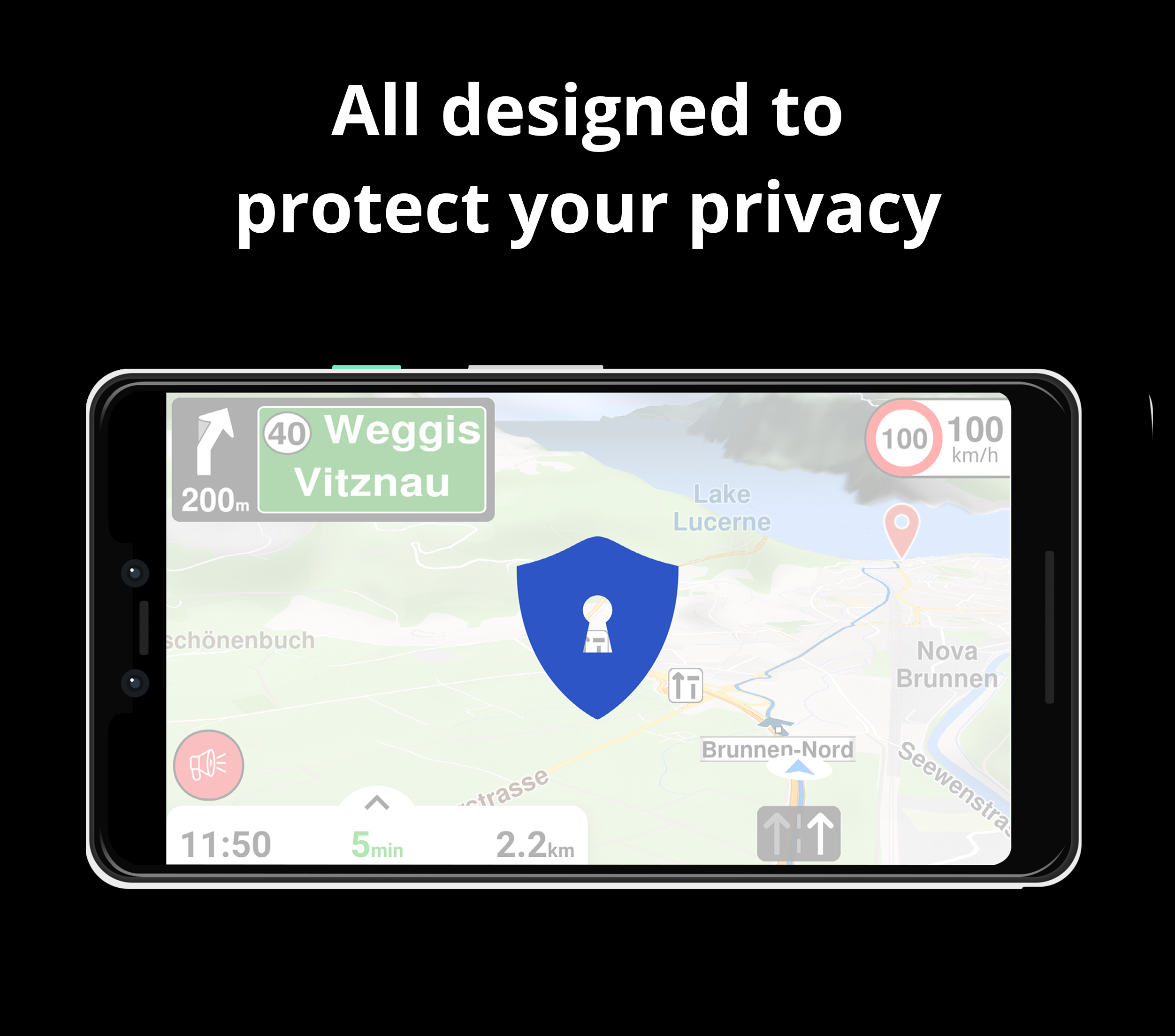
RESPECTING YOUR PRIVACY!
• Your privacy is of utmost importance to us. We do not track or profile you, nor do we engage in any activities involving your personal data; furthermore, we do not possess such information.
MAPS
• Save on mobile data usage and navigate accurately with offline maps based on OpenStreetMap. Access downloadable maps for 233 countries and regions.
• Select from 2D, 3D, and Satellite map perspectives.
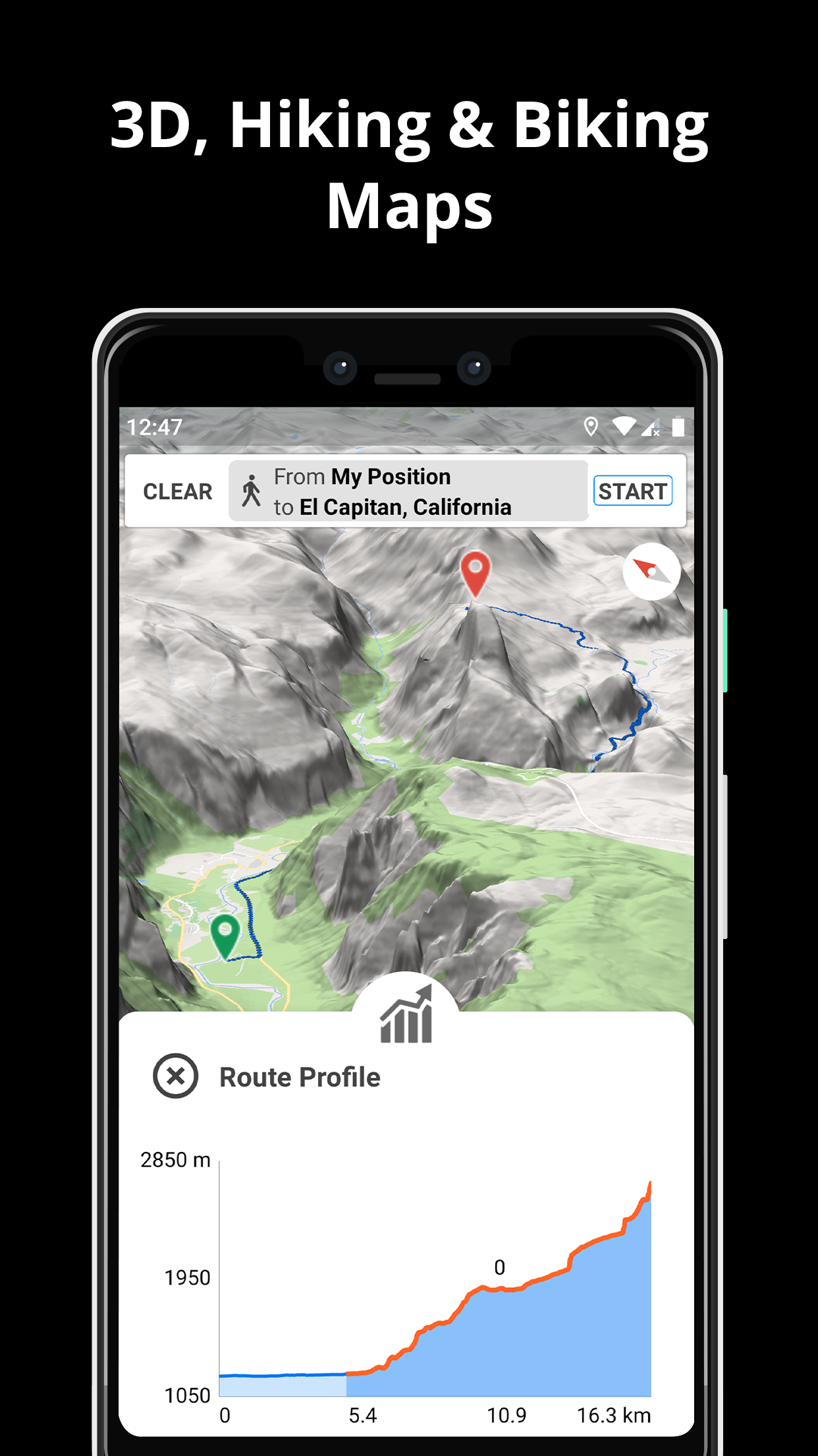
• Prepare for your travels by exploring detailed route information like terrain, complexity, distance, and elevation profile.
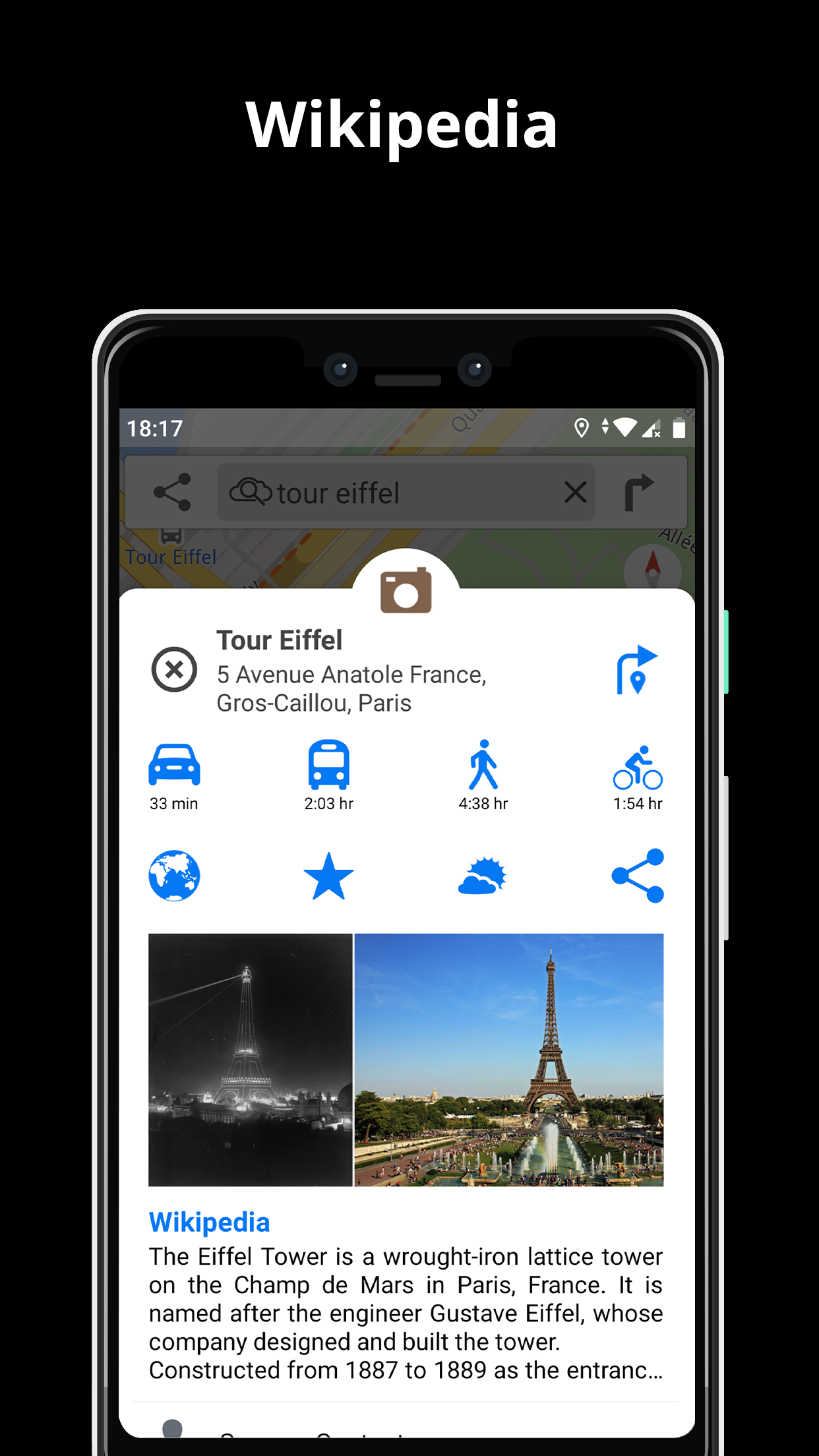
• Learn about nearby points of interest through Wikipedia articles.
• Quickly find parking spots near you for easy car parking.
• Benefit from regular free map updates to stay current.
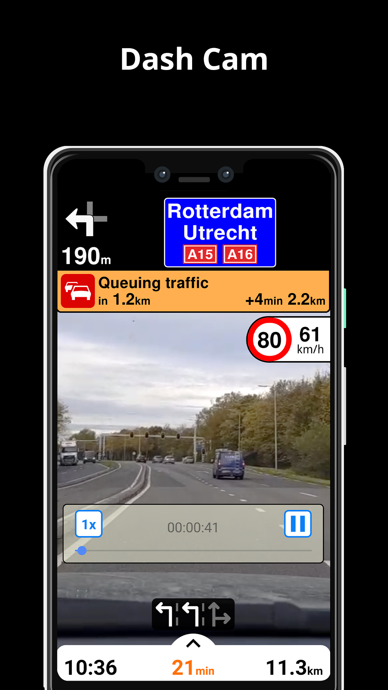
AI DASHCAM
• Enhance road safety and prevent accidents. Receive alerts for potential road hazards and capture your journey.
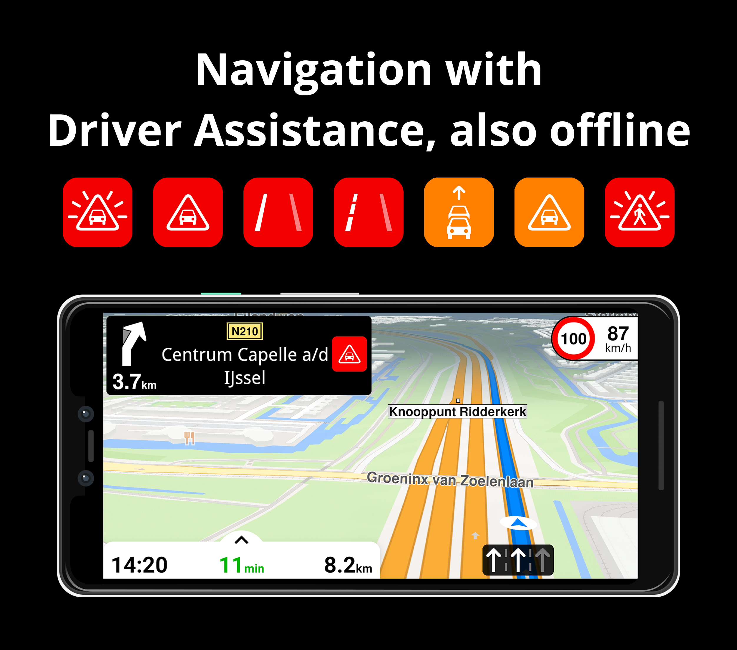
• AI DashCam includes features like Driver Assistance warnings and Dash Cam functionalities.
• Mitigate collisions and incidents with Driver Assistance alerts: Headway Warning, Forward Collision Warning, Pedestrian Collision Warning, Lane Departure Warning, Leaving Lane Warning, Stop & Go Assist.
• Capture the road ahead during navigation to assist in case of an accident.
• Driver Assistance alerts and Recordings are accessible when the device is mounted in landscape mode on the dashboard, offering a clear view of the road ahead.
* AI DashCam (with Driver Assistance warnings and Dash Cam functionality) is compatible with Android 7 or later.
NAVIGATION
• Opt for the fastest or shortest route to your destination when traveling by car, bike, foot, or public transport.
• Plan your route with multiple waypoints for convenience.
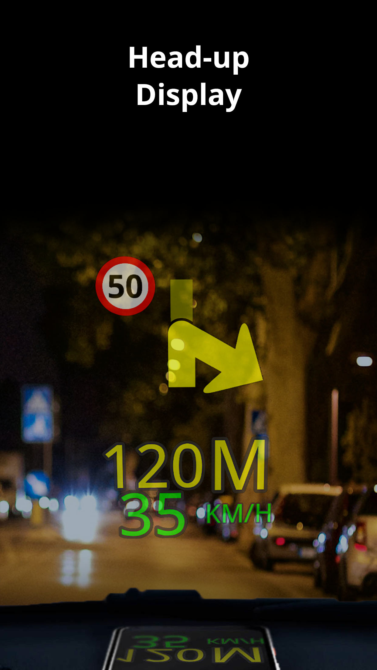
• Stay safe using the Head-up Display (HUD) feature that projects essential navigation details onto your car windshield.
• Receive precise turn-by-turn navigation instructions including lane guidance to help you choose the correct lane.
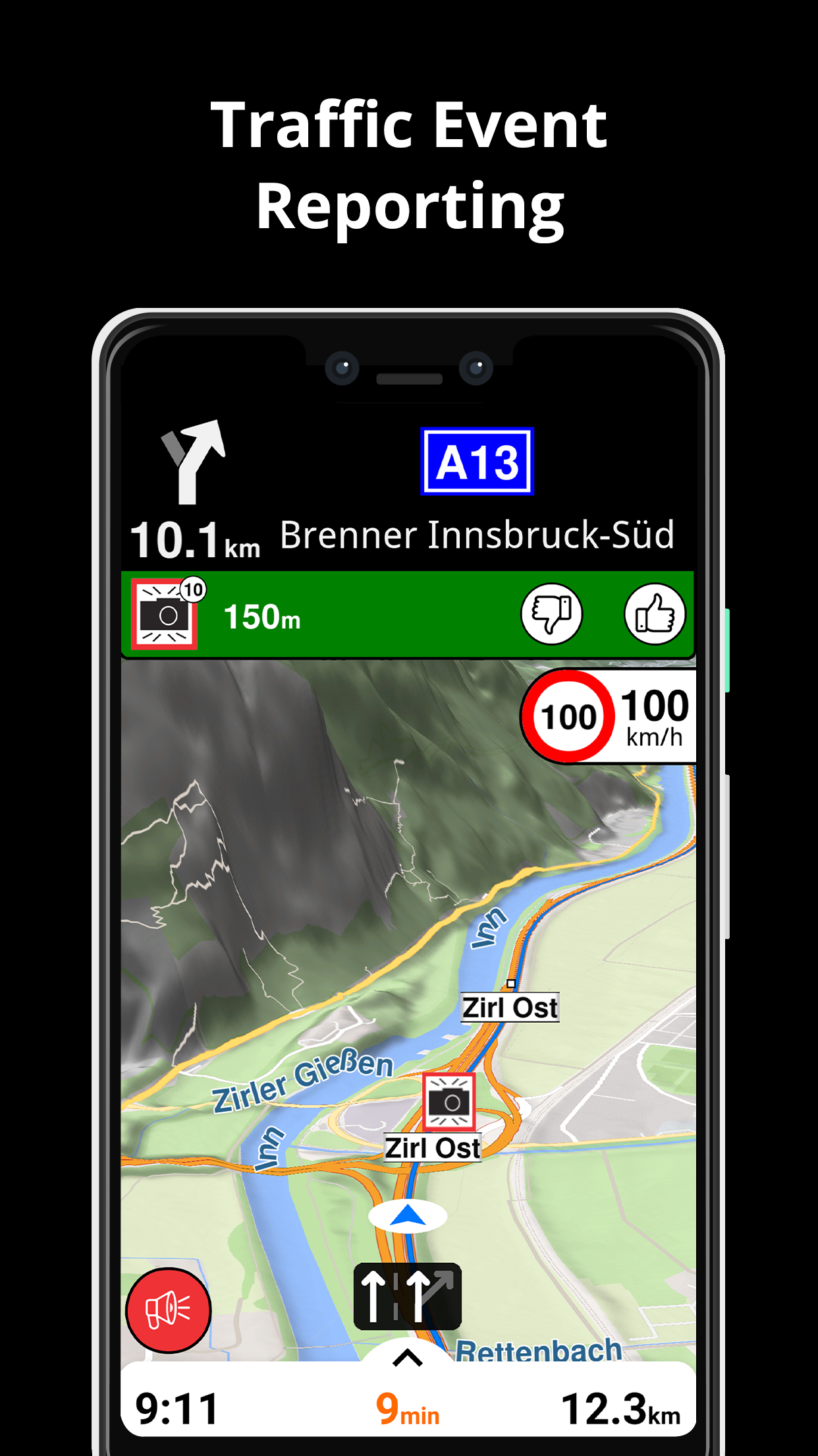
• Stay informed about speed cameras and current speed limits.
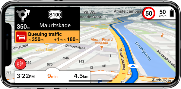
TRAFFIC INFO
• Access real-time traffic updates refreshed every minute.
• Explore alternative routes to avoid traffic congestion and save time on the road.
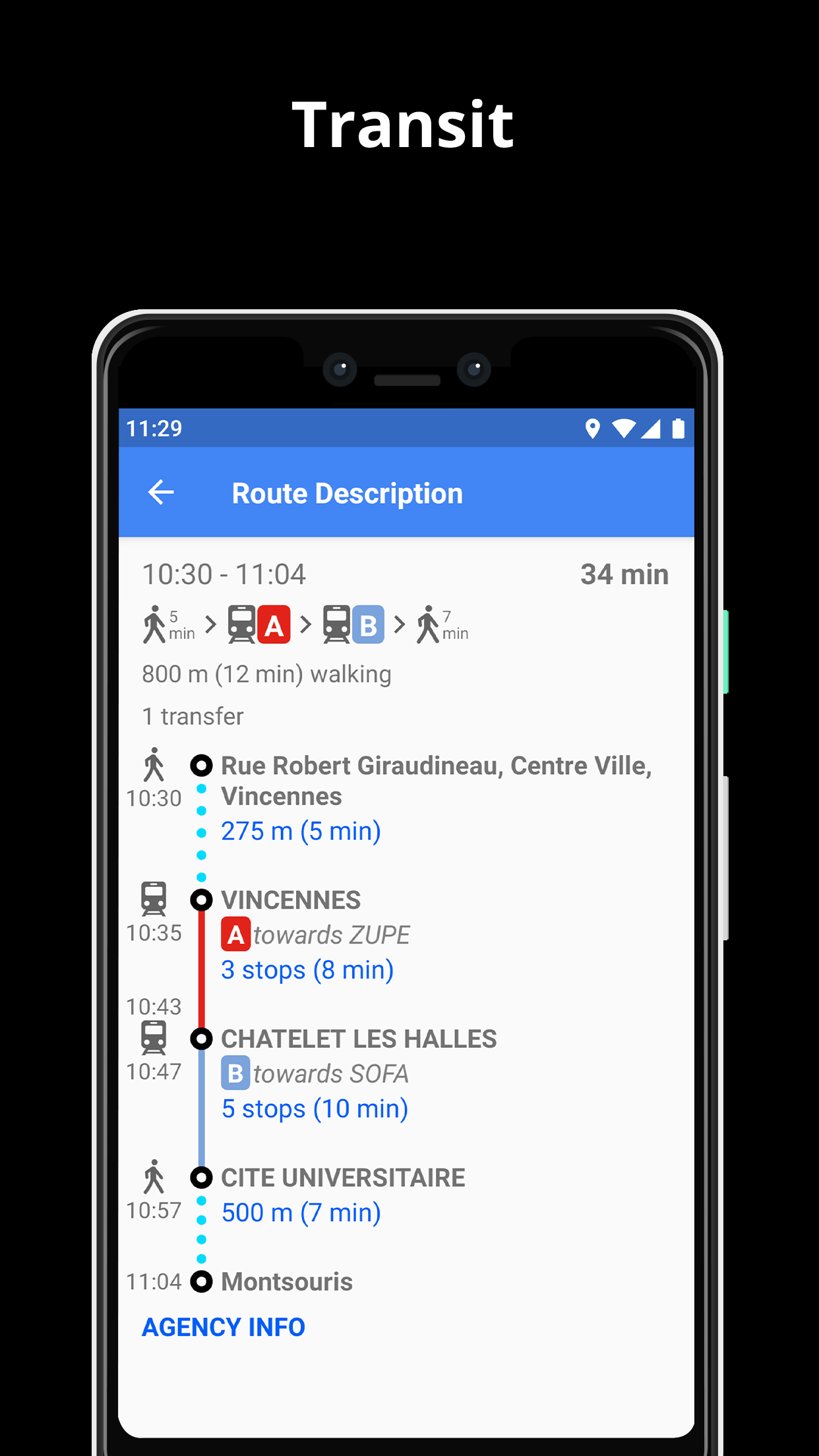
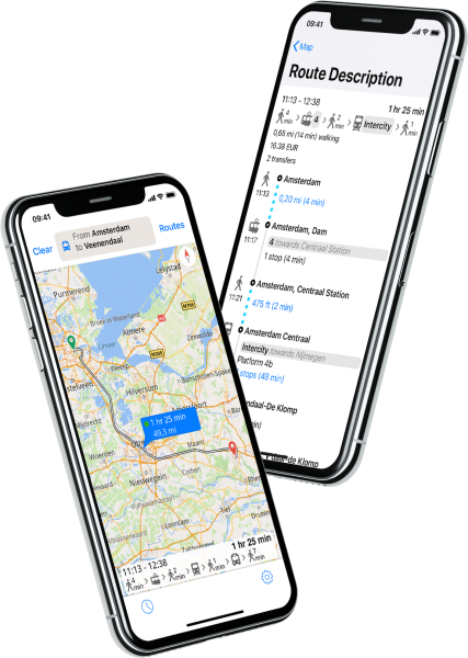
PUBLIC TRANSPORT
• Efficiently navigate urban areas with integrated public transit routes encompassing bus, metro, subway, light rail, train, and ferry options.
• Obtain walking directions, transfer durations, departure times, number of stops, and if available, the cost.
• Locate wheelchair-accessible or bike-friendly public transportation modes.
WEATHER
• Check the current temperature and local weather forecast for your preferred locations.
• Stay informed about expected weather conditions in the next few hours and review the 10-day forecast.
NOTES:
* Certain features may not be accessible in all countries.
* Some features necessitate an internet connection.
- Version7.1.24.25.F3F2D565.FB706A2B
- UpdateAug 21, 2024
- DeveloperGeneral Magic
- CategoryMaps & Navigation
- Requires AndroidAndroid 5.0+
- Downloads1M+
- Package Namecom.generalmagic.magicearth
- Signaturef6c3e5e667c320a1154a2545ca23deb9
- Available on
- ReportFlag as inappropriate
-
NameSizeDownload
-
270.76 MB
-
114.54 MB
-
264.12 MB


Users can download offline maps to navigate without an Internet connection
Provides real-time traffic information and road condition updates
Optimizes navigation routes based on real-time traffic conditions
Provides voice guidance
Although offline navigation is supported, some features (such as real-time traffic information) may not be available in offline mode