Mgrs & Utm Map - Coordinates conversion & mapping
Navigate with precision using MGRS & UTM coordinates in the field

- 6.6.1 Version
- 2.9 Score
- 1M+ Downloads
- Free License
- 3+ Content Rating

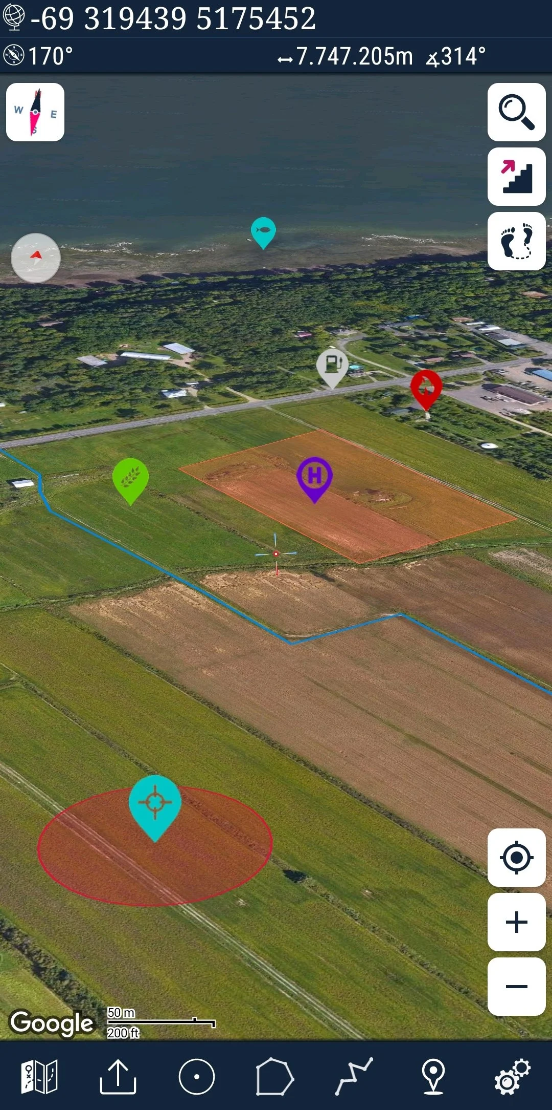
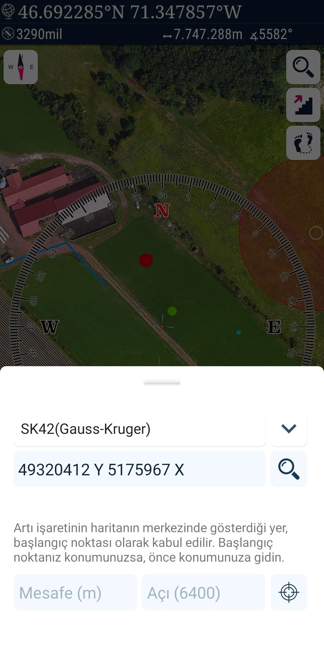
Mgrs & Utm Map is a handy tool for GPS and coordinate systems, designed specifically for military personnel. It serves as a comprehensive assistant for various outdoor activities such as mountaineering, trekking, hiking, cross country running, scouting, hunting, fishing, geocaching, off-road navigation, and more. Harnessing satellite navigation systems like GPS, GALILEO, and GLONASS (GNSS) supported by your device and sensors, it enables you to pinpoint your precise location on diverse map layers.
Key Features:
- Simple and Swift
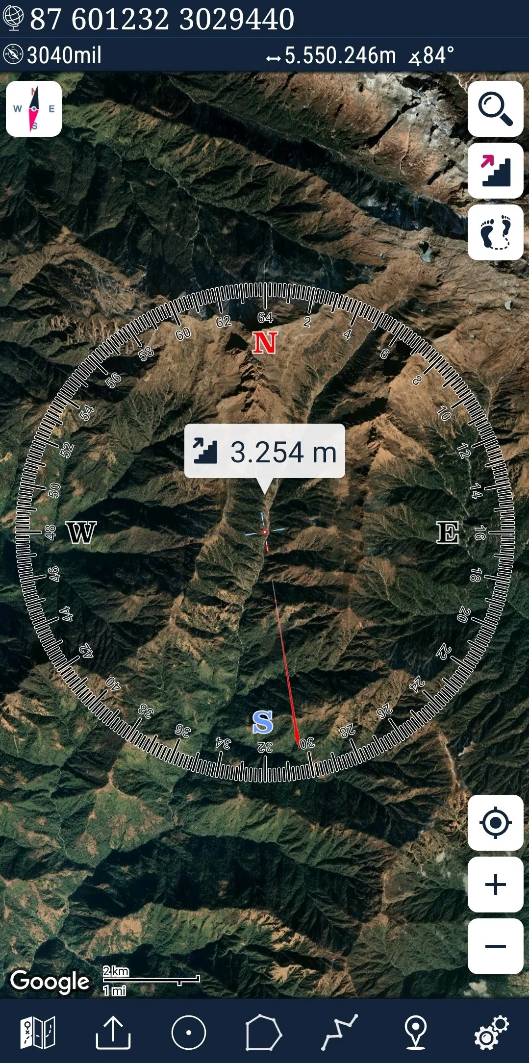
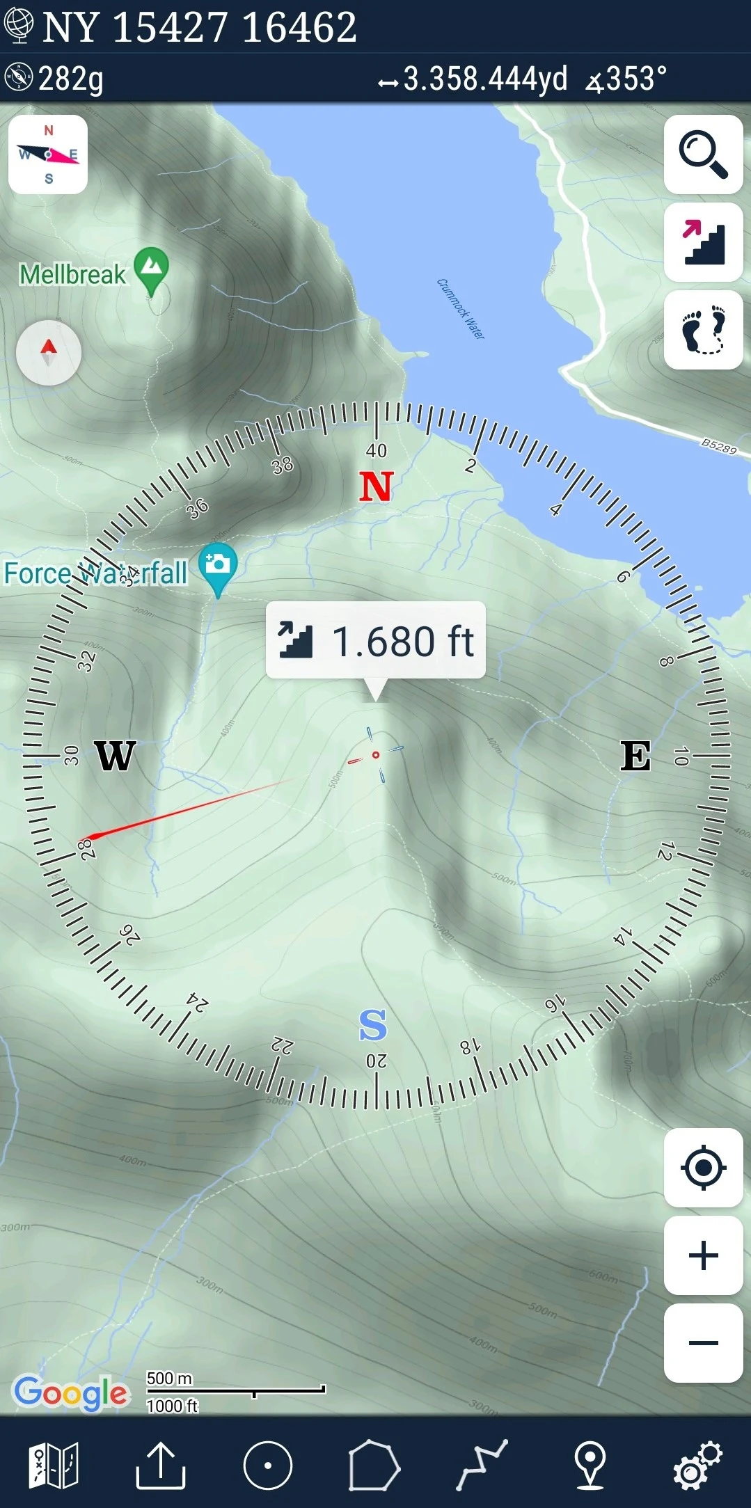
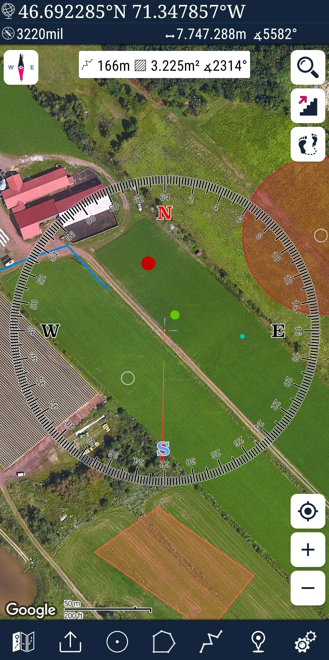
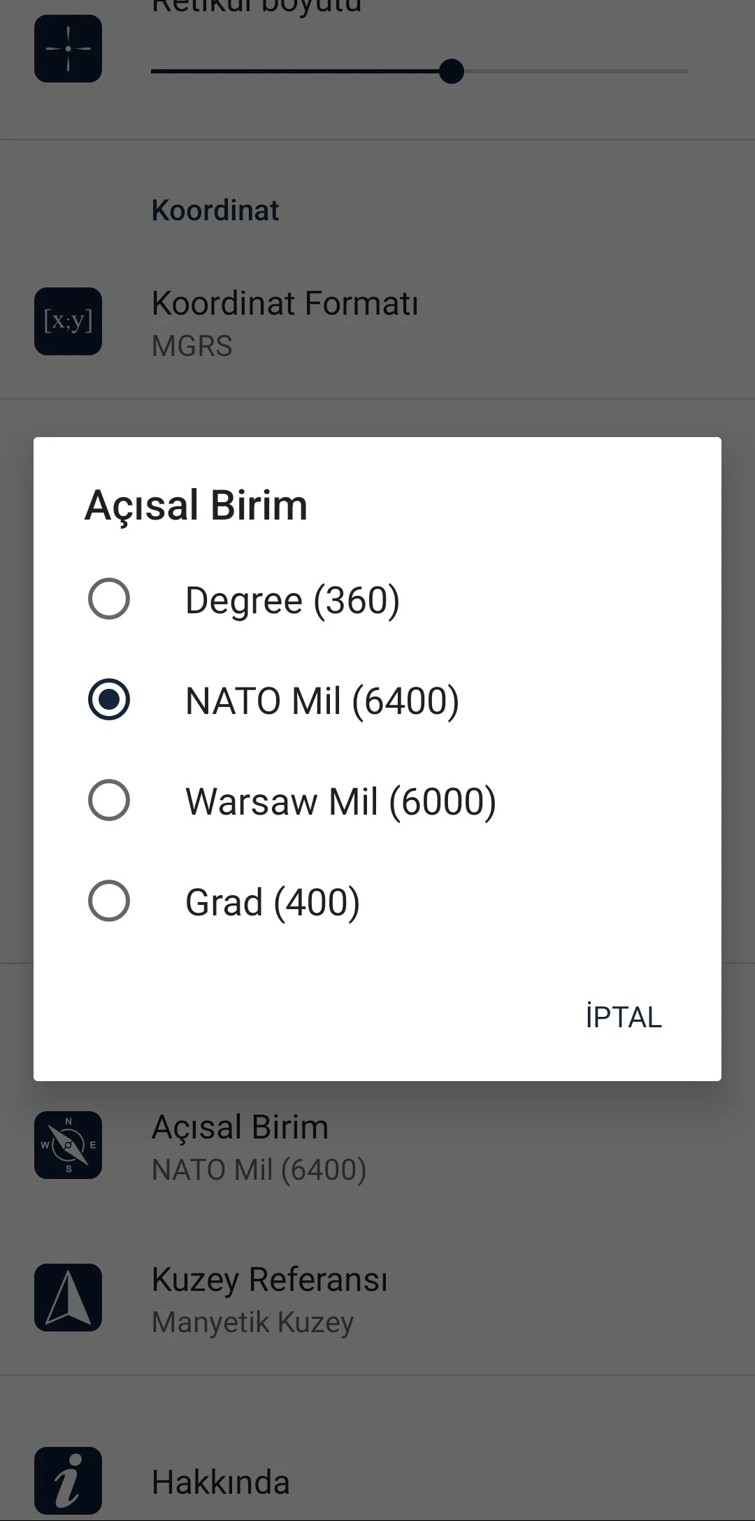
- Compass.
=> Compass on map (displays your direction on the map)
=> Compass only (indicates physical directions)
=> Angular units for compass (degrees, NATO mil, Soviet Mil, Grad)
- Follow Mode
=> The map's center tracks your location as you move.
- Markers can be added and removed.
- Distance measurement. (Allows customization of routes and calculation of total distance)
- Area measurement. (Enables selection of an area on the map and calculation of its square meters)
- Altitude information for your location.
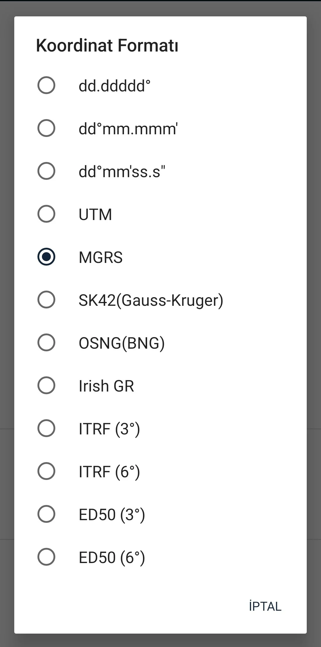
- Location identification in Degree/Minute/Second, MGRS, UTM, or Latitude/Longitude formats.
- Location (Coordinate) format choices.
=> MGRS / U.S. National Grid (USNG) (WGS84/NAD83)
=> D°M'S" (WGS84)
=> Latitude/Longitude (WGS84)
=> UTM (WGS84/NAD83)
=> SK42(Gauss Kruger)
- Map type selection (Road, Terrain, Satellite, Night Mode, Hybrid)
- Ability to share location coordinates.
- Distance units options (meters and feet).
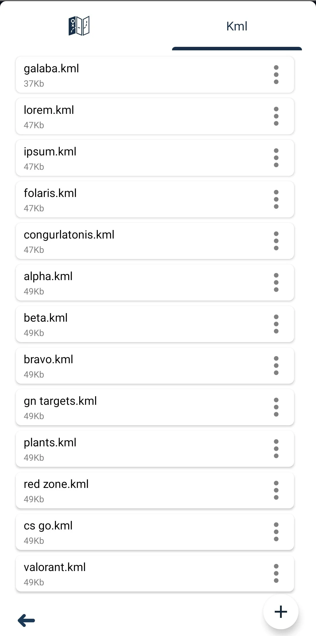
- KML viewer. (Supports export and import of KML layers).
- GPS track recording.
App Highlights:
1.Offline maps: Users can download maps for offline use, ensuring they have access to navigation tools even in areas with limited or no internet connectivity.
2.Coordinate conversion: The app supports the conversion of coordinates between different formats, making it easier to work with various mapping systems.
3.Customizable settings: Users can customize the app's settings to suit their preferences, including units of measurement, map styles, and display options.
What’s New
* Circular area feature added.
* Destination angle calculation feature added.
- Version6.6.1
- UpdateAug 06, 2024
- DeveloperDakikTech
- CategoryMaps & Navigation
- Requires AndroidAndroid 5.0+
- Downloads1M+
- Package Namecom.zahidcataltas.mgrsharita
- Signaturefa1b2252aa3adeda0c908a002ce6b51b
- Available on
- ReportFlag as inappropriate
-
NameSizeDownload
-
8.28 MB
-
4.75 MB
-
4.07 MB


Areas accessible by zooming in and scanning preloads
Loading speed is fast
Footprint tracker cannot be turned off