onX Offroad - Off-road navigation & mapping
Discover trails easily with 3D maps, offline navigation & cell coverage. Adventure awaits off the paved road!

- 24.10.0 Version
- 1.6 Score
- 1M+ Downloads
- In-app purchases License
- 3+ Content Rating

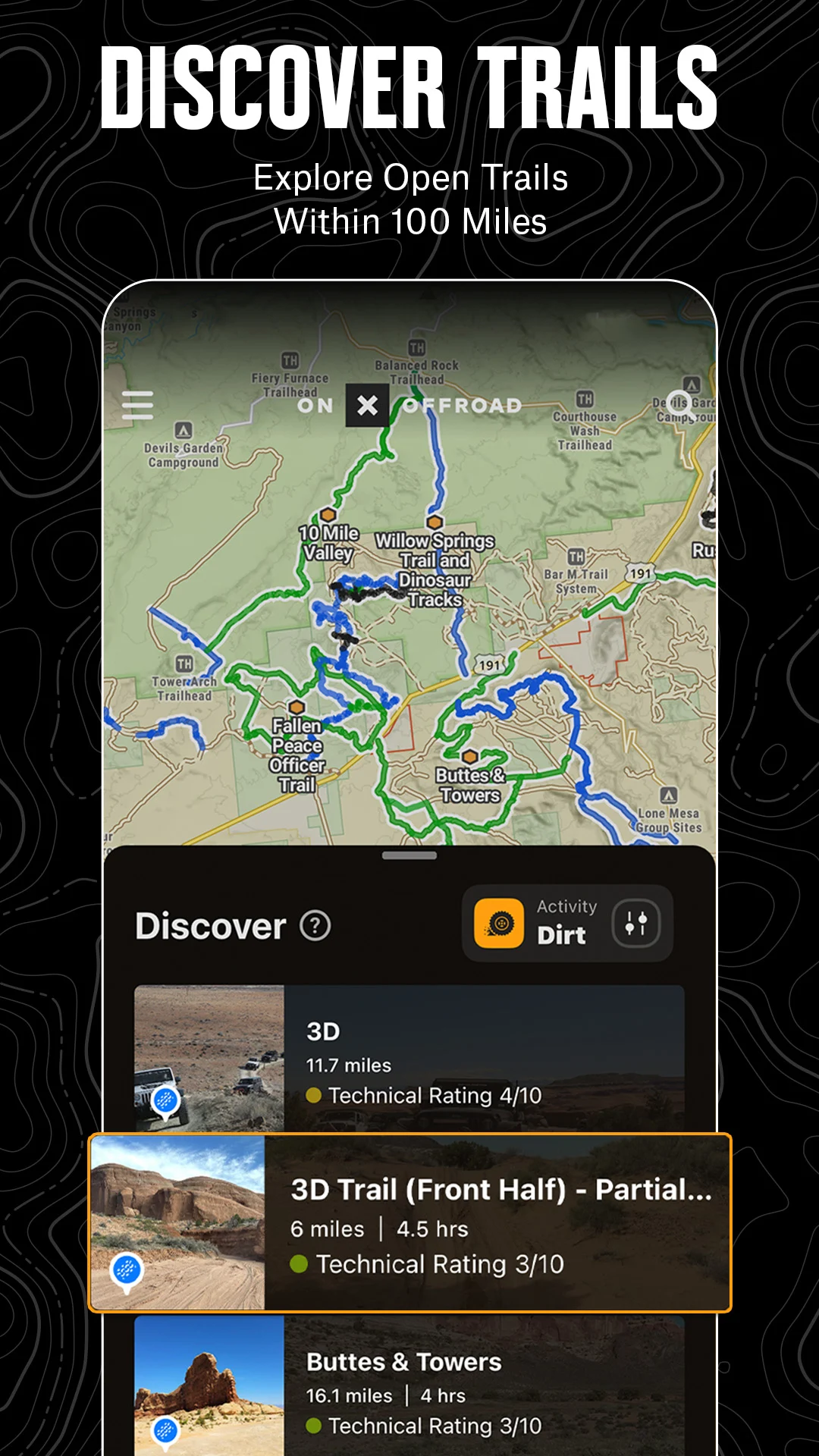
Explore off-road terrains and locate the trails you desire with onX Offroad. With 3D trail maps, GPS functionalities, and compass navigation, it's simple to find what’s accessible nearby or venture into uncharted territory.
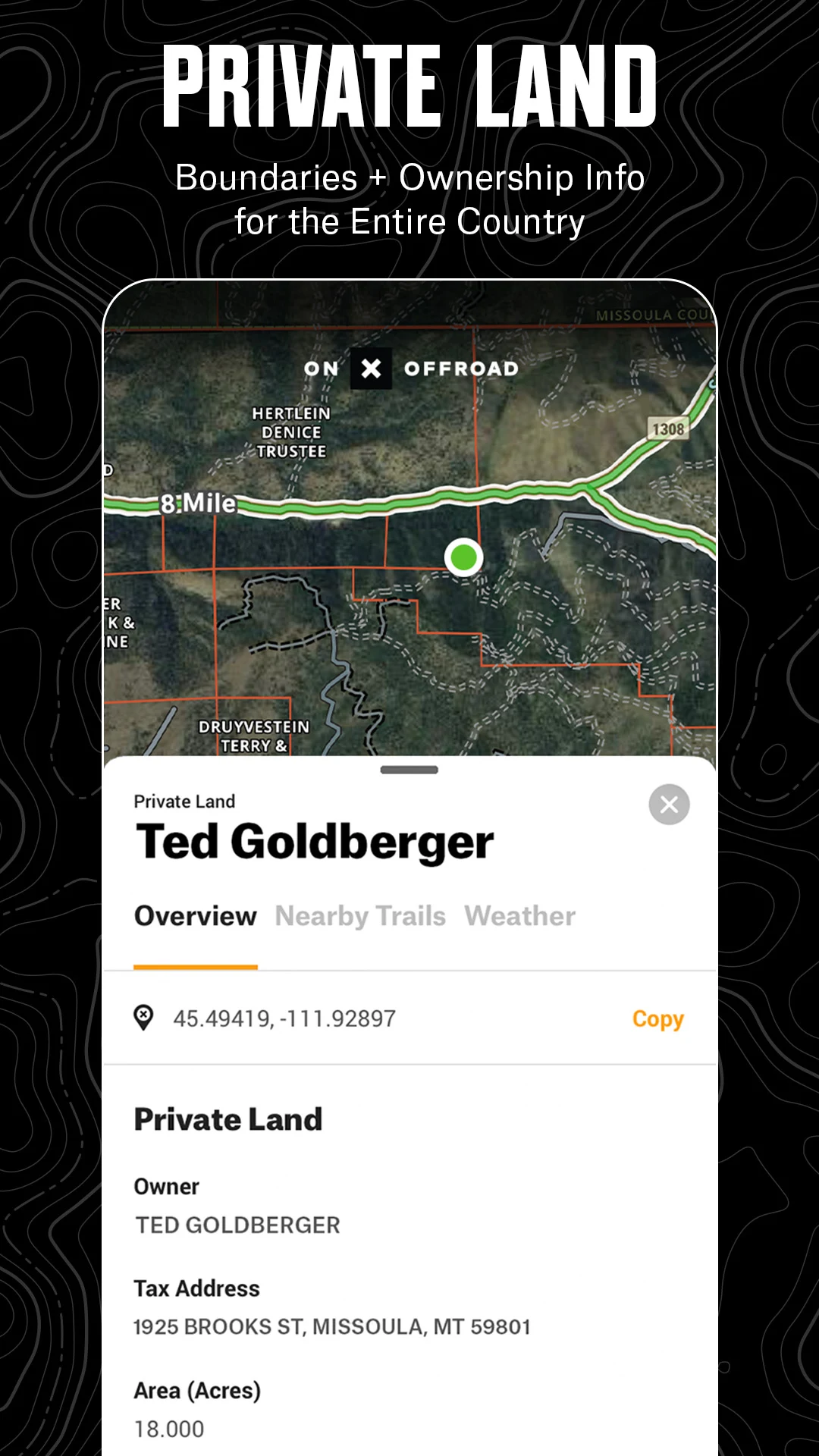
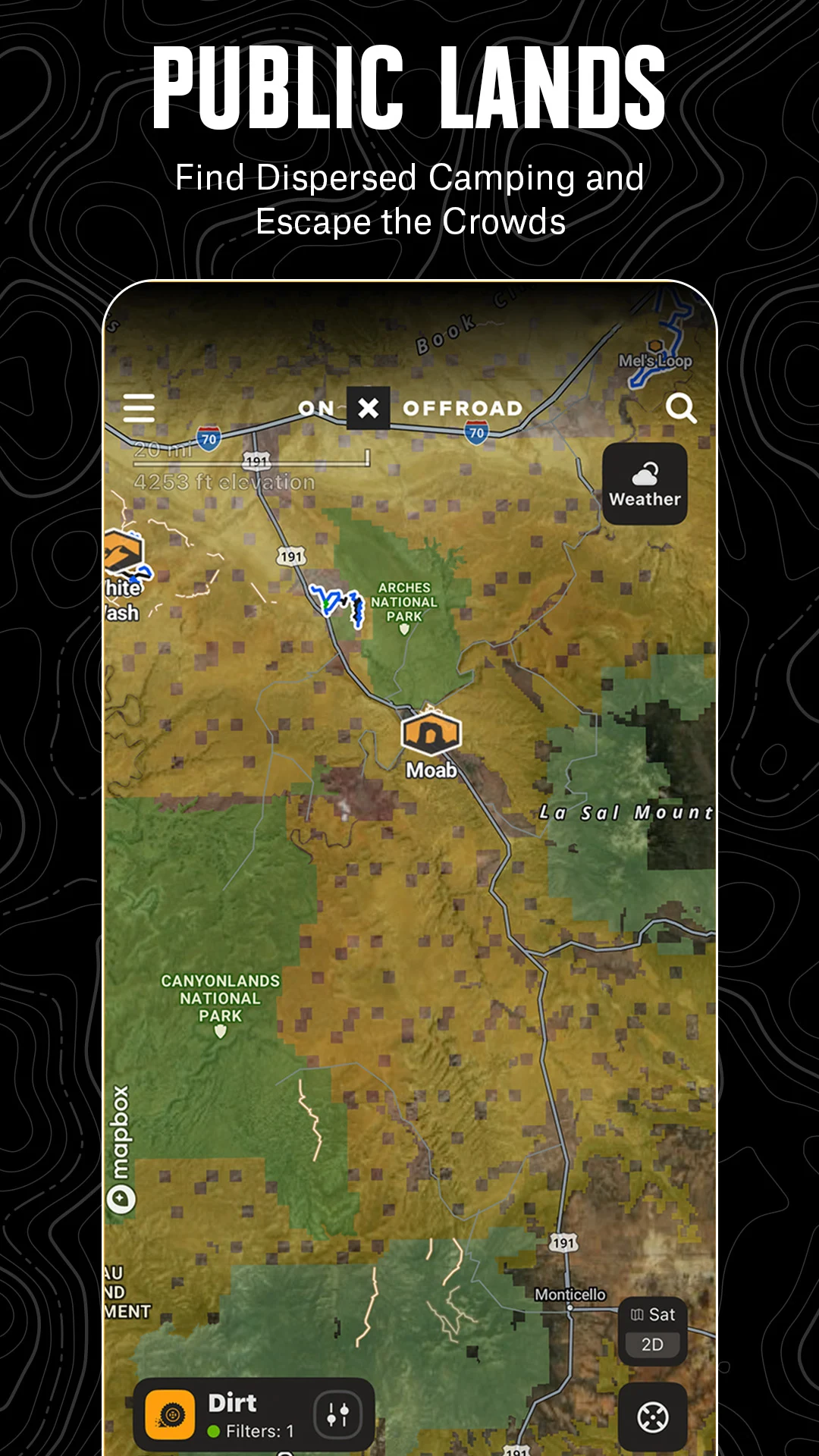
Filter trails based on suitability for 4x4, SxS, dirt bikes, motorcycles, ATVs/Quads, Overland vehicles, and snowmobiles. Gain access to over 650,000 miles of off-road paths across 852 million acres of public lands. The app allows you to view property boundaries, private landowner details, and total acreage.
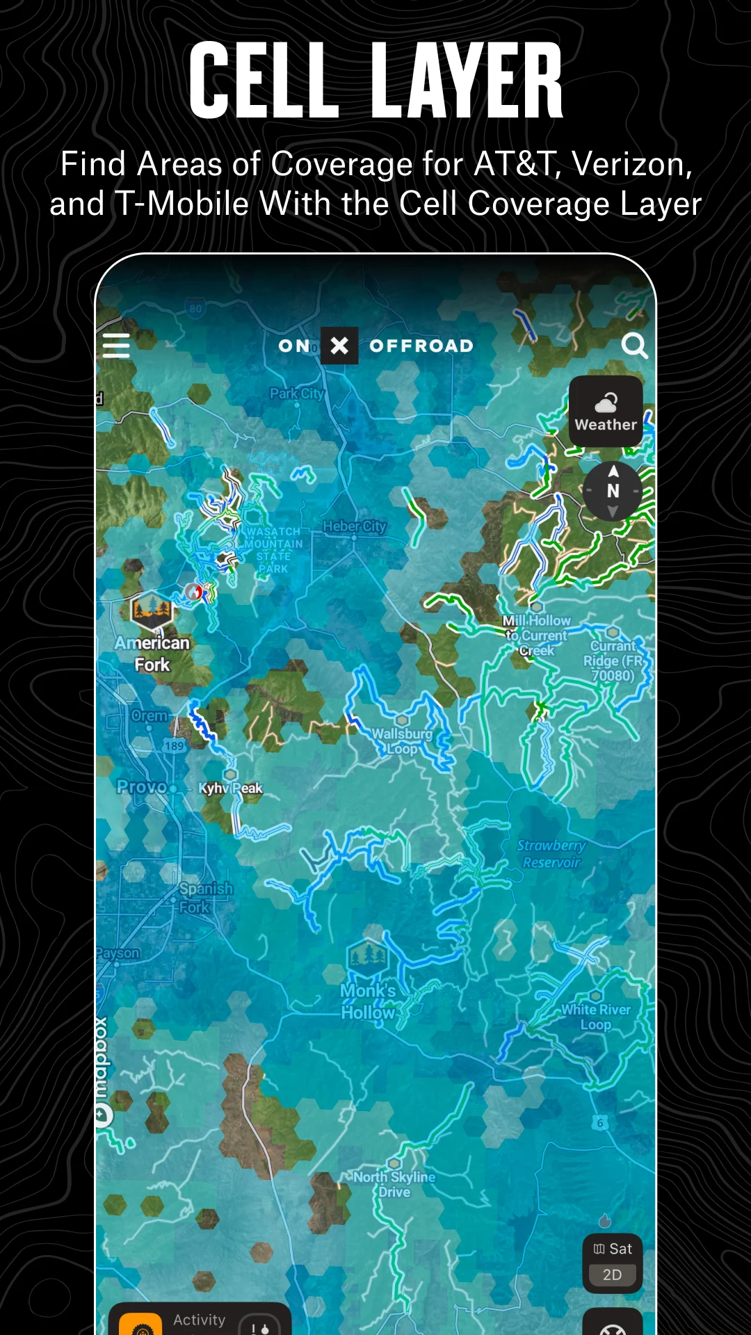
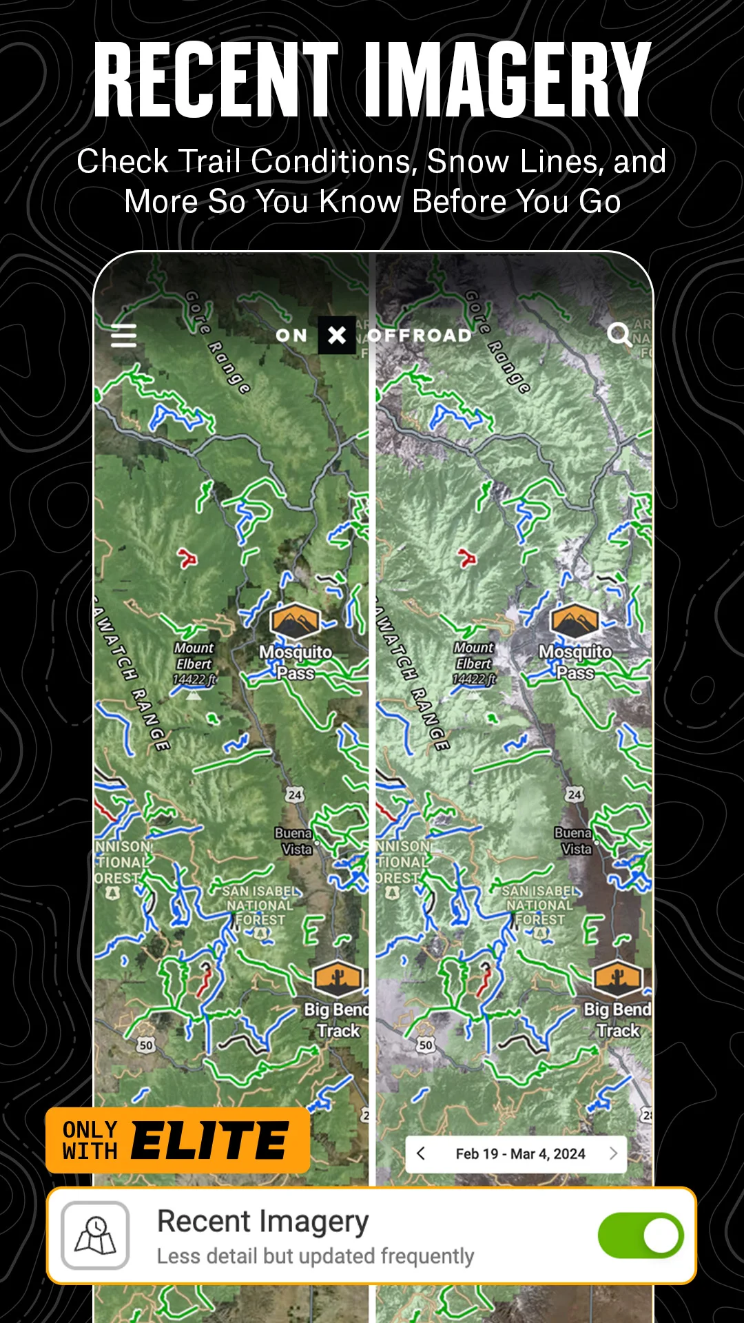
Remain connected even when you're away from urban areas! The new Cell Coverage Layers in onX Offroad provide current coverage information for major carriers. Whether you're embarking on an off-roading adventure, camping, or working remotely, you can identify where you'll have signal for emergencies and confidently plan your activities.
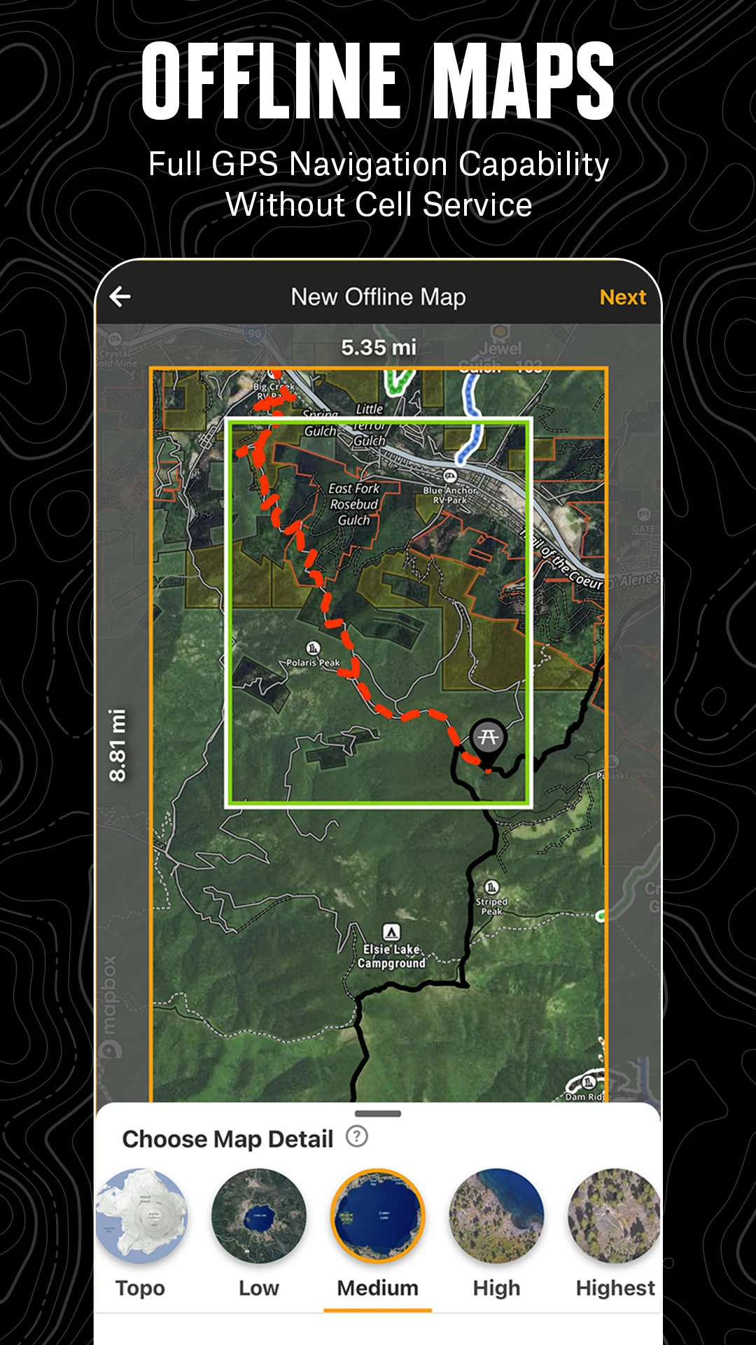
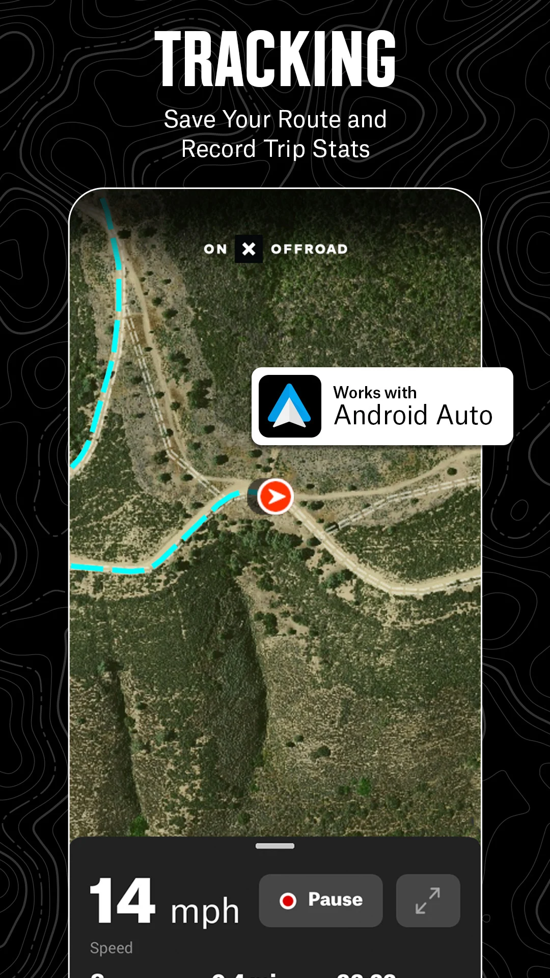
Receive directions from paved roads to your chosen trails with turn-by-turn navigation and integrate onX Offroad with Android Auto. Download Offline Maps onto your device for convenience. Locate trailheads, parking spaces for trailers, non-ethanol fuel stations, campgrounds, and much more.
Your adventure begins where the pavement ends. Discover paths unseen by other maps with onX Offroad.
Highlighted Features of onX Offroad:
▶ OHV Trails & Map Features
• Discover trails tailored to your preferences - whether for SxS, 4x4, ATV, dirt bikes, snowmobiles, etc.
• Switch between Dirt and Snow modes to access grooming reports and avalanche forecasts
• Activate various map layers to view weather data, land boundaries, and cell service information
• Pinpoint cell coverage zones for major carriers
▶ Offline Navigation & Route Development
• Check seasonal open/close dates, trail difficulty, and photos
• Store Offline Maps while retaining interactive land and trail attributes
• Utilize off-road turn-by-turn guidance via voice commands while syncing with Android Auto
• Create routes that automatically align with available roads and trails
▶ Trip Tracker & Recreation Points
• Monitor distance, location, speed, or elevation. Save and share your adventures with friends
• Access GPS navigation with diverse map views – including 3D, topographic, satellite, or hybrid
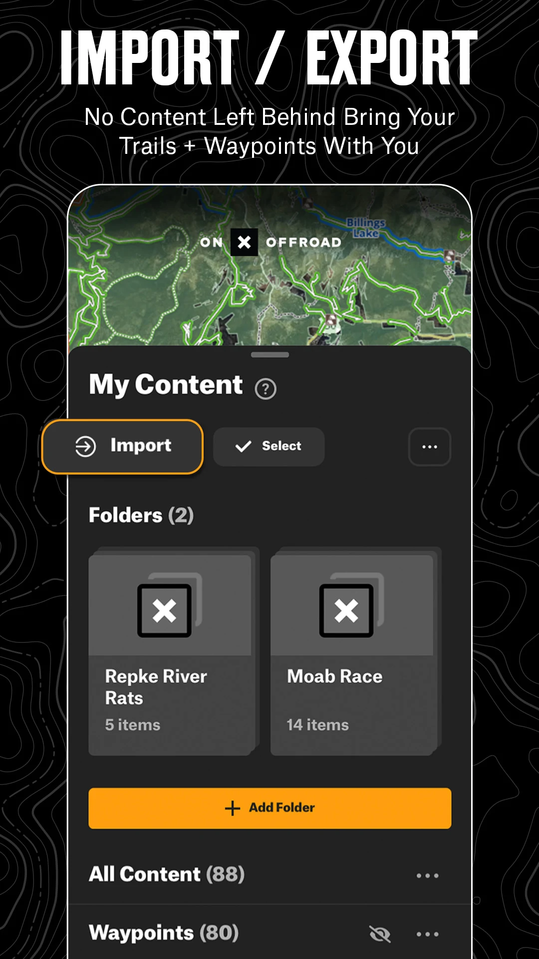
• Add Waypoints to highlight campsites, fuel stations, fishing spots, and others
• Personalize maps by marking recreation points, rock crawls, or hazards
▶ Private Property Maps (Elite Version Only)
• Retrieve private land ownership data nationwide
• Tap on the map to see public lands, boundaries, and acreage information
• Recognize National Forests, BLM areas, National Parks, and more
Download onX Offroad now to experience a reliable planning, mapping, and navigation tool that ensures you return home safely.
▶ Free Trial
Initiate an Elite trial at no cost upon installing the app. Experience the advantages of a leading off-roading tool for a week.
▶ Premium & Elite Membership Options:
Access our Premium features for $34.99 per year. For $99.99 yearly, enjoy all Premium features alongside property maps, landowner details, and discounts from industry brands.
• Over 650,000 miles of motorized routes and off-road trails
• Tailored trails for 4x4, Side-by-Side, dirt bikes, dual sports, ATVs, Quads, Overlanding, and snowmobiling
• 852 million acres of public land spread throughout the United States
• 24,000 topographical maps and 3D representations covering the entire U.S.
• Designated camping locations, campsites, campgrounds, hot springs, breweries, and more
• Unlimited offline map storage for navigation without cellular service
Learning the basic controls and main features of onX Offroad
This article will help you learn how to navigate around the map, how to zoom in and out, and how to find the main features of onX Offroad.
Table of Contents
Mobile App:
Moving the map and zooming in and out in the onX Offroad App.
Main map screen features of the onX Offroad App.
Your location, elevation, and the map scale bar in the onX Offroad App.
Web Map:
Moving the map and zooming in and out in the onX Offroad Web Map.
Main map screen features of the onX Offroad Web Map.
Map scale bar, coordinates, and your location.
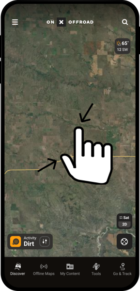
Moving the map and zooming in and out in the onX Offroad App
You can navigate the map using your fingertips. To pan around, touch the tip of your finger to the screen and move it in any direction. The map will move with your fingertip.
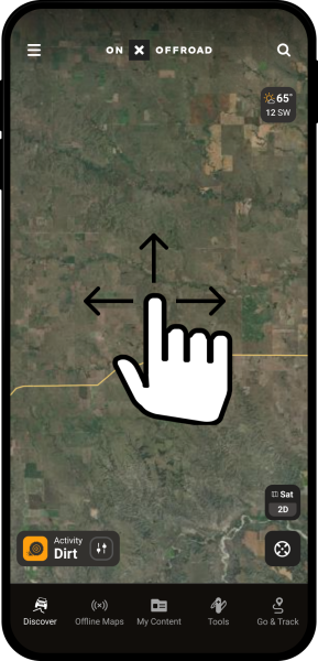
To zoom in, touch your finger and thumb to the screen and spread them apart.
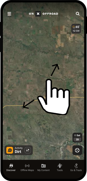
To zoom out, touch your finger and thumb to the screen and pinch them together.
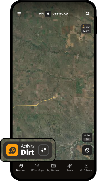
Main map screen features of the onX Offroad App
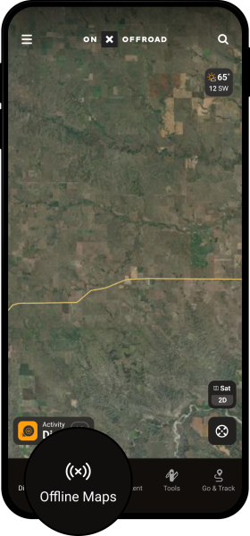
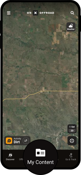
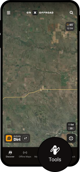
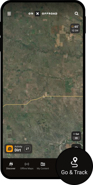
The icons and buttons near the edges of your screen let you use all of the features of the onX Offroad App. Most of the main features of the onX Offroad App are accessed from the Main Toolbar at the bottom of the screen.
Activity Filter: filter trails by type (dirt bike, ATV, overland, and full-width roads), and switch between Dirt Mode and Snow Mode. Click here to learn how to use the Activity Filter menu.
Main Toolbar
Offline Maps: save and manage maps for use outside the cell network. Click here to learn how to use the Offline Maps Menu.
My Content: edit and share your Waypoints, Lines, Shapes and Tracks. Click here to learn how to use the My Content Menu.
Tools: create Waypoints, Lines, and Shapes; measure distance or area. Click here to learn how to use the Map Tools Menu.
Go & Track: record your path and gather data regarding distance, time, and speed. Click here to learn how to use Go & Track.
- Version24.10.0
- UpdateApr 08, 2025
- DeveloperonXmaps
- CategoryMaps & Navigation
- Requires AndroidAndroid 6+
- Downloads1M+
- Package Nameonxmaps.offroad
- Signature289019365ce07ef4c21de3c312a5d944
- Available on
- ReportFlag as inappropriate
-
NameSizeDownload
-
170.44 MB
-
170.17 MB
-
140.30 MB


Enhances outdoor adventures
Inexpensive tool for safety
User-friendly interface
Detailed off-road mapping
Offline map downloads
Excellent customer service
Ability to track locations and routes
Minimal learning curve for new users
Offers a variety of trail information
Limited off-road coverage in some areas
Need for more tracking data features
Issues with Android Auto integration
Road closure feature inaccuracies
Inconsistent functionality for GPS tracking
High subscription cost for limited data
Cluttered interface and user experience issues
Lack of important POIs and legends
Glitches and crashes while using the app