SatFinder - Locate satellites easily
Pinpoint satellite locations with precision for optimal signal reception
- 1.49 Version
- 2.9 Score
- 5M+ Downloads
- In-app purchases License
- 3+ Content Rating


SatFinder is like having a personal GPS for the stars, helping you locate those elusive satellites with ease. Say goodbye to squinting up at the cosmos and hello to conveniently pinpointing satellites from the palm of your hand. So why stress when you can impress with our handy dandy SatFinder? Happy hunting, fellow cosmic explorers!
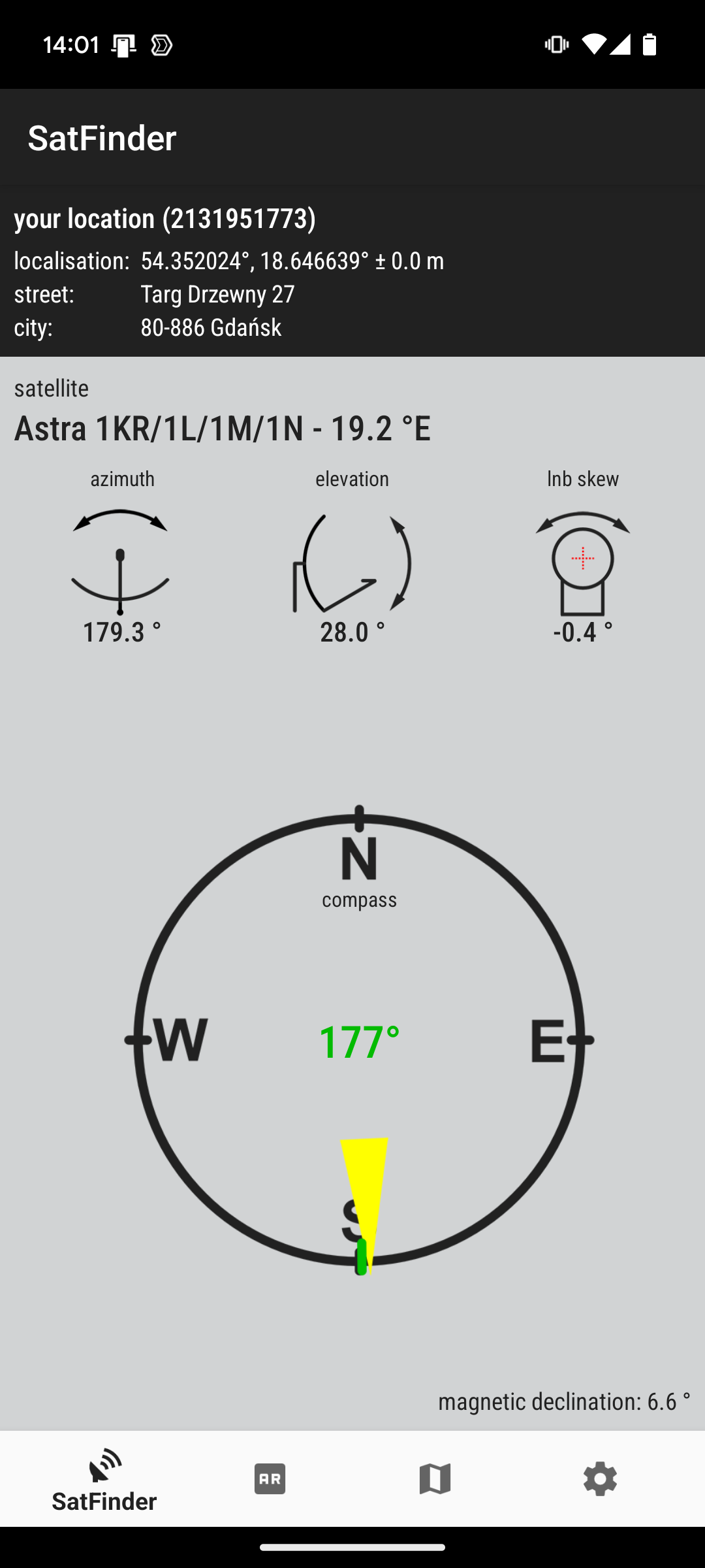
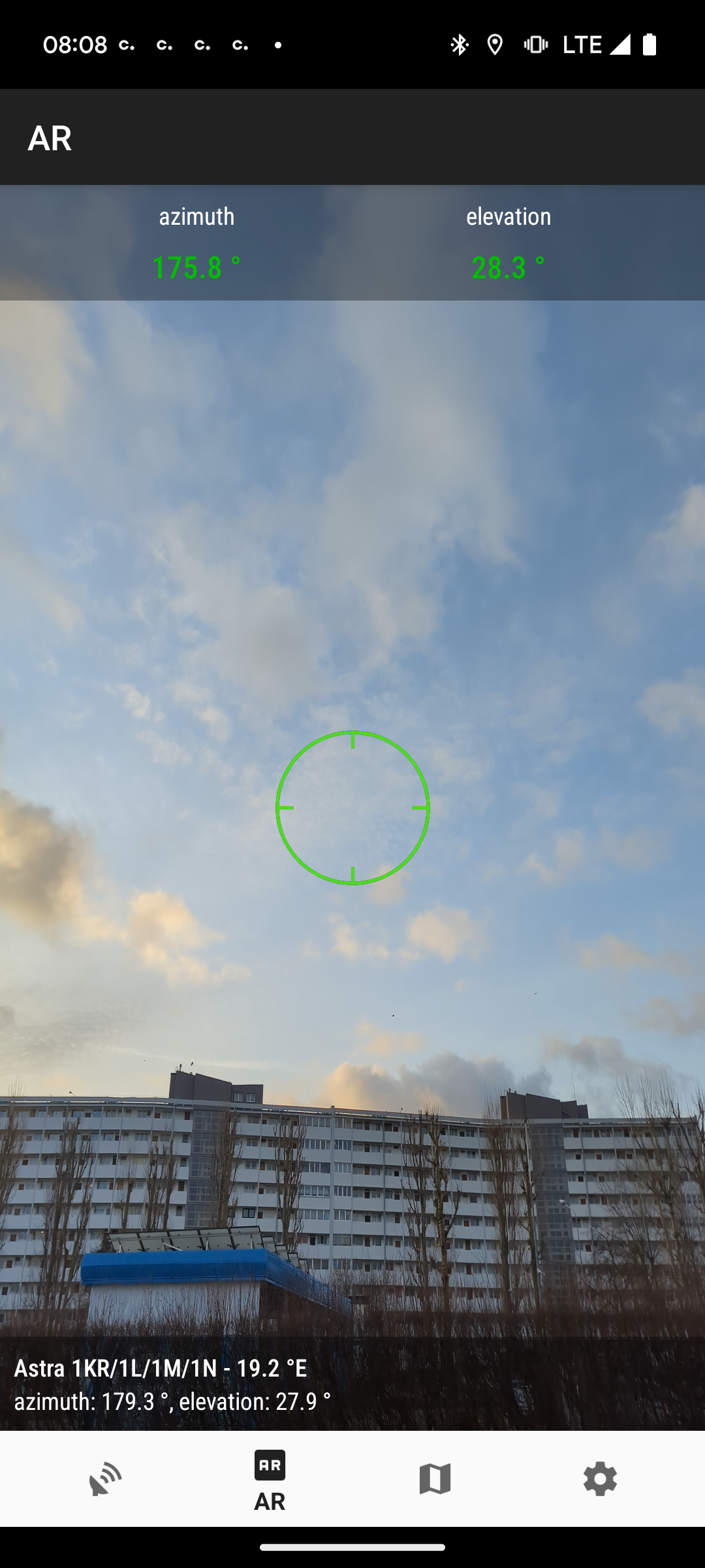
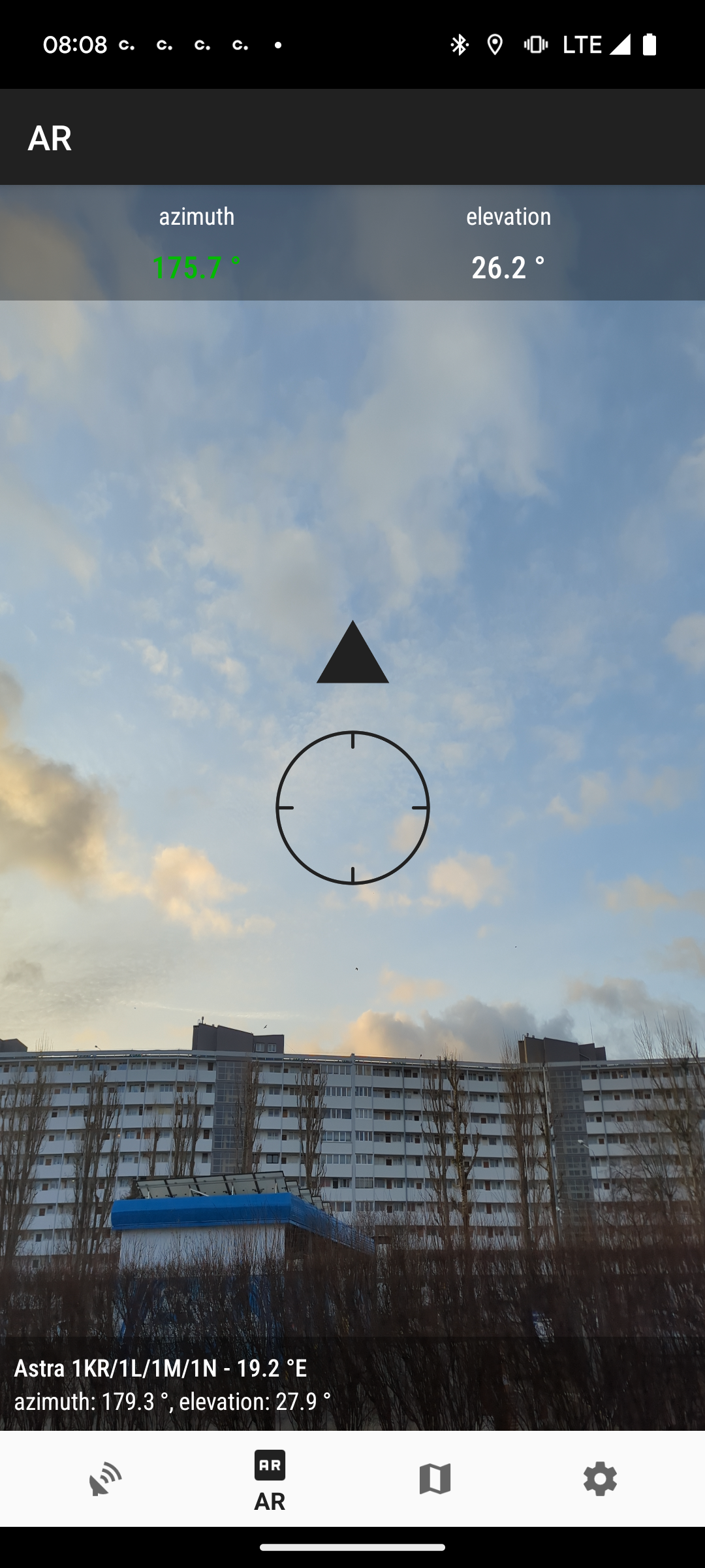
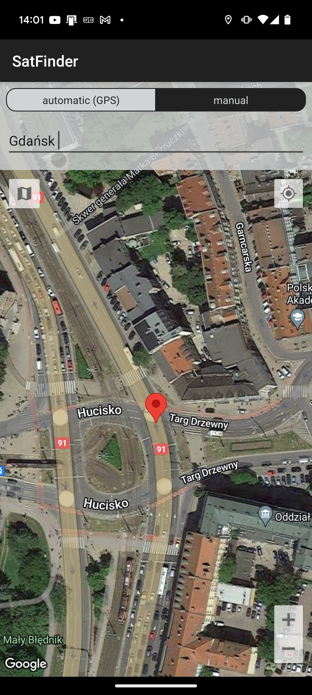
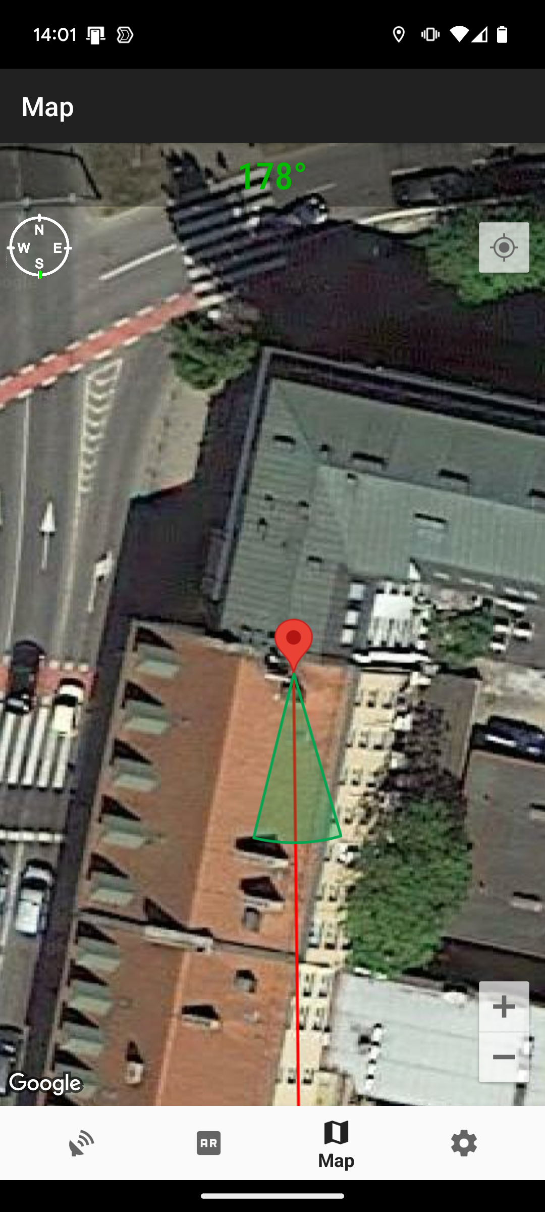
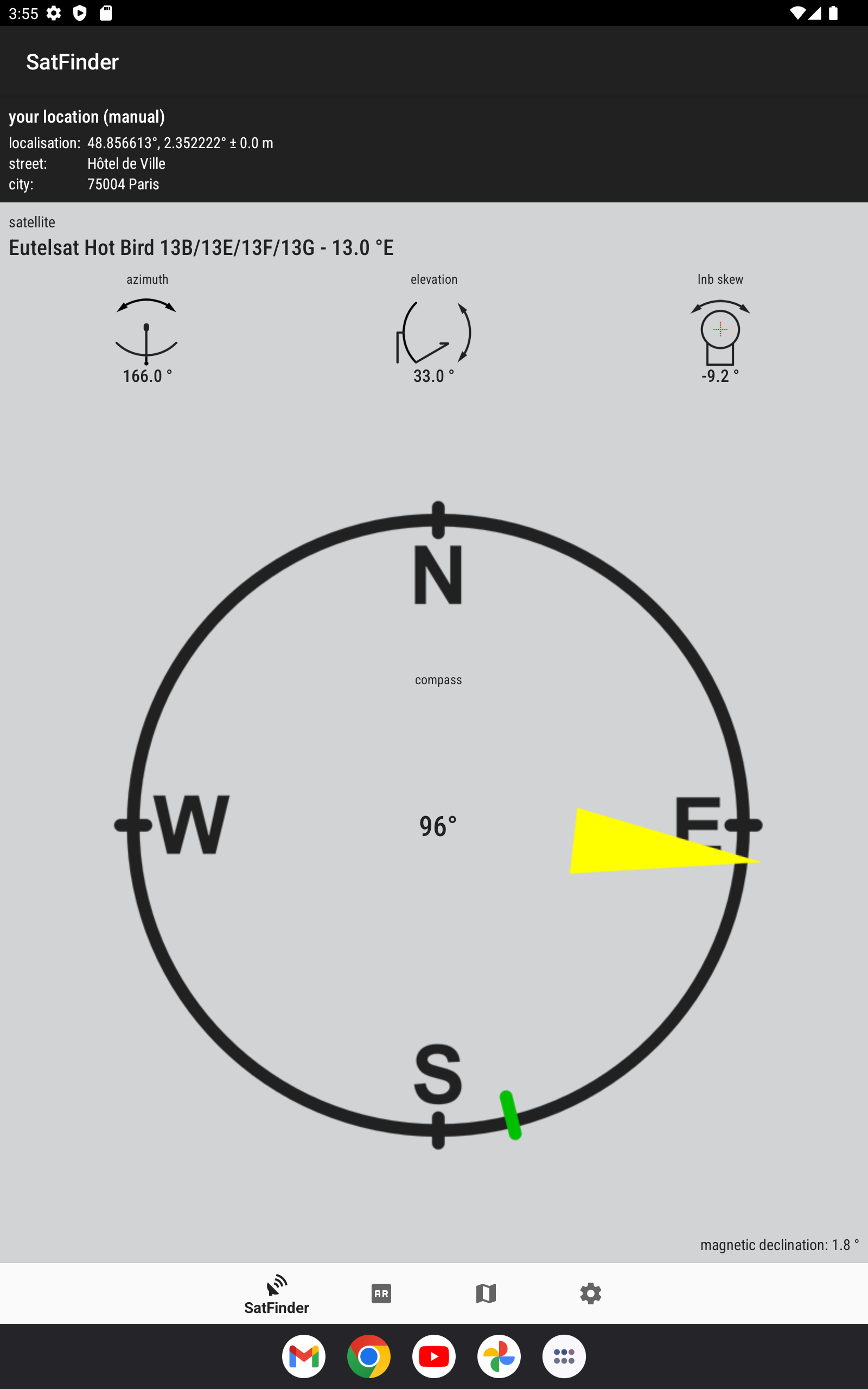
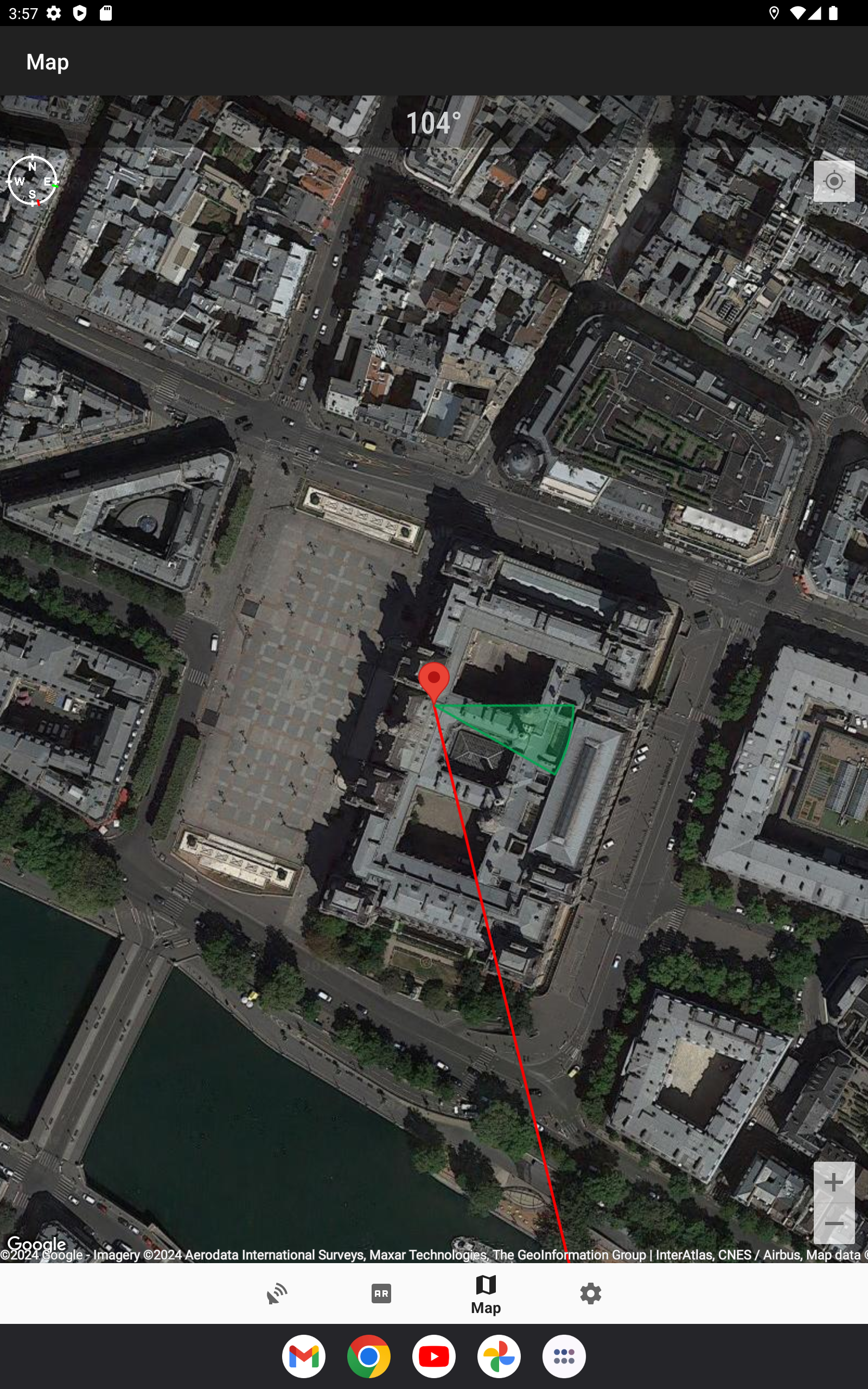
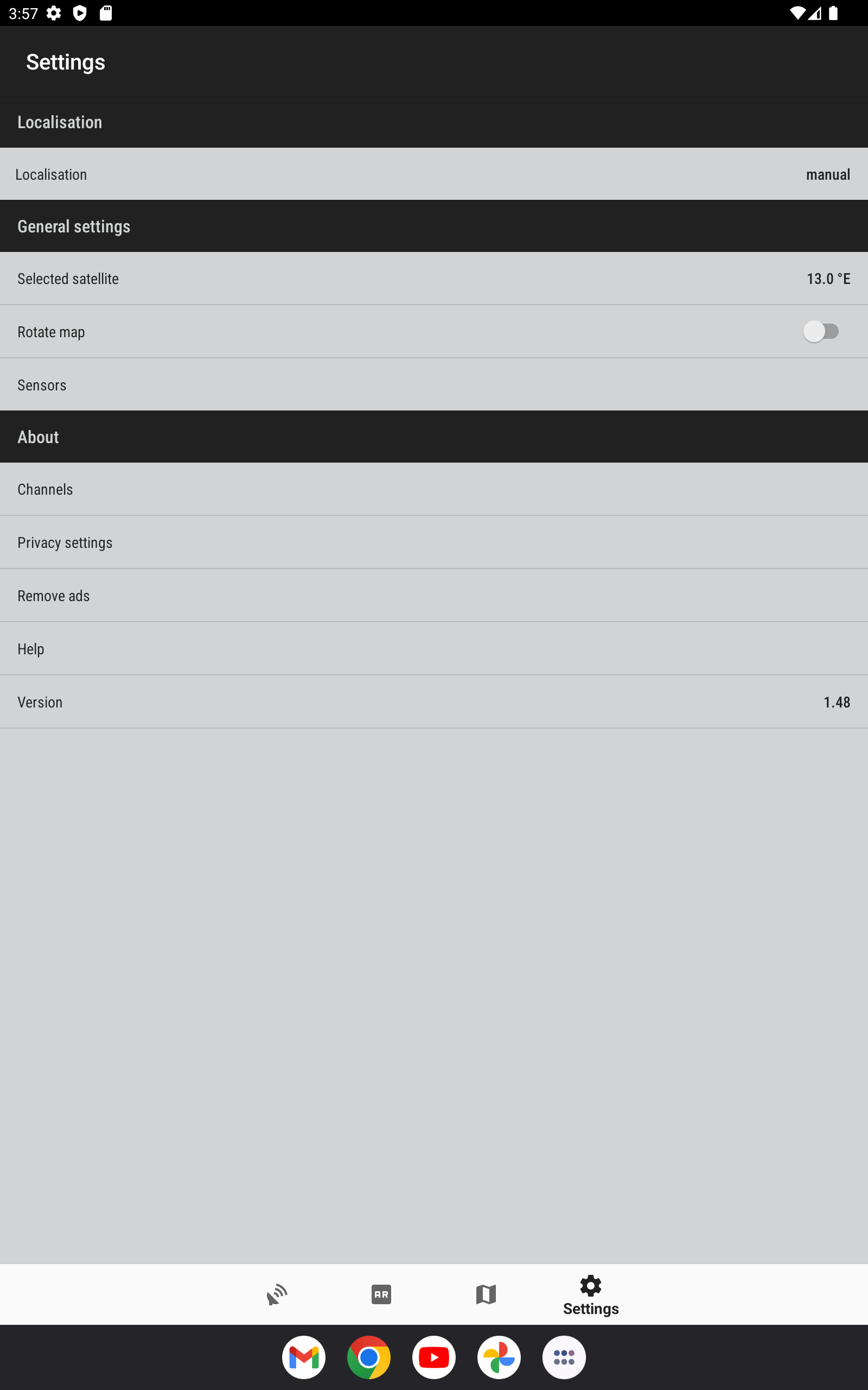
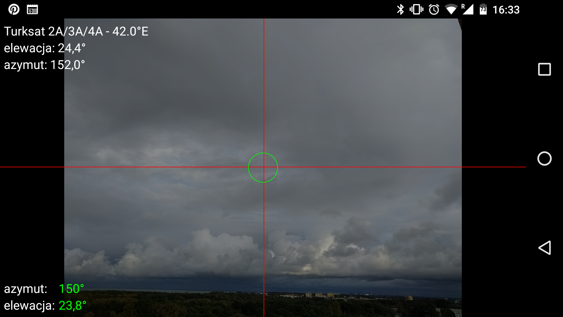
SatFinder, also known as Satellite Finder, is a helpful tool for setting up a satellite dish. Primarily, it provides azimuth, elevation, and LNB tilt tailored to your location using GPS coordinates and the selected satellite from a list. The results are displayed both numerically and graphically on Google Maps. Additionally, it features an integrated compass to assist in determining the proper satellite azimuth. Moreover, it utilizes augmented reality to visually guide you towards the satellite through your device's camera view.
Requirements for Compass Functionality: Please note that the compass feature is operational solely on devices equipped with a compass sensor (magnetometer).
Instructions for App Usage:
1.Begin by activating the GPS and Internet functionalities on your mobile device. Keep in mind that receiving a GPS signal indoors is generally challenging. For precise location accuracy, consider moving closer to windows or stepping outside.
In the current version of the app, the location should be detected promptly. If you encounter a 'no location' message, verify that all necessary features/permissions are enabled.
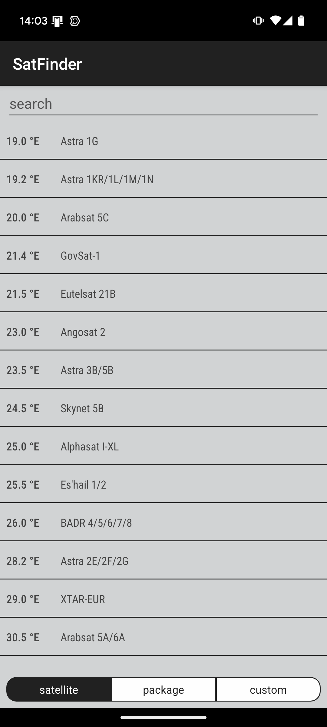
2.If your location is successfully identified, proceed to select the desired satellite. To do so, locate the icon resembling a magnifying glass and tap on it. The list will present all satellites with an elevation angle greater than zero degrees. Note: the satellite name does not impact angle calculations; the satellite position is crucial.
3.The app calculates the azimuth, elevation, and skew angle specific to your location and the chosen satellite. Below the computed values, a compass with a graphic illustration of the azimuth angle is provided. The azimuth angle is determined considering magnetic declination. It is advisable to calibrate the compass whenever it is being used. The green line indicates the phone's azimuth. When the green and red indicators align on the compass, the phone's front points towards the satellite direction. A correct compass reading will turn the phone's azimuth value green.
What the app can do:
This application was written to make it easier to set up satellite dishes. Based on GPS (or the entered address) and the selected position in orbit (or the TV operator), the application calculates the correct azimuth and elevation angles necessary to position the antenna. The built-in compass will show you the direction in which you should point your antenna. The results can also be presented on a map.
Hardware requirements:
Android > 4.0 device with a screen larger than 4.5-5"
Sensors: magnetometer (compass) and accelerometer,
GPS,
Internet,
Camera on the back of the screen.
How this app works on your device:
This section shows you whether this app works on your devices. You’ll only see devices that are linked to your Google Account and that have been active in the last 30 days.
- Version1.49
- UpdateAug 17, 2024
- DeveloperMaciej Grzegorczyk
- CategoryTools
- Requires AndroidAndroid 5.0+
- Downloads5M+
- Package Namecom.esys.satfinder
- Signature3b062b9c40e6c851d7a56e6d3edbbf5c
- Available on
- ReportFlag as inappropriate
-
NameSizeDownload
-
17.47 MB
-
17.64 MB
-
4.98 MB