토지이음 - Map & land use info
Discover your area's zoning, compare maps, and stay updated on local planning with this intuitive mapping app
- 5.0.4 Version
- 2.0 Score
- 446K+ Downloads
- Free License
- 3+ Content Rating


[Key Features Description]
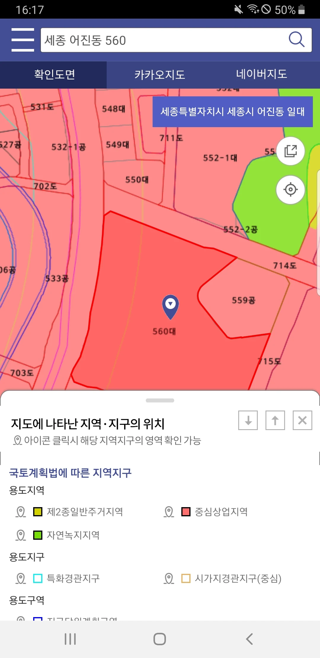
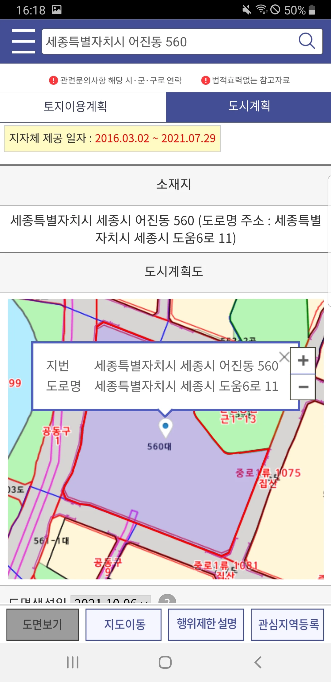
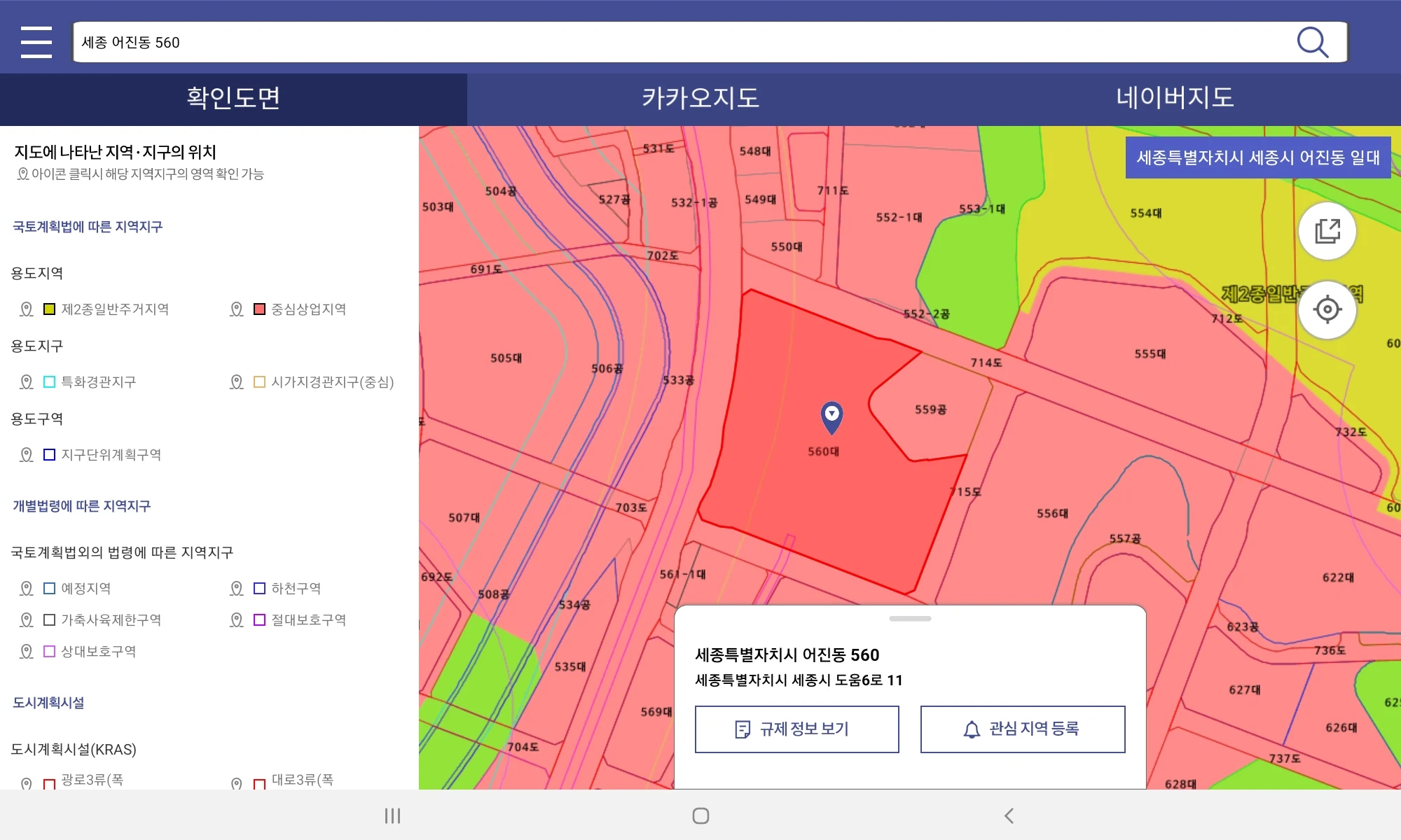
Map Service: You can navigate the map to check the designation status and range of specific areas by location.
Additionally, you can compare with 2D and satellite maps from private providers.
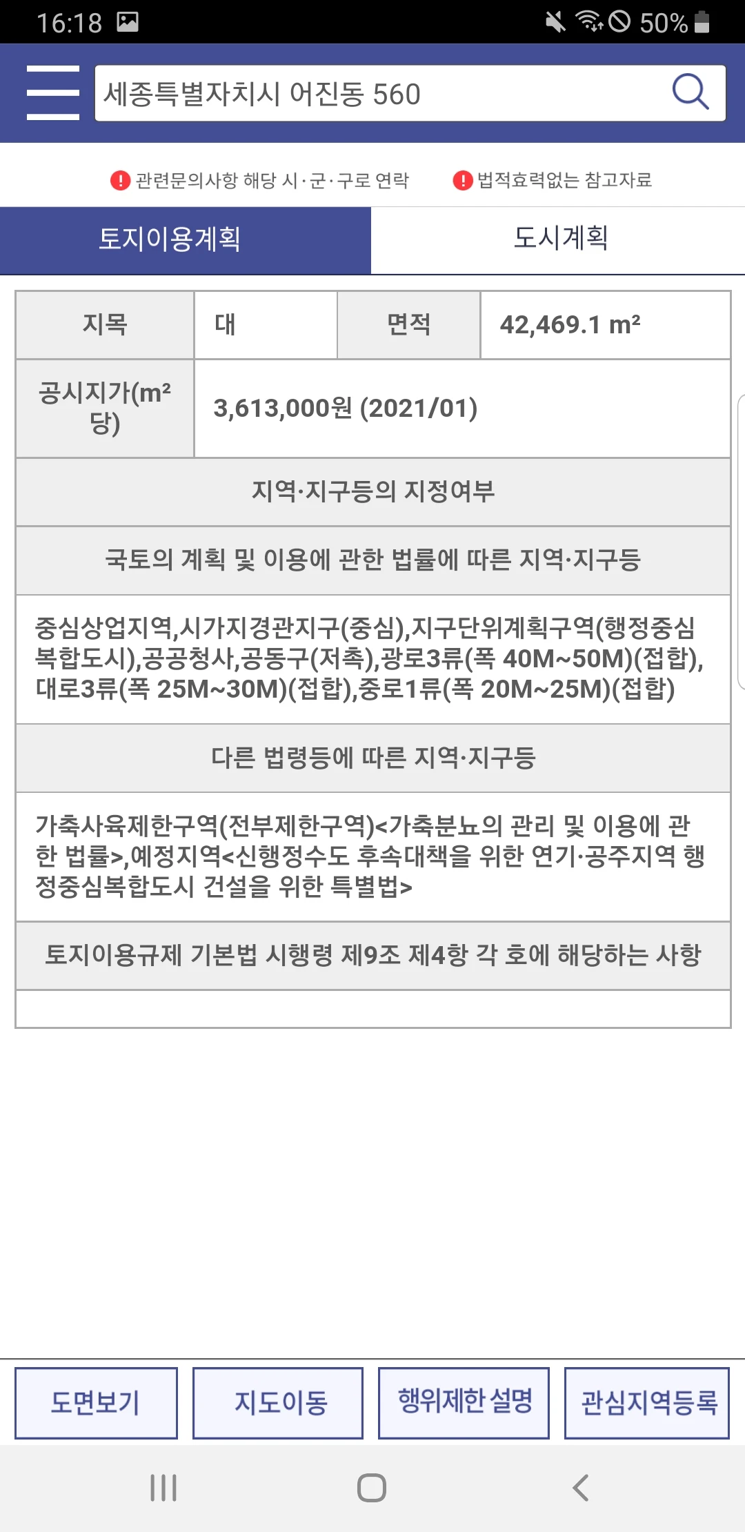
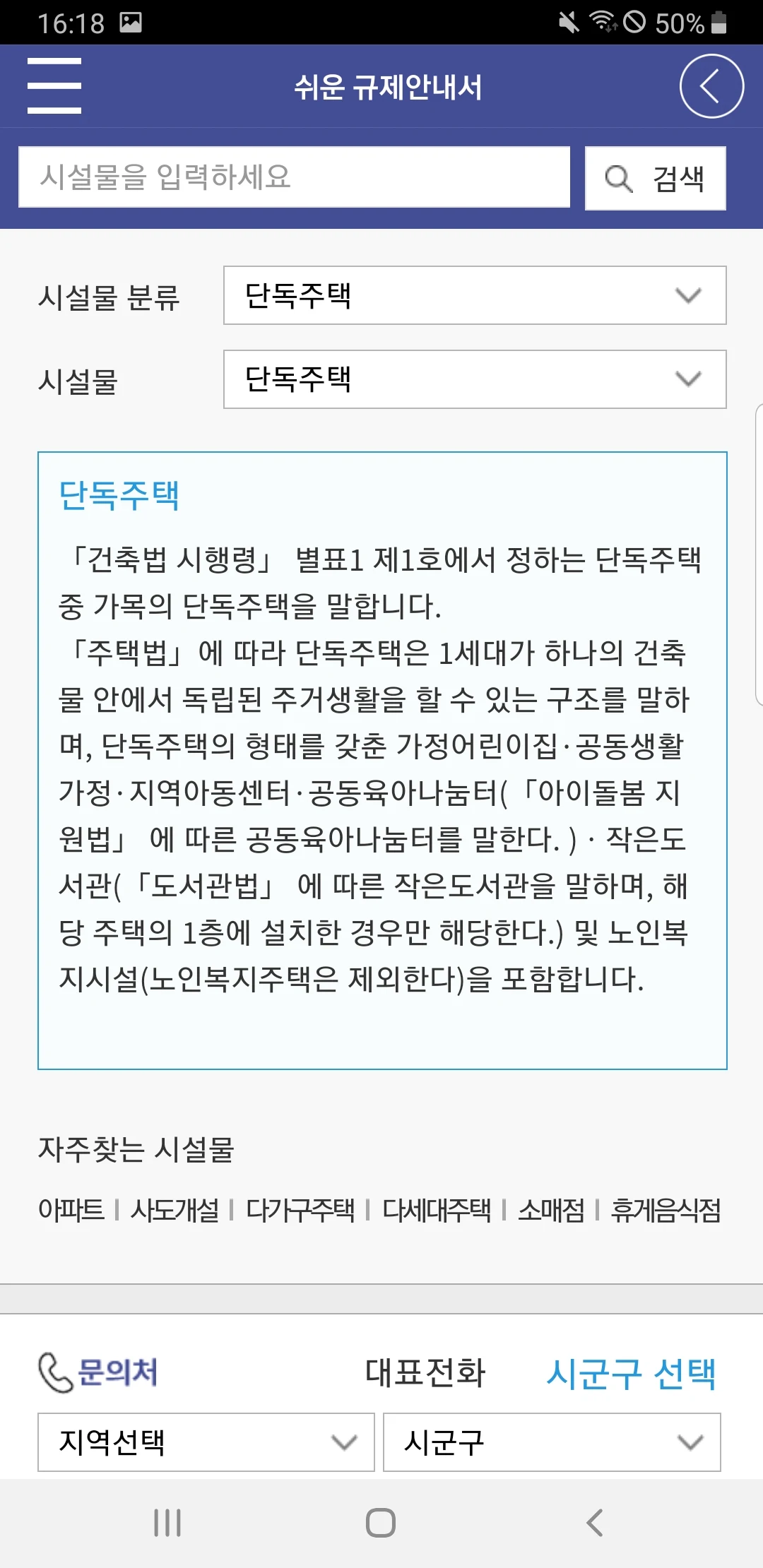
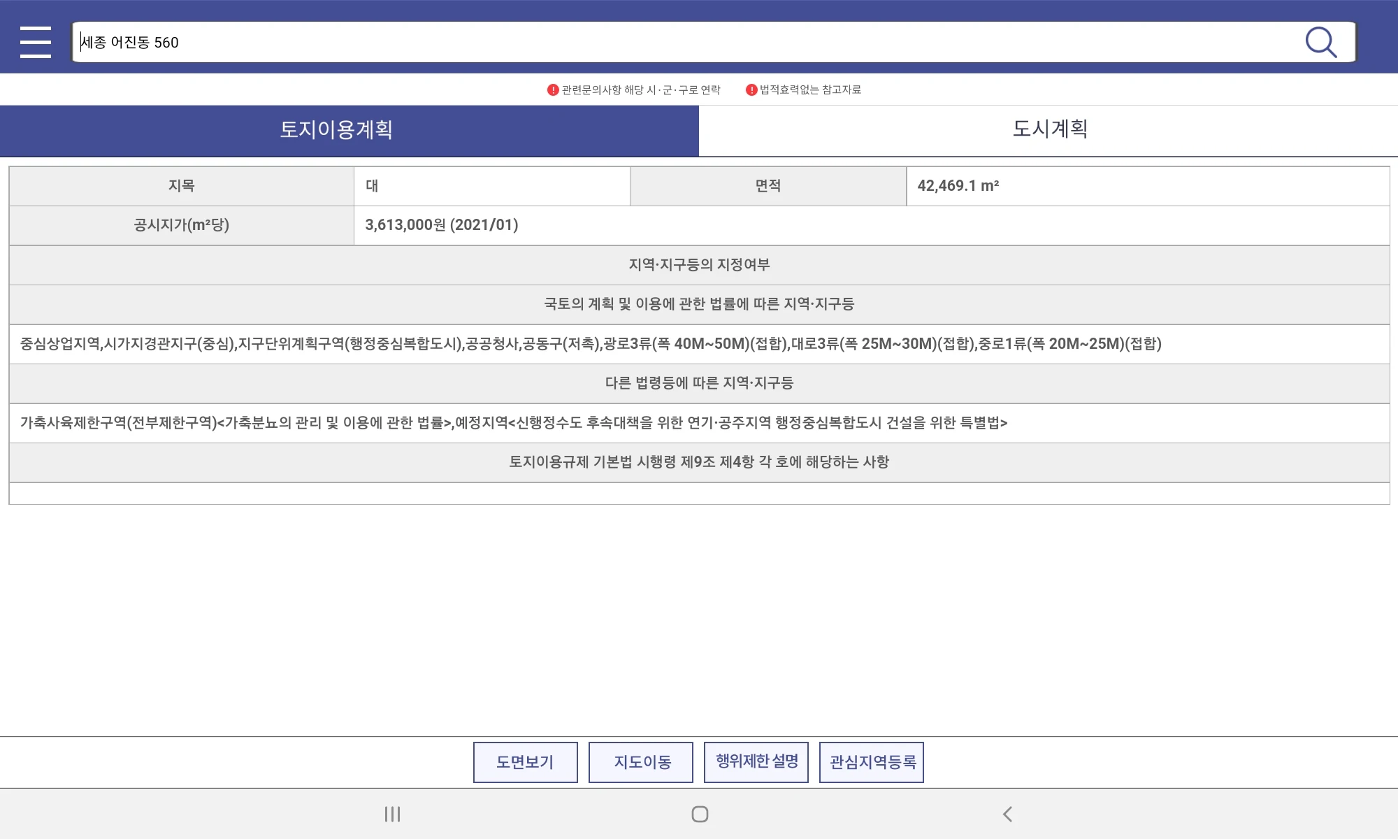
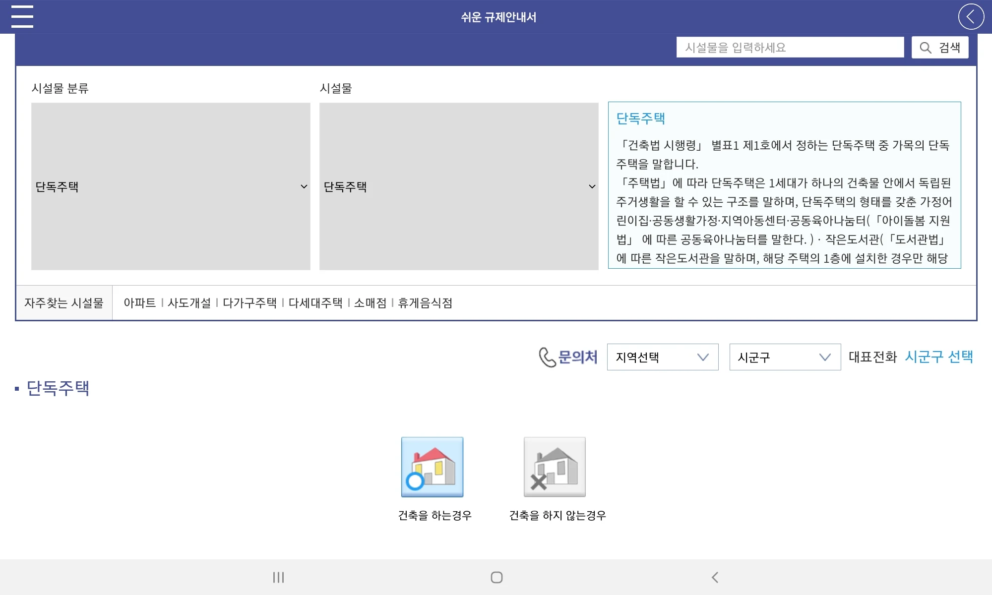
Land Use Plan: You can view land use plans and regulations by lot number and access related documents.
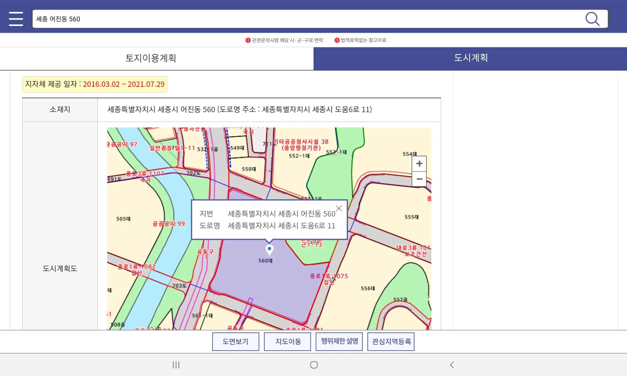
Urban Planning: The map allows you to see urban planning facilities and district planning areas.
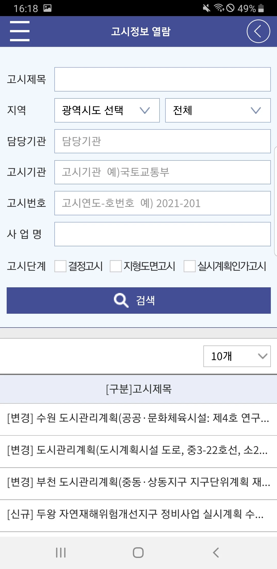
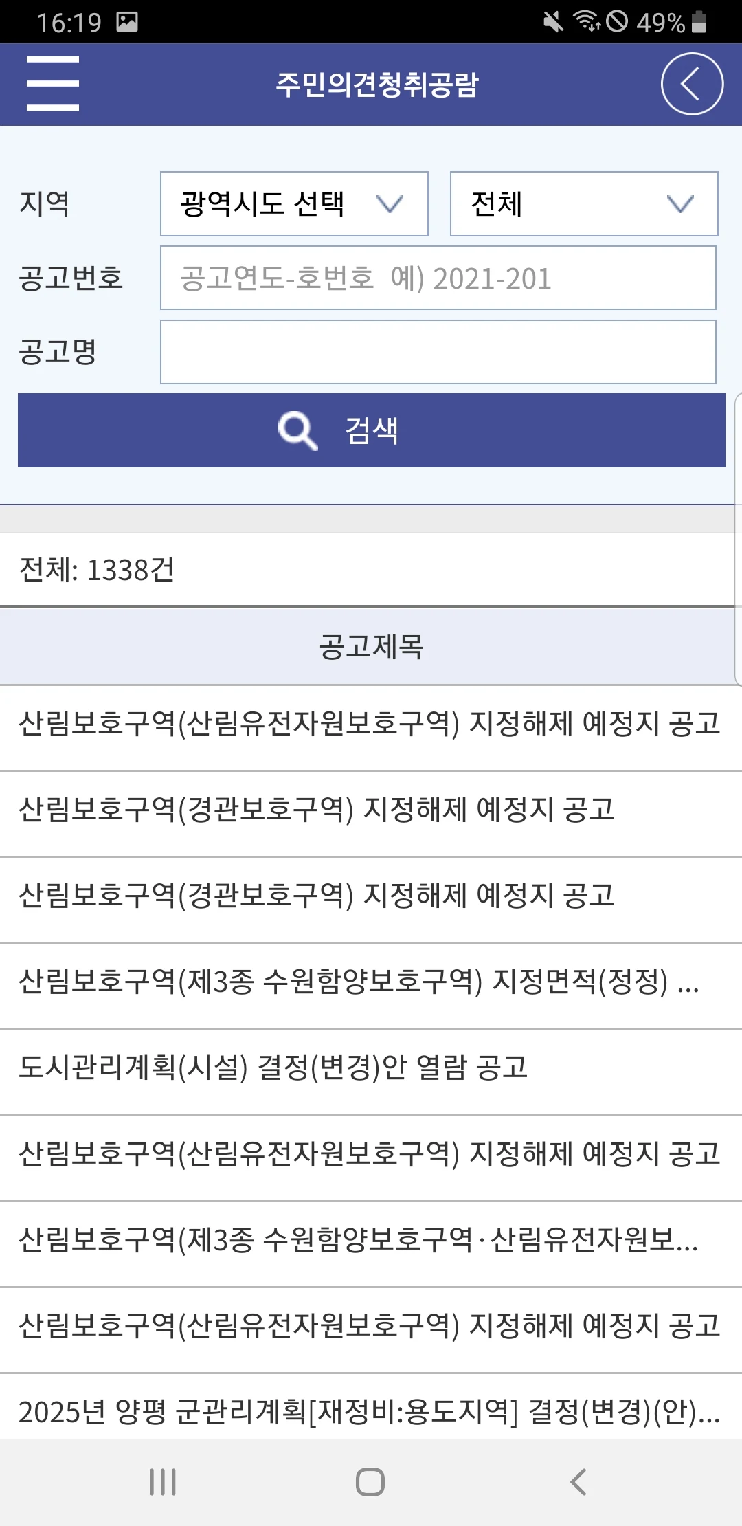
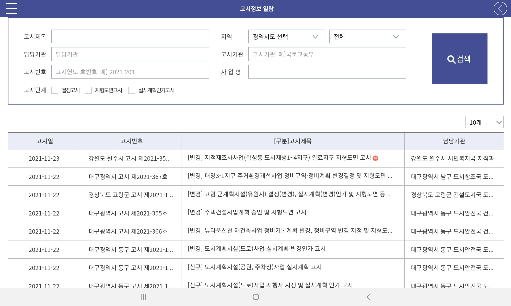
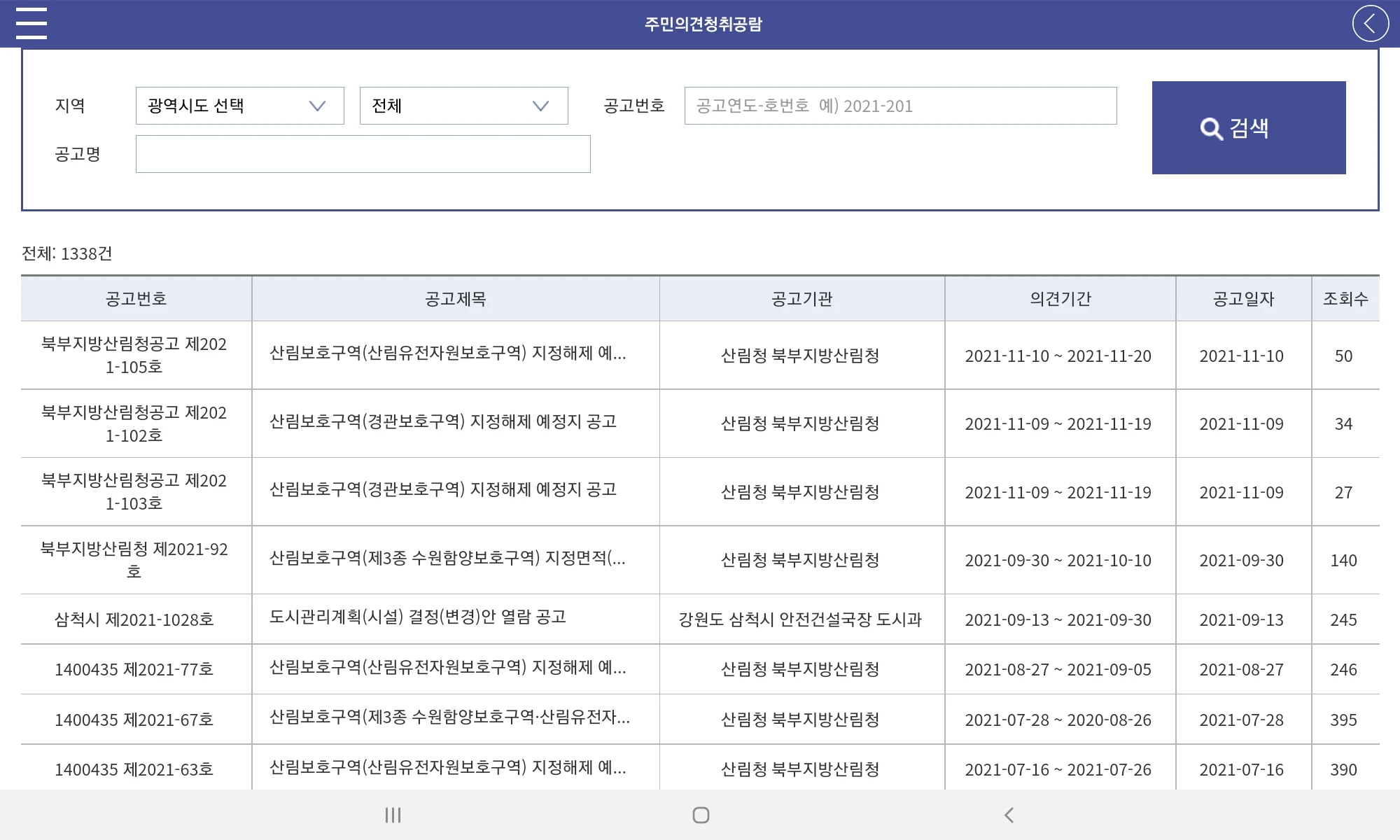
View Changes in Areas of Interest: By registering an area of interest, you can confirm recent public announcements for that administrative region and participate in resident feedback sessions.
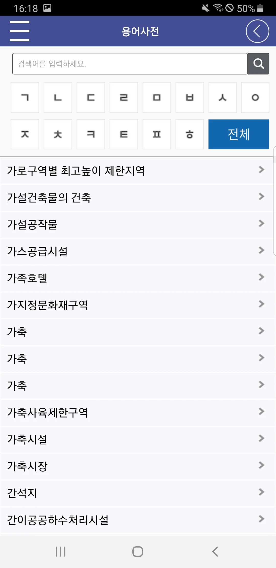
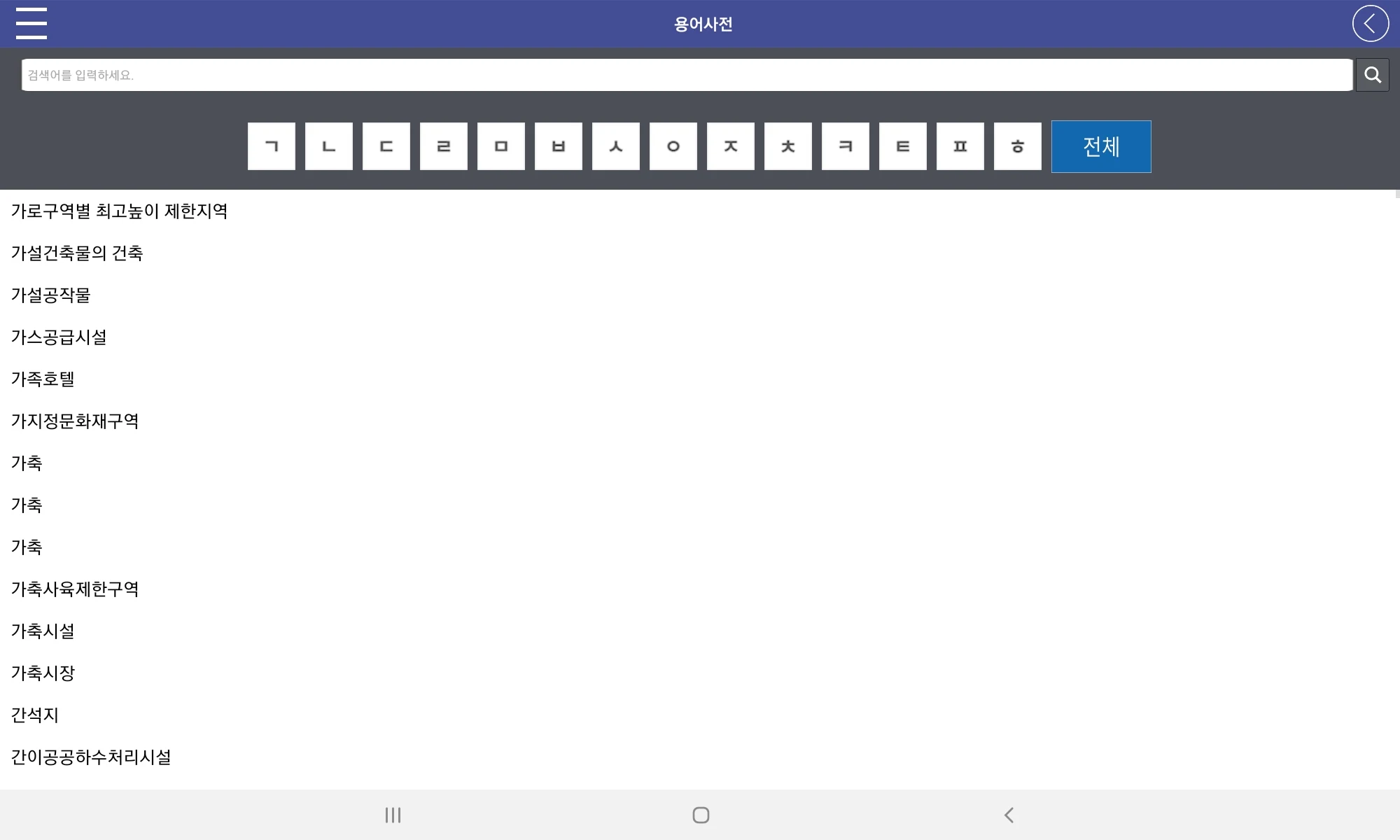
The information and glossary available on the Land Integration website are also accessible via the mobile app.
※ For inquiries regarding app installation and usage: Customer support is available weekdays from 09:00 to 18:00, with a lunch break from 12:00 to 13:00.
※ Permission Guide
[Optional Access Permissions]
- Phone: Used to provide updates on changes in areas of interest.
- Location: Utilized for navigating to your current location within the map.
- Notifications: Employed for alert service regarding public announcements and resident feedback for areas of interest.
* Even if you do not consent to optional permissions, you can still use services that do not require those functions.
* You can adjust permission settings through your phone by going to Settings > Applications > Land Integration > Permissions menu.
More information
토지이음 provides a comprehensive map service that allows you to evaluate the status and boundaries of regional district designations by location. By navigating through the map, you can easily compare details with 2D and satellite maps offered by popular private map services. This feature ensures you have a clear understanding of geographic specifics in relation to regional planning.
Detailed Land Use Information
The app offers insights into land use plans and regulations based on parcel numbers. You can view and assess confirmation drawings, providing a detailed overview of specifications pertinent to land utilization. This feature is complemented by a convenient urban planning tool, which allows you to visualize urban planning facilities and the organization of district-level planning areas directly on the map.
Track Changes and Stay Informed
By registering areas of interest, you benefit from real-time updates and notifications regarding the administrative district of concern. This interactive element empowers you to participate actively in public discussions and listen to the opinions of residents, enhancing engagement in community planning processes.
Enhance Your Experience
토지이음 also offers a glossary and additional notification information to enhance user interaction on the platform. While optional access to features such as phone and location information enriches the app’s functionality, you retain control over your permissions, ensuring a customized and secure user experience. Comprehensive access settings can be managed conveniently through the phone’s application settings.
토지이음 integrates advanced mapping with user-centric features, laying out an efficient path for personal and community-level engagement in urban and regional planning.
- Version5.0.4
- UpdateMar 25, 2025
- Developer국토교통부 도시정책과
- CategoryLifestyle
- Requires AndroidAndroid 4.0.1 – 4.0.2+
- Downloads446K+
- Package Namecom.coops.LandUseControlSystem
- Signaturedb77f49f4e00e01c170f50d8892ab56e
- Available on
- ReportFlag as inappropriate
-
NameSizeDownload
-
47.29 MB
-
41.92 MB
-
42.10 MB