UTM Geo Map - Track location history
Visualize geographic data with precision using UTM coordinates on the go

- 4.0.8 Version
- 1.6 Score
- 1M+ Downloads
- In-app purchases License
- 3+ Content Rating


Complete, simple, easy-to-use, and free application for Land Surveying, Topography, Bathymetry, & GIS. Suitable for Geodesy Engineering, Civil Engineering, Geology, and other disciplines related to maps, coordinates, location, address, and spatial analysis. Can be used as a tool in determining position, coordinates, location & address, area & distance measurement, simple spatial analysis such as Overlay, Buffering, TIN/Delaunay Triangulation, Voronoi Diagram, Convex Hull, Smoothing, show WMS Map (Map Server), etc.
UTM Geo Map FAQ
1.Why can't I install UTM Geo Map?
The installation of UTM Geo Map may fail because of the lack of device storage, poor network connection, or the compatibility of your Android device. Therefore, please check the minimum requirements first to make sure UTM Geo Map is compatible with your phone.
2.How to check if UTM Geo Map is safe to download?
UTM Geo Map is safe to download on APKPure, as it has a trusted and verified digital signature from its developer.
3.How to download UTM Geo Map old versions?
APKPure provides the latest version and all the older versions of UTM Geo Map. You can download any version you want from here: All Versions of UTM Geo Map
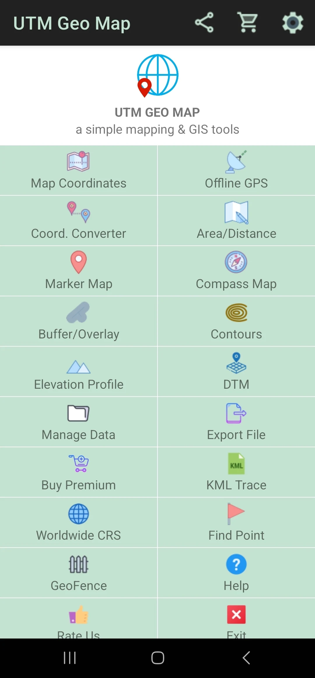
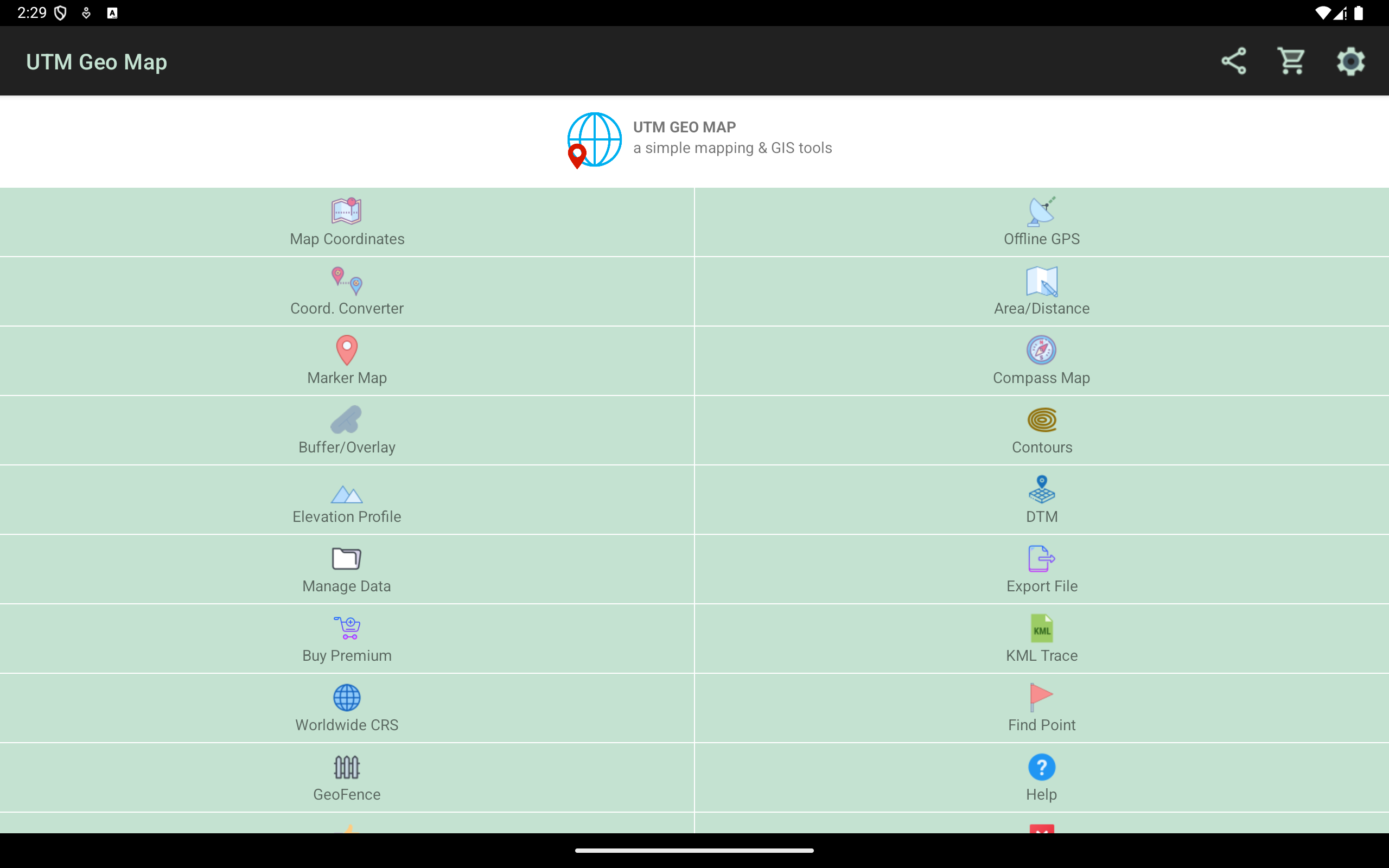
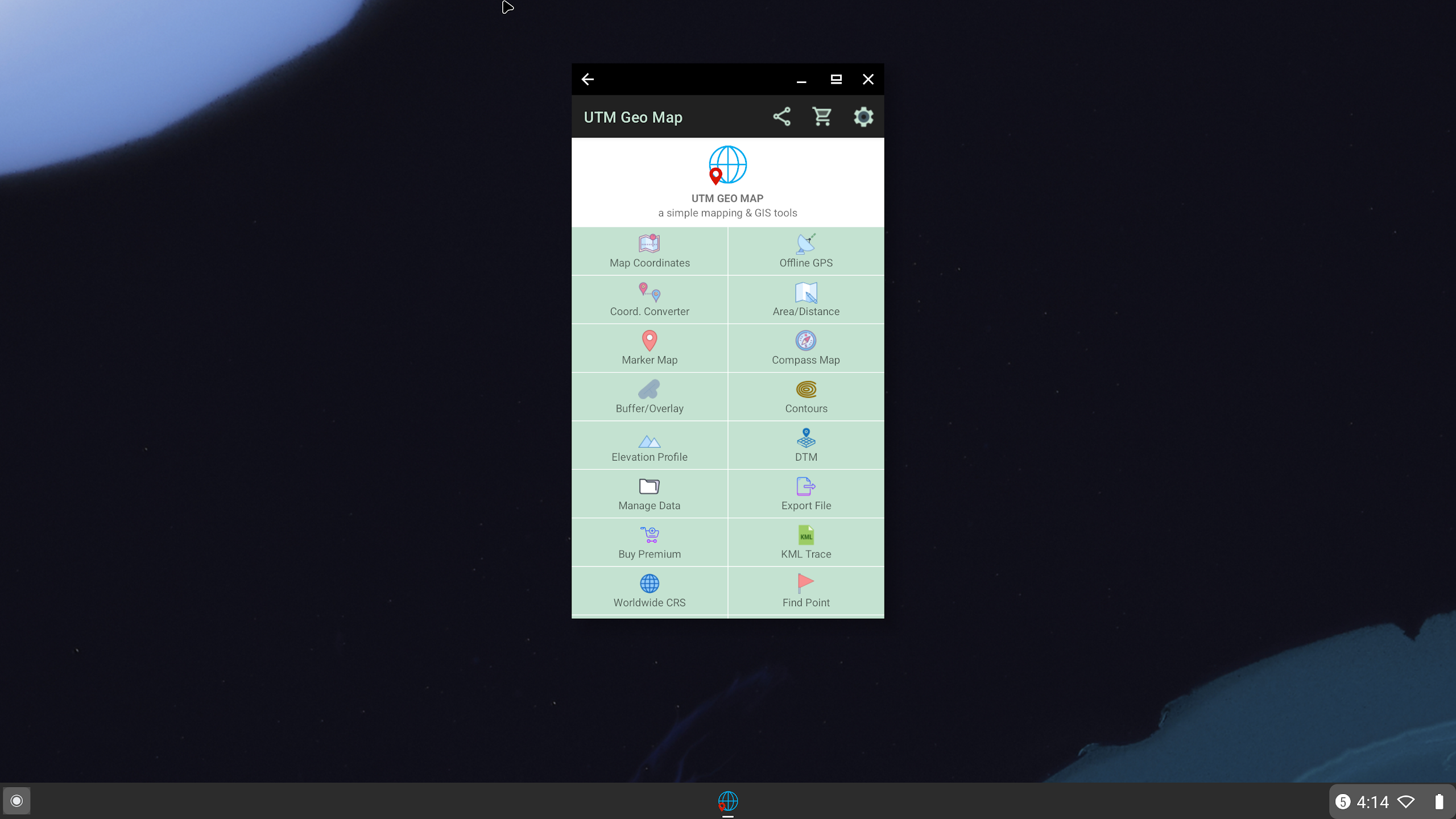
Main Features:
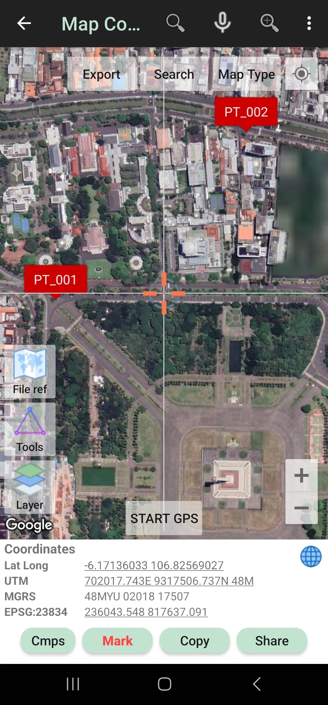
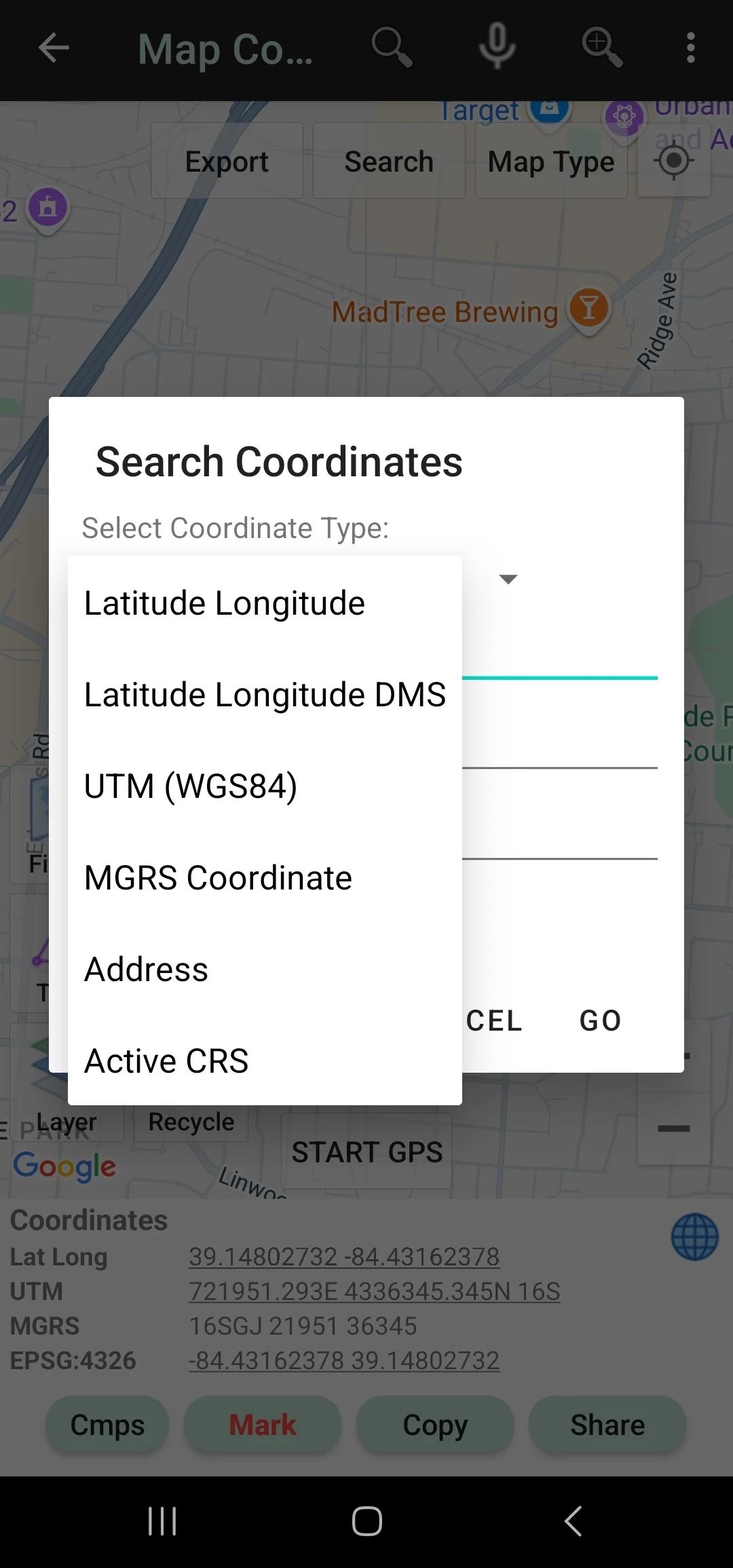
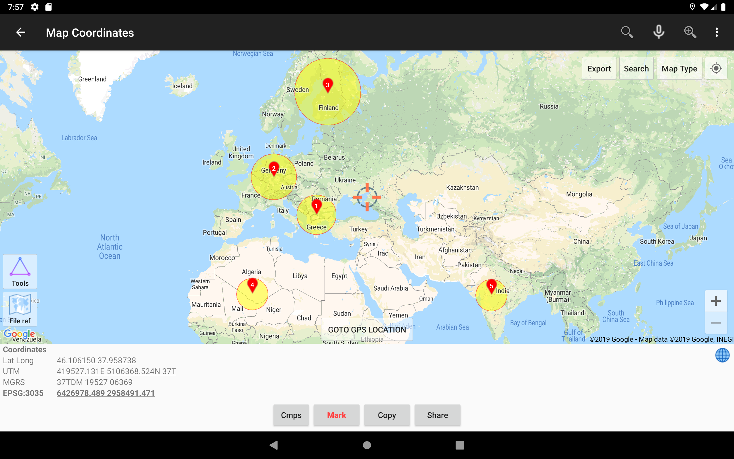
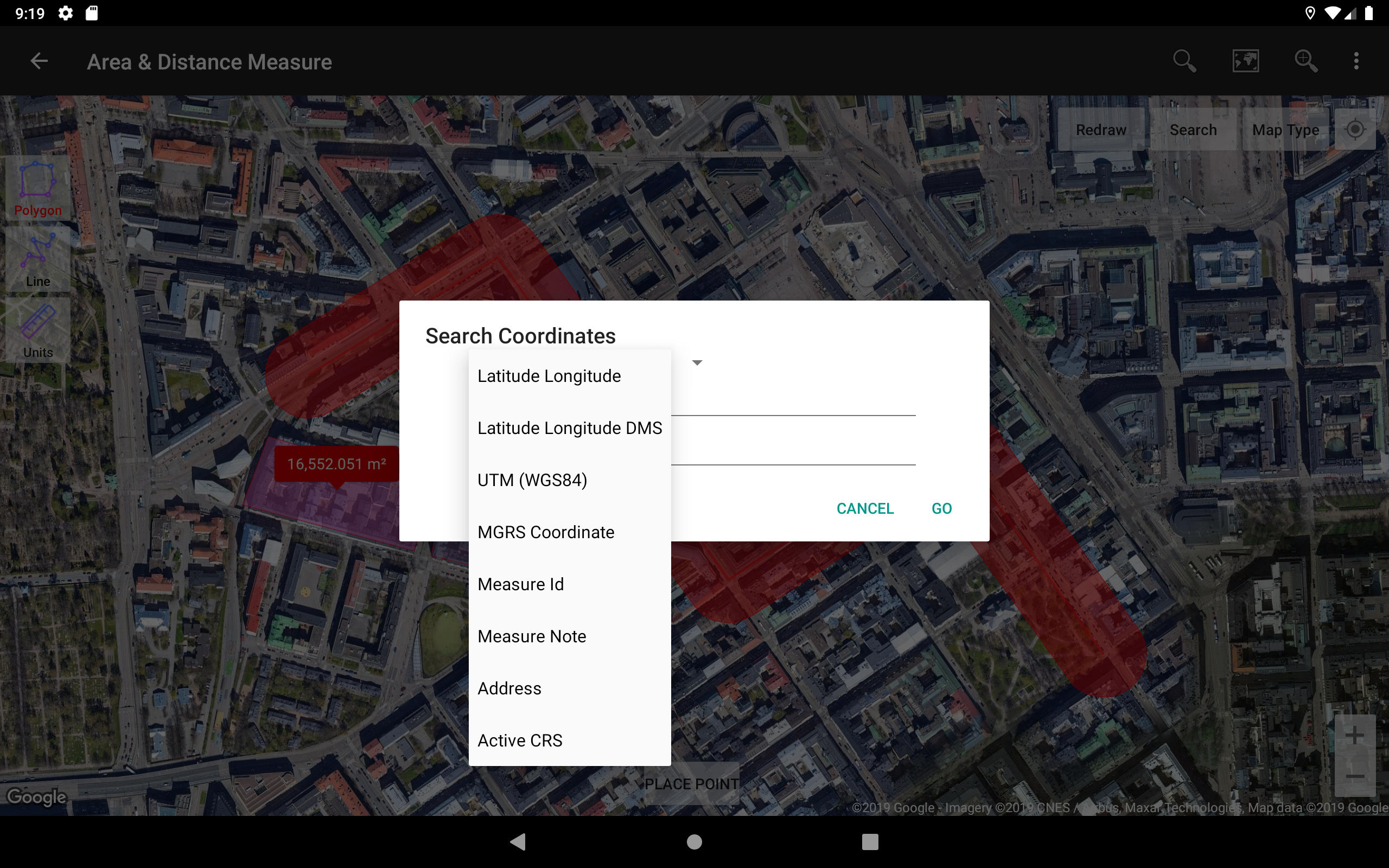
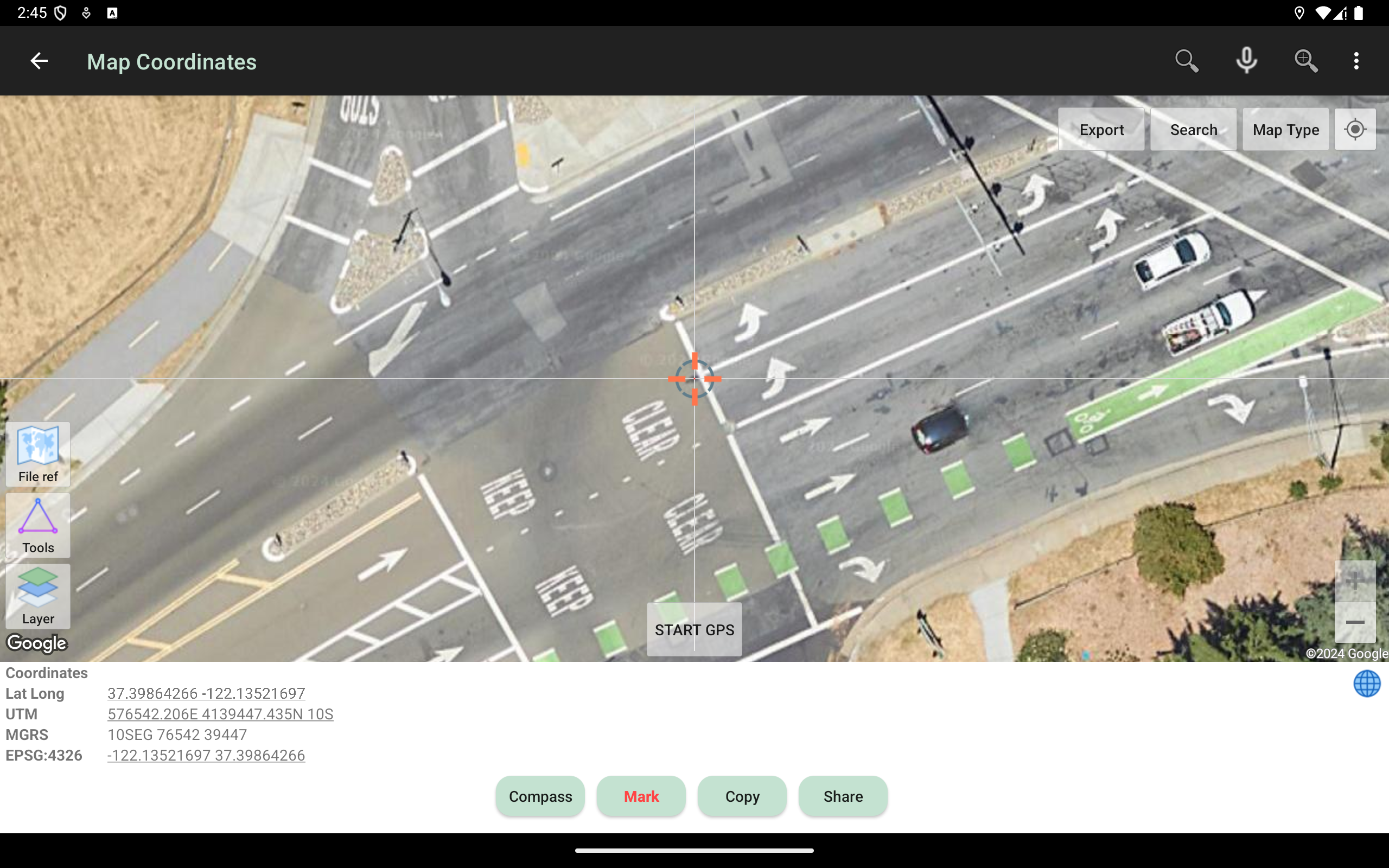
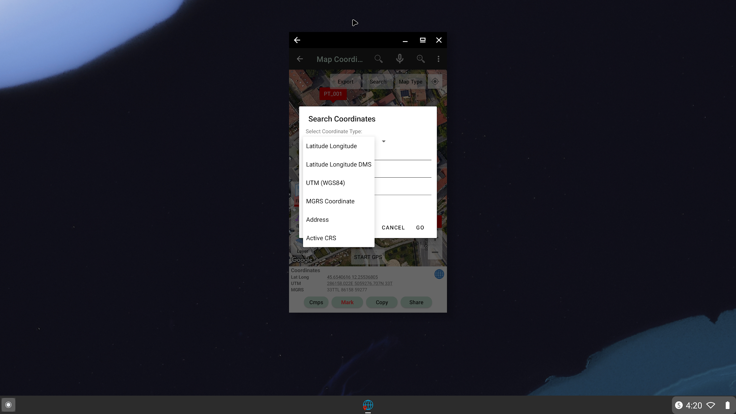
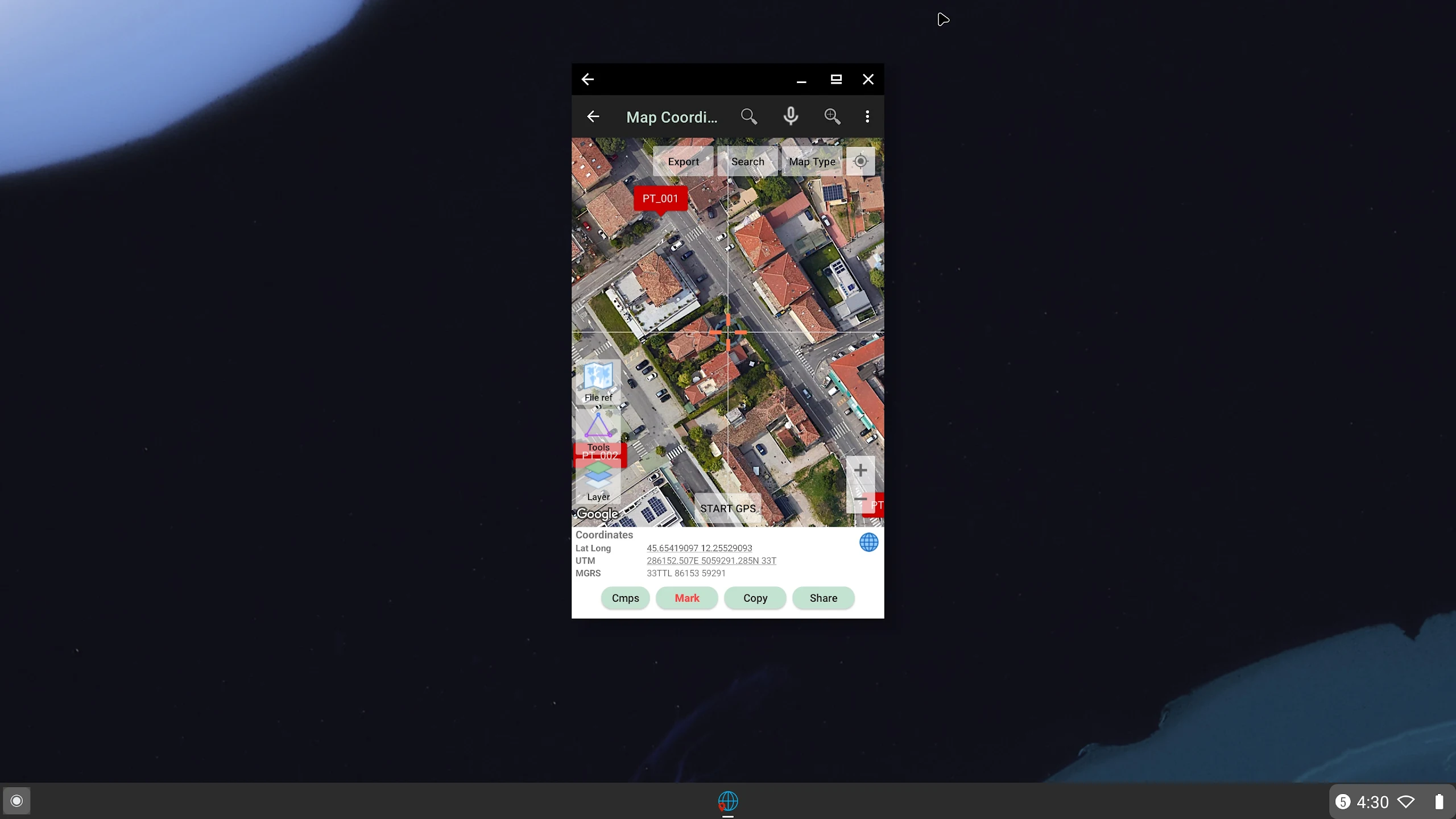
- Map Coordinates
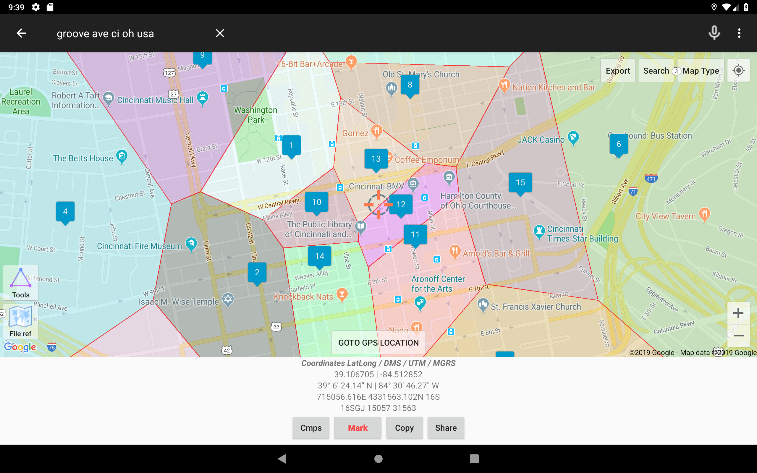
Can be used to obtain Latitude-Longitude, UTM, MGRS (WGS84) & other CRS (using EPSG codes) in real-time, register points complete with coordinate data, time taken, notes/labels, elevation (premium), addresses, photos, etc. This module can also display TIN, Voronoi Diagrams, and Buffers in real-time from existing points.
- Offline GPS
Used to get coordinates in an offline state (without internet access), your cell phone will function like a Handheld GPS to get Latitude-Longitude coordinates, UTM, MGRS, Elevation (ellipsoid), MSL Elevation (EGM96), accuracy, satellite, and other useful information. Coordinate data can be stored in an unlimited number inside your databases, given notes/labels, photos, or exported into CSV, KML, DXF & GPX formats.
- Coord. Converter
To convert coordinates manually from Latitude-Longitude to UTM & MGRS and vice versa. It can also be used to convert addresses to coordinates (Geocoding; requires an internet connection). Some conversions support batch conversion.
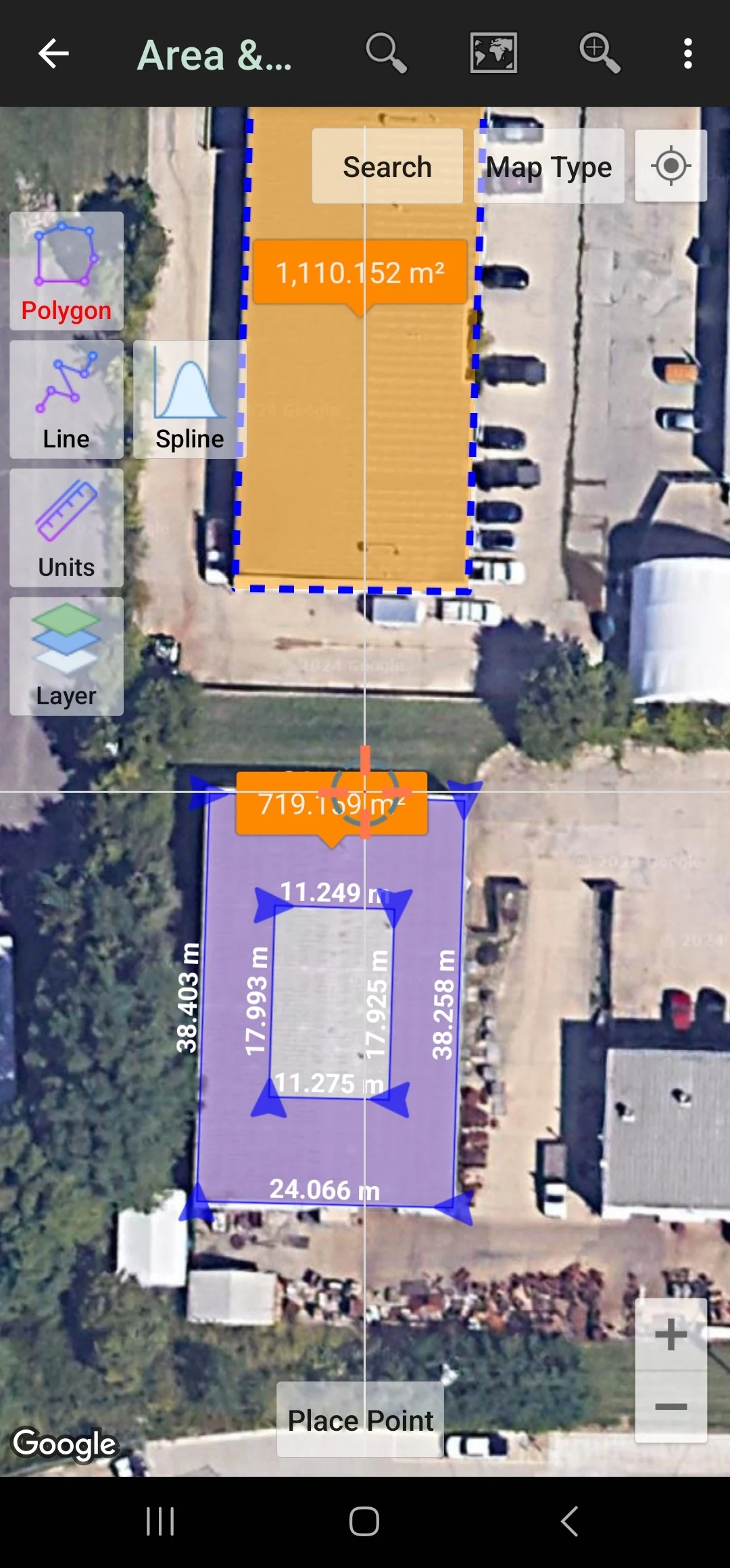
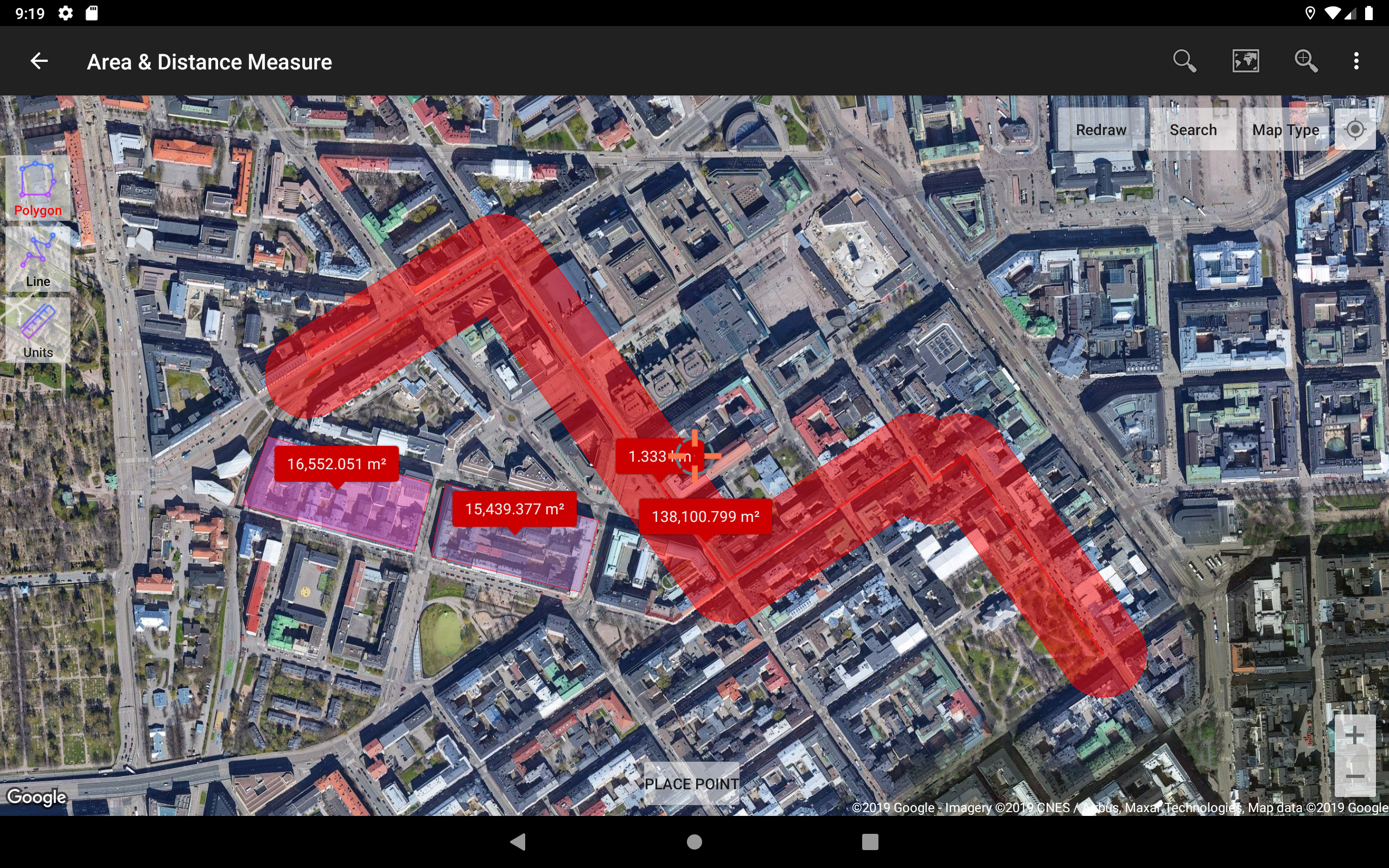
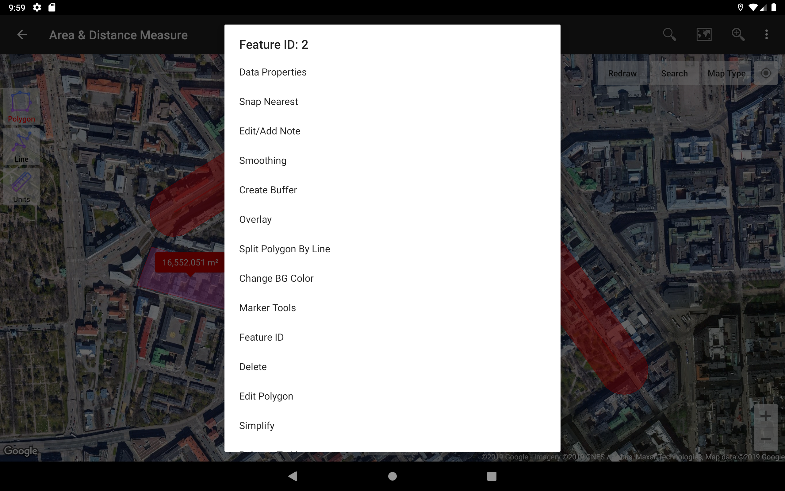
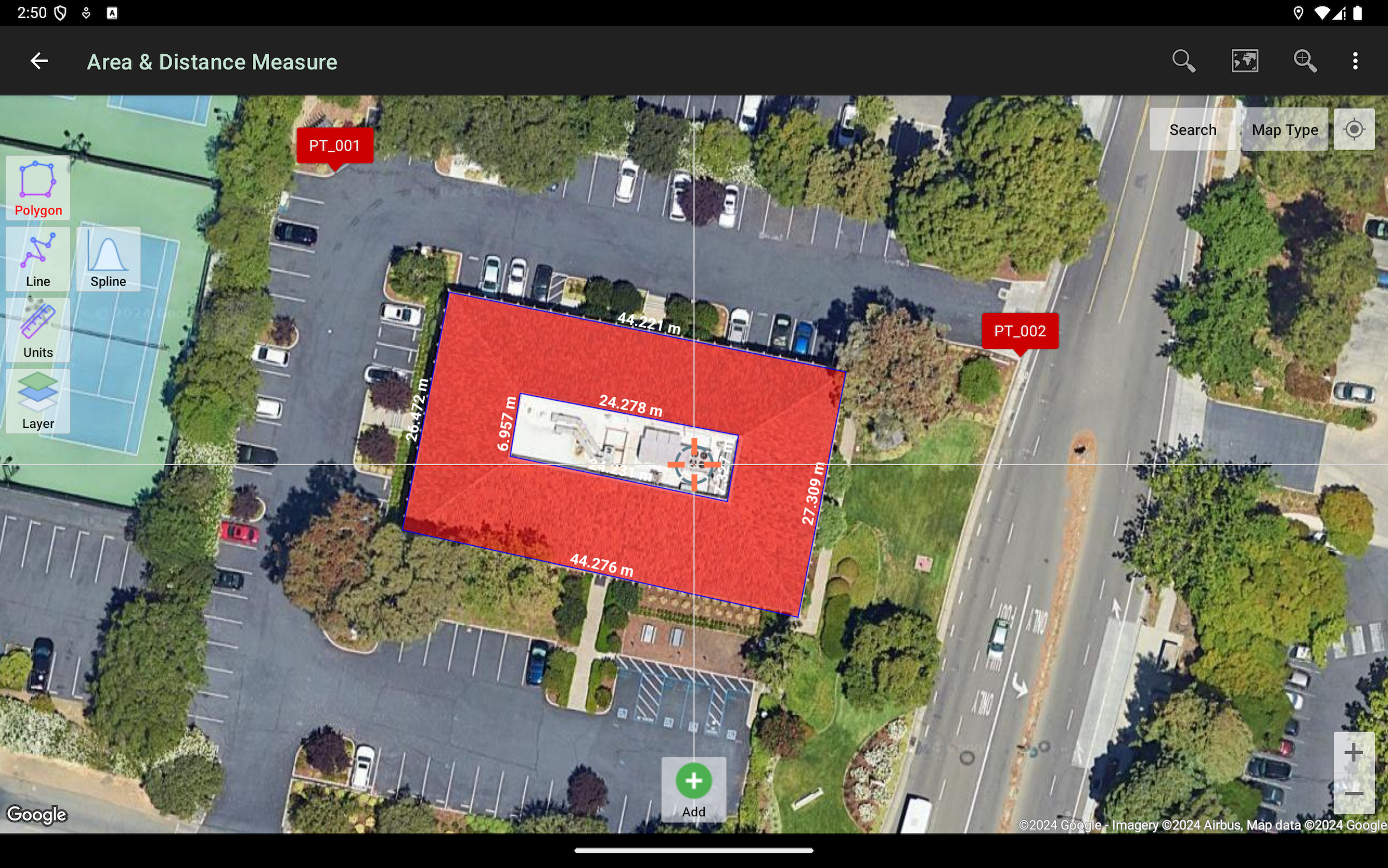
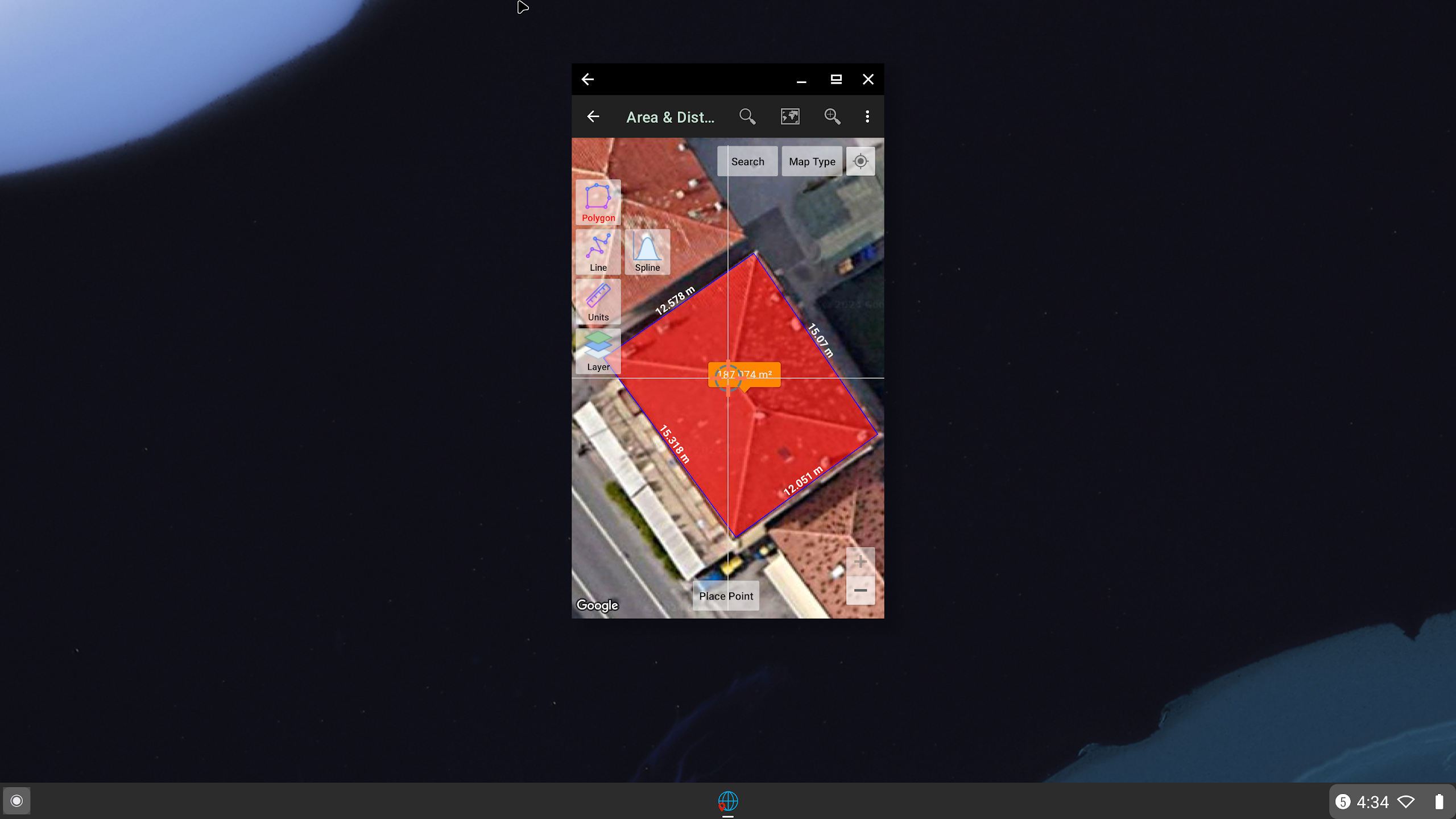
- Area/Distance
Used to measure distance and area (support units: m, km, ft, miles, hectare, acre), register lines/polygons, make polygons automatically from measure points, create buffers from lines/polygons, overlay, etc.. Line/polygon data can be stored in an unlimited number inside your database, displayed on a map, added photos and labels, or exported to CSV, KML, or DXF format. Equipped with spatial editing algorithms such as Snap Nearest, Delete Object Inside/Outside Polygon, Smoothing (cubic bezier interpolation), Split Polygon By Line, and so on. Can read CSV & KML formats to import or display as reference files.
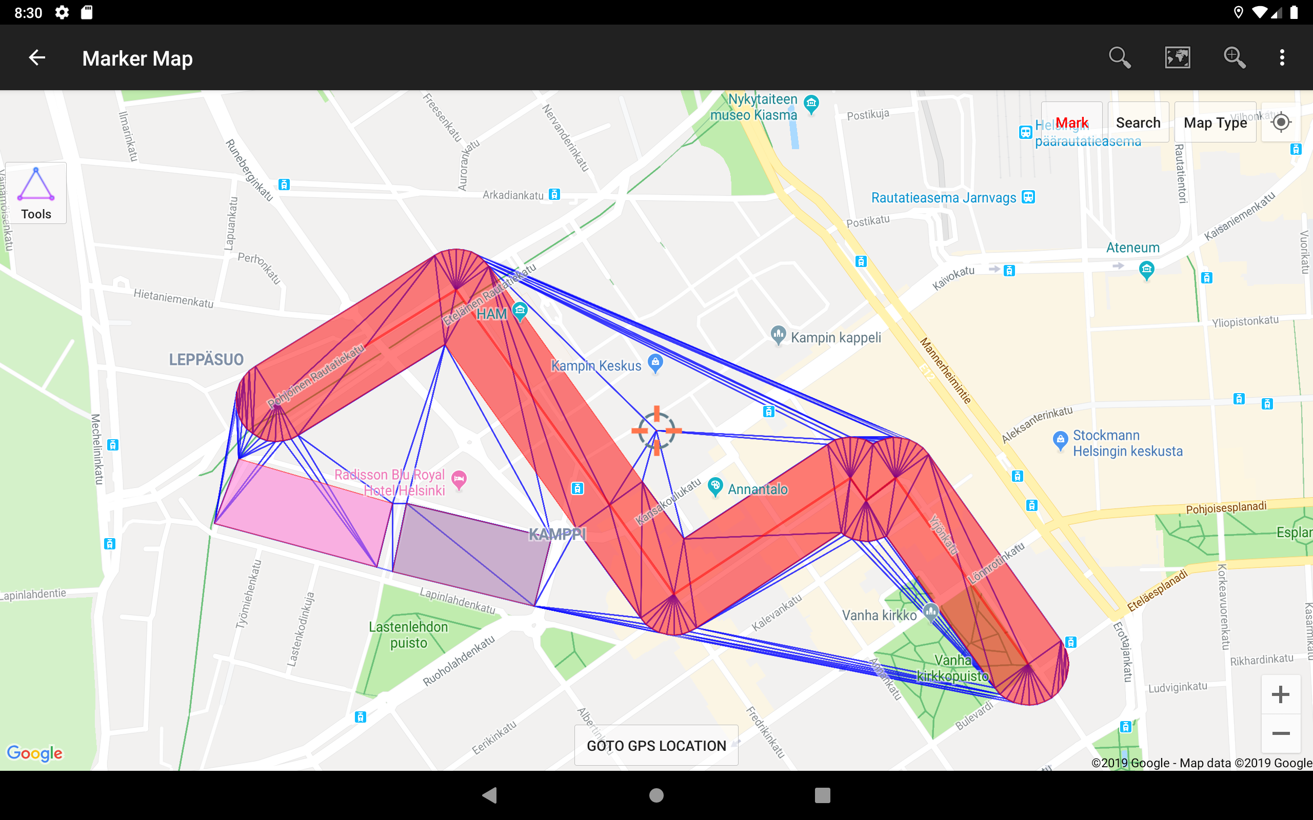
- Marker Map
Similar to the Map Coordinates module but with more complete & complex geometry calculation such as displaying Dynamic/Variable Buffers. In this module, geometric analysis such as TIN & Voronoi Diagrams can be made from a combination of point data (markers) as well as lines and polygons (breakline). These geometries can also be exported to KML or DXF files for use on other devices or PC.
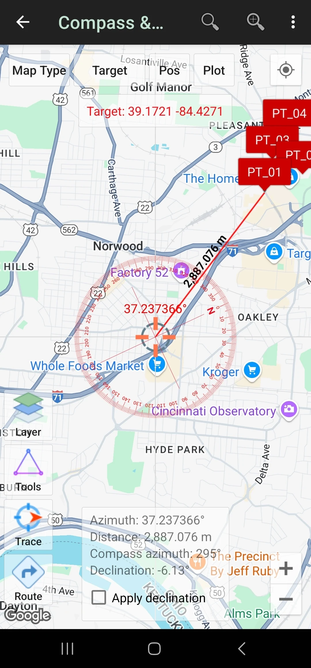
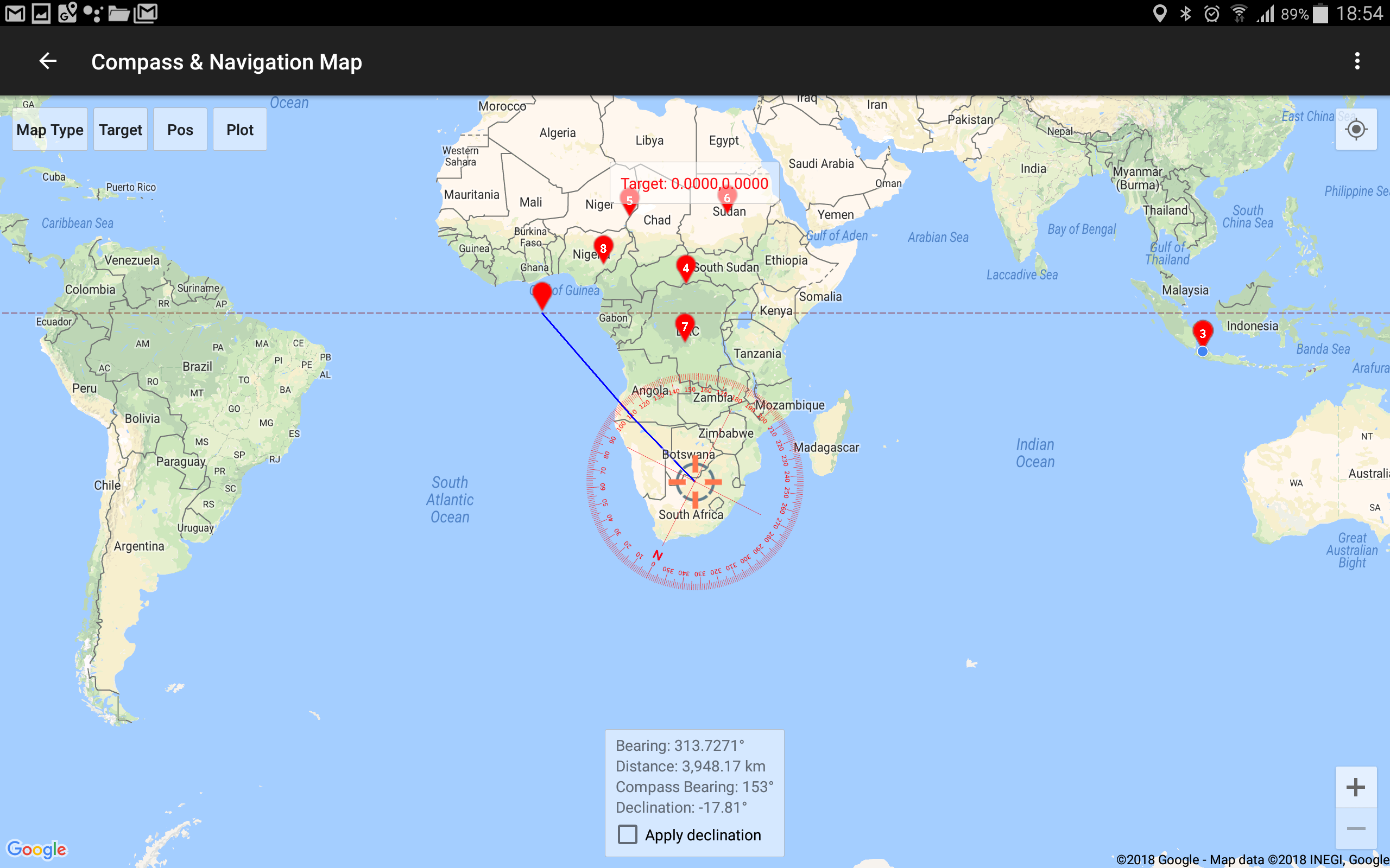
- Compass Map
Module with a map and compass with magnetic declination, can be used to assist in navigating or measuring the azimuth angle and determining distance & direction.
- Buffer/Overlay
Module to perform buffering & overlays (and other GIS operations) with several options including Union, Intersection, Difference, and Symmetrical Difference.
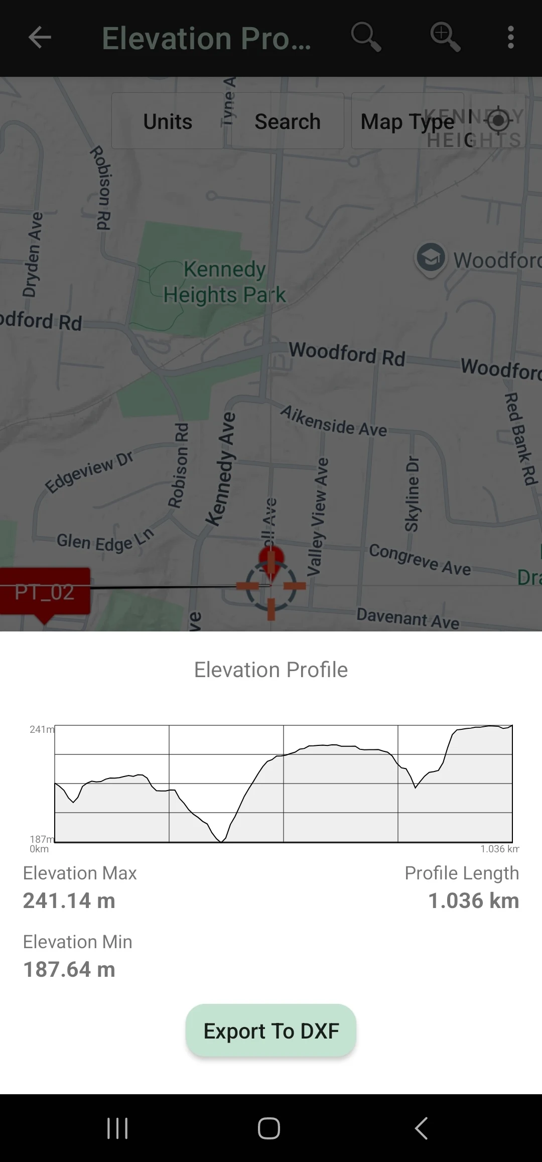
- Elevation Profile
Used to create simple elevation profiles (cross-section/long section) from height data with metric & ft/mile units. This module can also create elevation profiles from multiple points including an elevation profile from a route (premium).
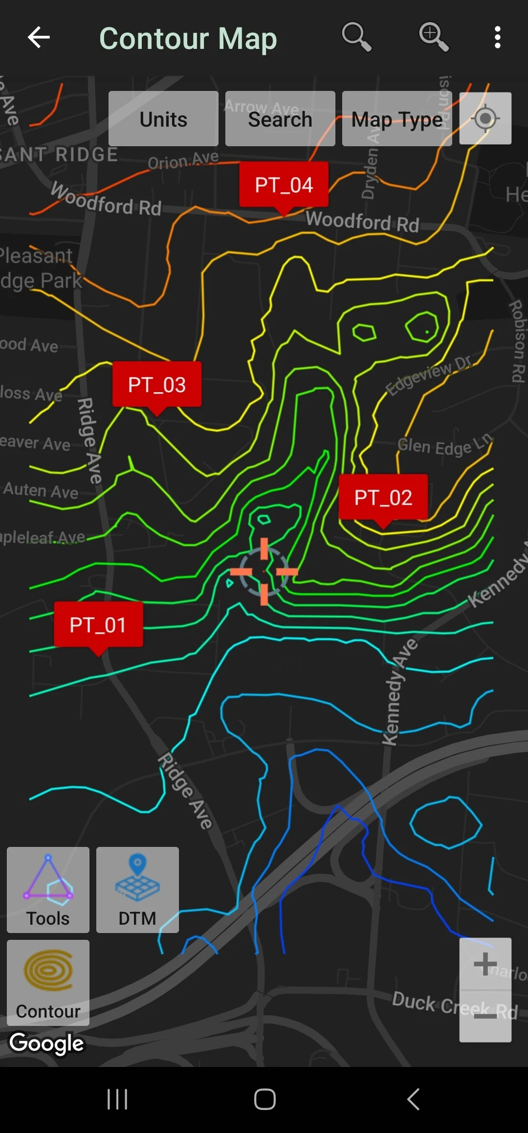
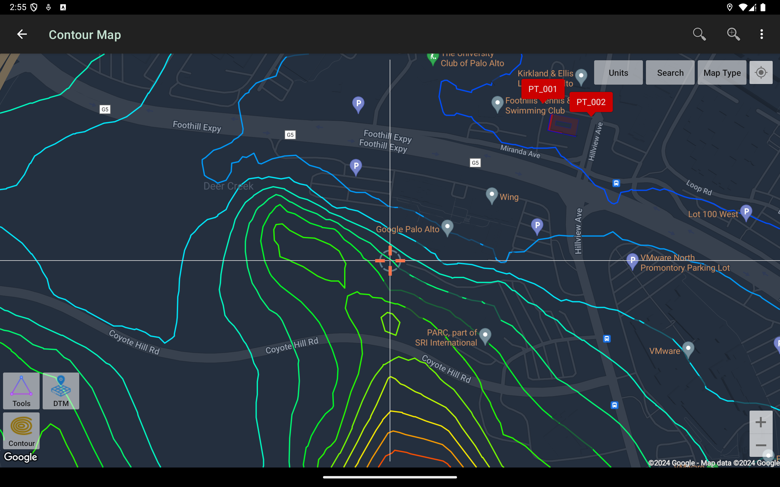
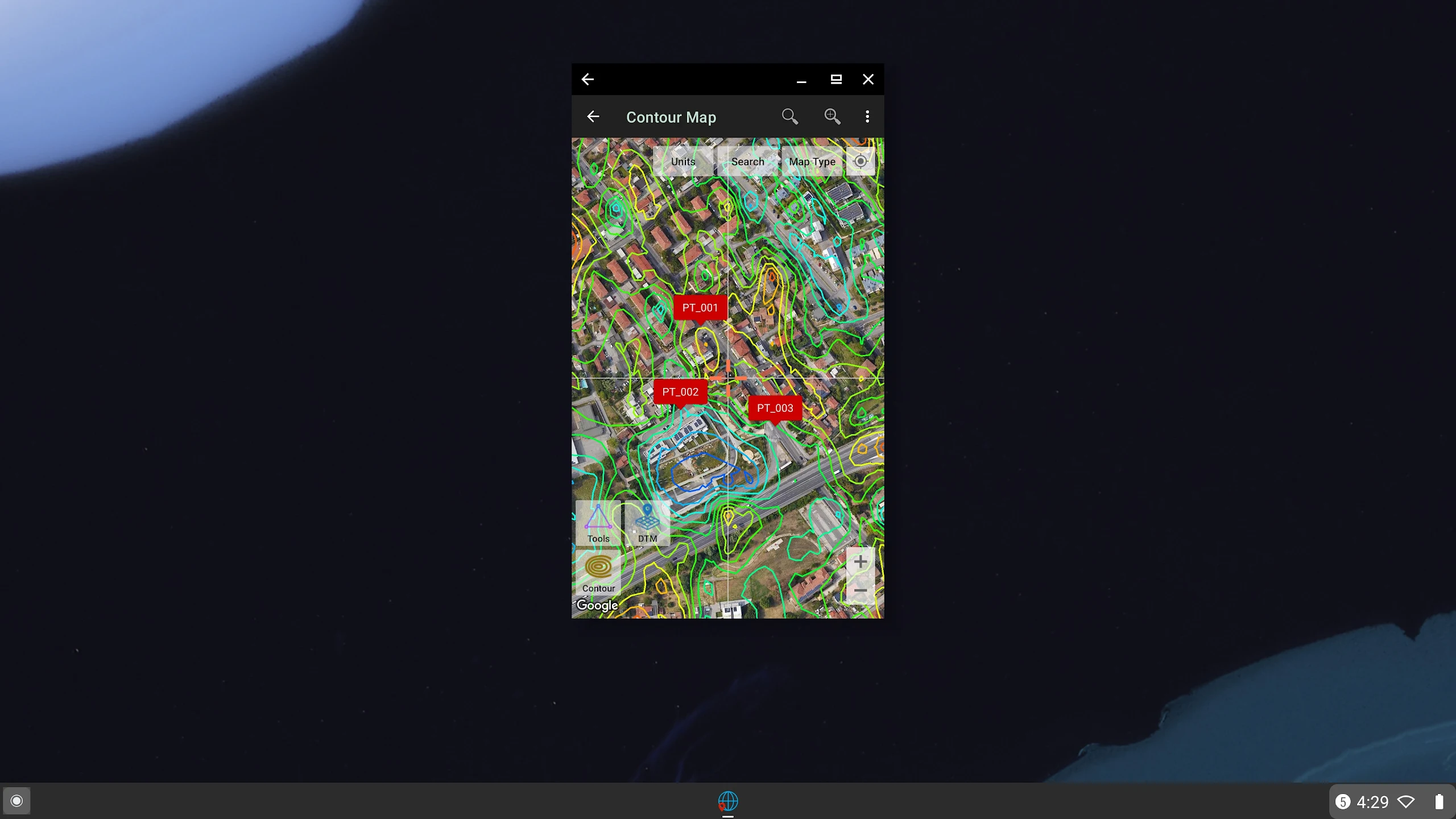
- Contours
Module to generate contours based on the number of contour lines, desired elevation, or contour interval. This is a premium module and needs an internet connection.
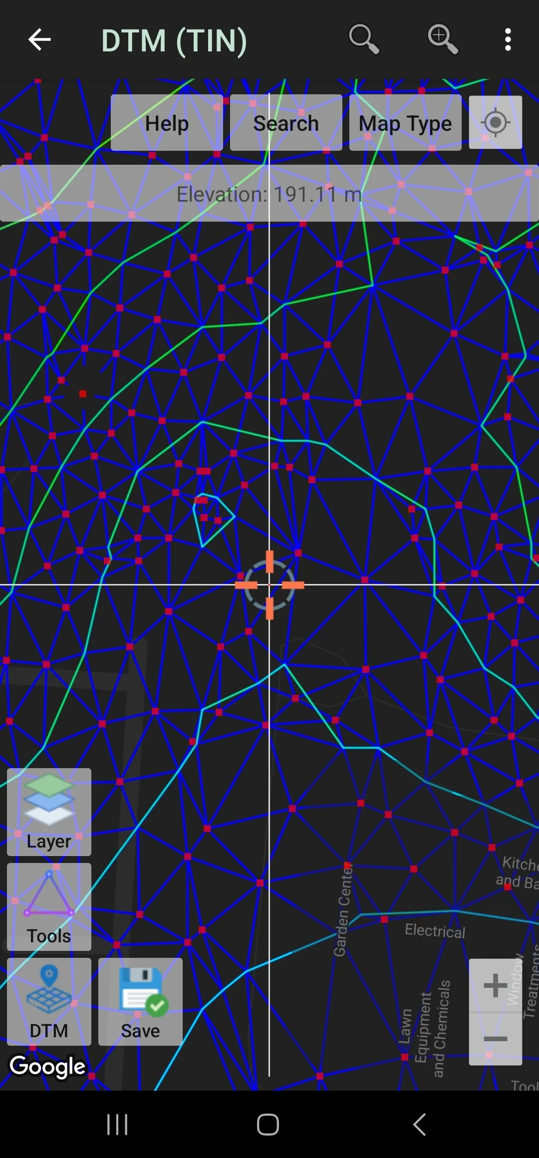
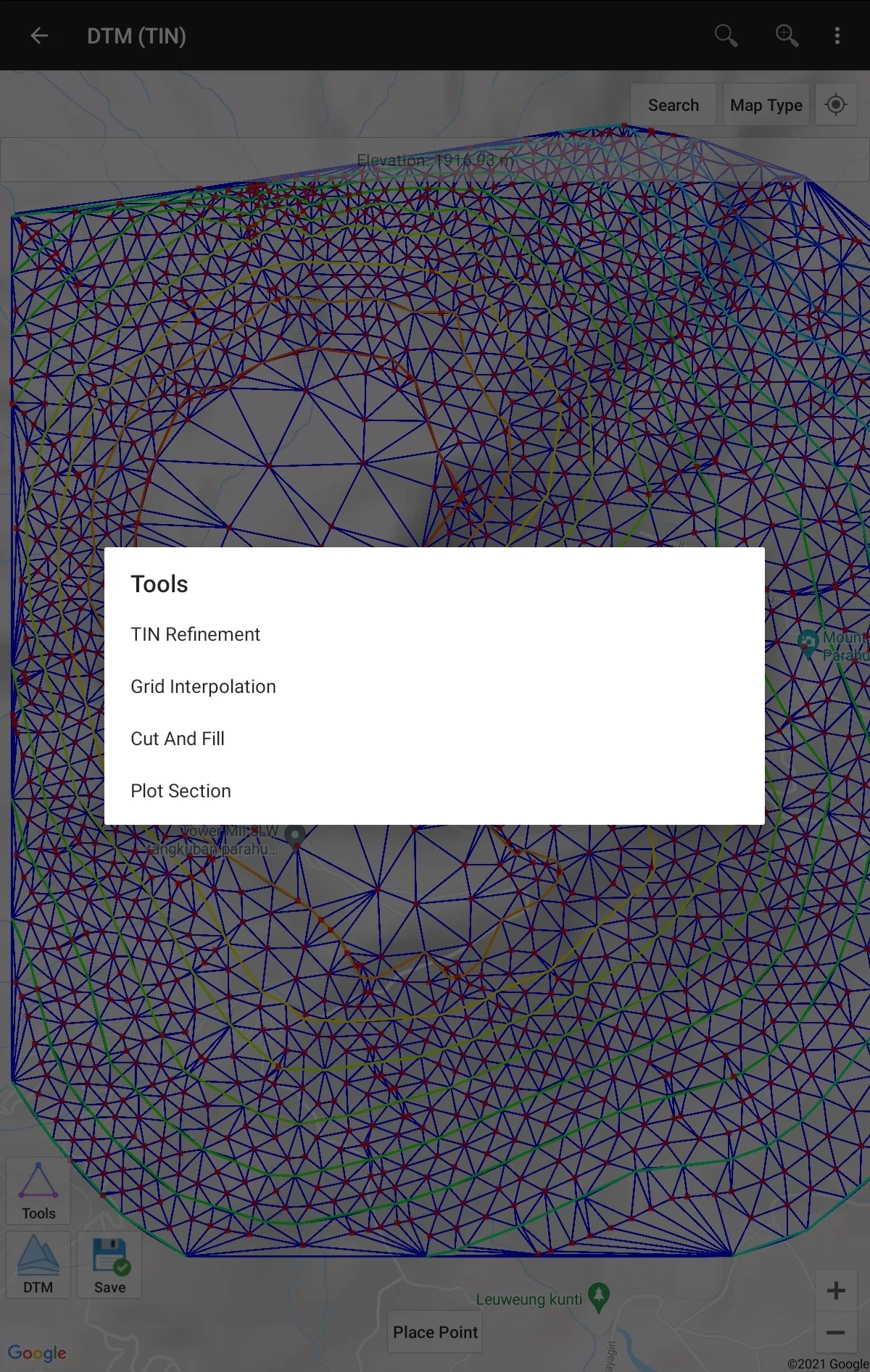
- DTM
Digital Terrain Model, module to generate TIN/GRID surface & Contour Lines from elevation data. Calculate Cut And Fill volume, TIN refinement, Grid interpolation, and dynamic Elevation Profile.
- Version4.0.8
- UpdateFeb 13, 2025
- DeveloperY2 Tech
- CategoryMaps & Navigation
- Requires AndroidAndroid 5.0+
- Downloads1M+
- Package Nameinfo.yogantara.utmgeomap
- Signature57a4b5a225115c0419d4659a89b33d8a
- Available on
- ReportFlag as inappropriate
-
NameSizeDownload
-
12.44 MB
-
12.40 MB
-
12.28 MB


Provides dynamic geometry calculations
Can pinpoint location
Some features require a paid subscription or internet connection